Old Maps of Iron County, Michigan for Academic Research
Study the evolution of Iron County with 265 high-resolution historic maps. Whether you're teaching, researching, or modeling changes in land use, these maps provide essential visual documentation of urban, environmental, and geographic change.
- Analyze long-term change: Track patterns in development, transportation, and natural features.
- Ideal for environmental or urban studies: Support academic projects with primary historical map data.
- Use in the classroom or lab: Educators and researchers rely on these maps to bring historical context to life.
These maps are a powerful tool for teaching, research, and visualizing how Iron County has changed over the decades.
Iron County, MI maps
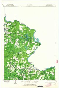
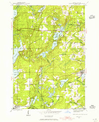
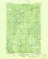
(265)- 1895 Map of Ned Lake
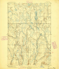 1895 Ned Lake1895 Print · USGSIron County and Baraga County are captured here during the late nineteenth-century timber and mining era. You can trace the path of the Chicago Milwaukee and St Paul RR as it bypasses the waters of Ned Lake and the Hemlock River.4 unique versions available
 - 1895 Map of Perch Lake
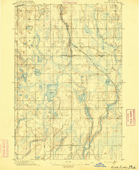 1895 Perch Lake1895 Print · USGSThe Upper Peninsula wilderness comes into focus in the mid-1890s as railroads began to pierce the deep woods of Iron and Baraga counties. Genealogists and historians can trace early rail routes like the D. S. S. and A. R. R. and remote waters such as Perch Lake and the Net River.3 unique versions available
 - 1898 Map of Iron River, 1899 Print
 1898 Iron River1899 Print · USGSUpper Peninsula mining and timber frontiers emerge in the 1890s as railroads begin connecting remote outposts. Researchers can trace early rail lines through Iron River and Stambaugh or locate former stations and camps at Hazle, Atkinson, and Saunders.2 unique versions available
 - 1899 Map of Sagola
 1899 Sagola1899 Print · USGSIron and Dickinson counties were defined by the expansion of the rail-and-river economy in the late nineteenth century. Genealogists and historians can trace the early layouts of Channing, Sagola, and Mansfield alongside the winding Michigamme River.3 unique versions available
 - 1899 Map of Witbeck
 1899 Witbeck1899 Print · USGSThe Upper Peninsula’s rugged timber and rail corridor comes to life in this survey conducted during the 1890s. Researchers can trace the dual rail lines serving Witbeck or locate early wilderness landmarks like Fence Lake, Witch Lake, and the winding Michigamme River.3 unique versions available
 - 1899 Map of Crystal Falls
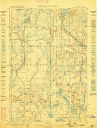
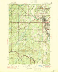
 1899 Crystal Falls1899 Print · USGSIron County mining and timber operations are at their peak at the close of the century. Genealogists and industrial historians can trace early rail spurs to the Mastodon Mine, Shafer Mine, and the developing town of Crystal Falls.2 unique versions available
 - 1939 Map of Long Lake, 1957 Print
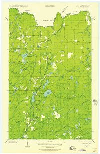 1939 Long Lake1957 Print · USGSNortheastern Wisconsin’s timber country comes alive in this pre-war survey of Florence and Forest counties. Researchers can trace the logging spurs of the Chicago and Northwestern, the Long Lake CCC Camp, and local landmarks like Wild Rose Sch.2 unique versions available
 - 1939 Map of Iron Mountain, 1963 Print
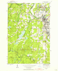
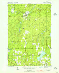
 1939 Iron Mountain1963 Print · USGSThe Menominee River borderlands at the end of the 1930s show a landscape of hydroelectric power and deep-woods settlements. Genealogists and historians can trace rural school districts like Golden Rule Sch and early industrial sites such as the Henry Ford Dam.
 - 1941 Map of Florence
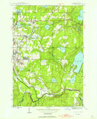
 1941 Florence1941 Print · USGSFlorence and the surrounding lake country appear in this early 1940s survey just as modern highways began to bypass the old rail corridors. Local researchers can trace rural schoolhouse locations like Fern Sch and landmarks like the Rainbow Firetower.
 - 1941 Map of Iron Mountain
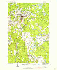
 1941 Iron Mountain1941 Print · USGSThe Menominee River borderlands thrive with hydroelectric power and iron mining during the late thirties. Genealogists can trace family footprints at Woodlawn Cem or find early rural schoolhouses like Golden Rule Sch and Hauserman Sch.
 - 1944 Map of Iron River, 1956 Print
 1944 Iron River1956 Print · USGSIron River and the Menominee Range are shown in the 1940s during a peak era of Michigan mining activity. Researchers can trace the extensive rail-and-mine network connecting sites like James Mine, Wauseca Mine, and the Virgil Location worker settlement.2 unique versions available
 - 1944 Map of Crystal Falls, 1956 Print
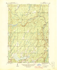
 1944 Crystal Falls1956 Print · USGSIron County mining settlements and railroads are captured in this mid-century survey of the Upper Peninsula. Genealogists can trace family connections to industrial sites like Tobin Mine and company housing at Shafer Location or Western Location.
 - 1944 Map of Gaastra, 1956 Print
 1944 Gaastra1956 Print · USGSIron County thrived during the mid-forties as a critical mining hub where rail lines and company towns shaped the landscape. Genealogists and industrial historians can locate worker housing at Bates Location and trace the paths of the Bates Mine and Bengal Mine.2 unique versions available
 - 1944 Map of Fortune Lakes, 1958 Print
 1944 Fortune Lakes1958 Print · USGSIron County, Michigan, was a landscape of remote timber and rail-bound mining settlements during the mid-1940s. Genealogists and historians can trace the residents of Alpha and Pentoga or locate the specialized mining outposts at Dunn Location and New Bridge Location.2 unique versions available
 - 1945 Map of Gibbs City
 1945 Gibbs City1945 Print · USGSIron County, Michigan, is depicted here at the end of the Second World War as a landscape of timber, rail, and small forest settlements. Genealogists and historians can locate the Finnish Lutheran Ch, trace the Chicago and Northwestern line, and find sites like Camp Gibbs.2 unique versions available
 - 1945 Map of Sunset Lake, 1959 Print
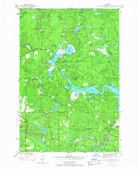
 1945 Sunset Lake1959 Print · USGSIron County’s Upper Peninsula timberlands are captured here in the mid-1940s, centered on the waters of Bates Township. Researchers can trace the settlement at Sunset, locate the Paint Dam (Abandoned), and explore the shoreline of Sunset Lake.3 unique versions available
 - 1945 Map of Kelso Junction, 1968 Print
 1945 Kelso Junction1968 Print · USGSIron County's timber and rail landscape is well-defined here during the mid-forties, centered on the Paint River drainage. Genealogists and historians can trace the Milwaukee and Pacific line to Kelso Junction and Mitchell Spur.2 unique versions available
 - 1945 Map of Amasa, 1970 Print
 1945 Amasa1970 Print · USGSIron County’s mining and rail history is frozen in time during the mid-1940s near the Hematite district. Genealogists can trace family footprints at Amasa, locate the Casagranda Race Track, or study industrial sites like the Warner Mine (abandoned).2 unique versions available
 - 1946 Map of Iron River
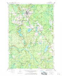
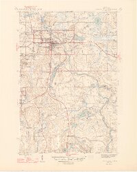
 1946 Iron River1946 Print · USGSIron County’s mining heartland is captured here during the mid-1940s, showing the dense industrial corridor from Stambaugh to Caspian. Trace the iron ore legacy through the Hiawatha No 1 Mine and the many worker-housing sites like Homer Location.2 unique versions available
 - 1946 Map of Sunset Lake
 1946 Sunset Lake1946 Print · USGSIron County’s wooded river valleys are captured here just after the war, showing a landscape defined by its waterways and early infrastructure. Researchers can locate the Paint Dam (Abandoned) and trace family-named streams like Barnetts Creek and De Moss Creek.2 unique versions available
 - 1946 Map of Crystal Falls
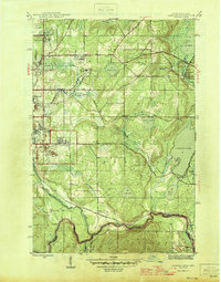
 1946 Crystal Falls1946 Print · USGSMining locations and rail lines dominate the Iron County landscape during the mid-forties. Genealogists and historians can trace the specific neighborhoods of Western Location and Odgers Location or locate the industrial footprints of the Shafer Mine and Tobin Mine.2 unique versions available
 - 1946 Map of Gaastra
 1946 Gaastra1946 Print · USGSIron County’s mining heartland is captured here in the mid-1940s, showing the height of local industrial and community life. Genealogists can locate specific homesteads and family sites near Bates Location, Bates Sch, and the Bengal Mine.
 - 1946 Map of Fortune Lakes
 1946 Fortune Lakes1946 Print · USGSIron County's lake country is captured here just after the war, showing the intersection of industrial mining life and growing public recreation. Researchers can trace old rail lines and worker settlements like New Bristol Location and Dunn Location near Bewabic Park.2 unique versions available
 - 1946 Map of Gibbs City
 1946 Gibbs City1946 Print · USGSIron County’s timber and rail landscape is captured here in the mid-1940s, centered on the confluence of the Paint River. Genealogists and historians can trace the Chicago and Northwestern tracks through Hazel and locate the Finnish Lutheran Ch near the banks of the South Branch Iron River.2 unique versions available
 - 1947 Map of Naults
 1947 Naults1947 Print · USGSThe Brule River borderland was a remote frontier of rail and timber in the late 1940s. Genealogists and historians can trace the settlement at Naults and the route of the Chicago and Northwestern railroad through the Mastodon area.
Showing maps 1-25 of 265
Top cities of Iron County
- Iron River historical maps
- Crystal Falls historical maps
- Caspian historical maps
- Gaastra historical maps
Frequently asked questions
- What are the different types of historical maps available for Iron County?
- What is the oldest map of Iron County?
- Where can I purchase historical maps of Iron County for my home or office?
- Where can I download high-res historical maps of Iron County?
- Are there historical topographic maps available for Iron County?
- Is there historical aerial imagery available for Iron County?
- Where are historical maps of Iron County sourced from?