Old Maps of Bates Township, Michigan
Explore 87 old maps of Bates Township, spanning from 1895 to today. These high-resolution historic maps reveal how streets, neighborhoods, landmarks, and natural features evolved over time — perfect for genealogy, metal detecting, research, and local history exploration.
What you can do with these maps:
- See how Bates Township changed over time: Compare historical maps to modern-day views to trace roads, homesites, rail lines & more.
- View detailed metadata: Each map includes creators, publishers, year, scale, and archive source.
- Overlay maps with satellite & LiDAR: Visualize the past alongside modern tools to explore terrain & human change.
- Trusted historical sources: Maps sourced from the USGS, Library of Congress, and other archives.
- Access maps your way: View online, download high-res files, or order prints for personal or research use.
Start exploring old maps of Bates Township to uncover forgotten places, hidden landmarks, and the deep history beneath your feet.
Bates Township, MI maps
(87)- 1895 Map of Perch Lake
 1895 Perch Lake1895 Print · USGSThe Upper Peninsula wilderness comes into focus in the mid-1890s as railroads began to pierce the deep woods of Iron and Baraga counties. Genealogists and historians can trace early rail routes like the D. S. S. and A. R. R. and remote waters such as Perch Lake and the Net River.3 unique versions available
 - 1898 Map of Iron River, 1899 Print
 1898 Iron River1899 Print · USGSUpper Peninsula mining and timber frontiers emerge in the 1890s as railroads begin connecting remote outposts. Researchers can trace early rail lines through Iron River and Stambaugh or locate former stations and camps at Hazle, Atkinson, and Saunders.2 unique versions available
 - 1899 Map of Crystal Falls
 1899 Crystal Falls1899 Print · USGSIron County mining and timber operations are at their peak at the close of the century. Genealogists and industrial historians can trace early rail spurs to the Mastodon Mine, Shafer Mine, and the developing town of Crystal Falls.2 unique versions available
 - 1944 Map of Gaastra, 1956 Print
 1944 Gaastra1956 Print · USGSIron County thrived during the mid-forties as a critical mining hub where rail lines and company towns shaped the landscape. Genealogists and industrial historians can locate worker housing at Bates Location and trace the paths of the Bates Mine and Bengal Mine.2 unique versions available
 - 1944 Map of Fortune Lakes, 1958 Print
 1944 Fortune Lakes1958 Print · USGSIron County, Michigan, was a landscape of remote timber and rail-bound mining settlements during the mid-1940s. Genealogists and historians can trace the residents of Alpha and Pentoga or locate the specialized mining outposts at Dunn Location and New Bridge Location.2 unique versions available
 - 1945 Map of Gibbs City
 1945 Gibbs City1945 Print · USGSIron County, Michigan, is depicted here at the end of the Second World War as a landscape of timber, rail, and small forest settlements. Genealogists and historians can locate the Finnish Lutheran Ch, trace the Chicago and Northwestern line, and find sites like Camp Gibbs.2 unique versions available
 - 1945 Map of Sunset Lake, 1959 Print
 1945 Sunset Lake1959 Print · USGSIron County’s Upper Peninsula timberlands are captured here in the mid-1940s, centered on the waters of Bates Township. Researchers can trace the settlement at Sunset, locate the Paint Dam (Abandoned), and explore the shoreline of Sunset Lake.3 unique versions available
 - 1945 Map of Amasa, 1970 Print
 1945 Amasa1970 Print · USGSIron County’s mining and rail history is frozen in time during the mid-1940s near the Hematite district. Genealogists can trace family footprints at Amasa, locate the Casagranda Race Track, or study industrial sites like the Warner Mine (abandoned).2 unique versions available
 - 1946 Map of Sunset Lake
 1946 Sunset Lake1946 Print · USGSIron County’s wooded river valleys are captured here just after the war, showing a landscape defined by its waterways and early infrastructure. Researchers can locate the Paint Dam (Abandoned) and trace family-named streams like Barnetts Creek and De Moss Creek.2 unique versions available
 - 1946 Map of Gaastra
 1946 Gaastra1946 Print · USGSIron County’s mining heartland is captured here in the mid-1940s, showing the height of local industrial and community life. Genealogists can locate specific homesteads and family sites near Bates Location, Bates Sch, and the Bengal Mine.
 - 1946 Map of Fortune Lakes
 1946 Fortune Lakes1946 Print · USGSIron County's lake country is captured here just after the war, showing the intersection of industrial mining life and growing public recreation. Researchers can trace old rail lines and worker settlements like New Bristol Location and Dunn Location near Bewabic Park.2 unique versions available
 - 1946 Map of Gibbs City
 1946 Gibbs City1946 Print · USGSIron County’s timber and rail landscape is captured here in the mid-1940s, centered on the confluence of the Paint River. Genealogists and historians can trace the Chicago and Northwestern tracks through Hazel and locate the Finnish Lutheran Ch near the banks of the South Branch Iron River.2 unique versions available
 - 1947 Map of Amasa
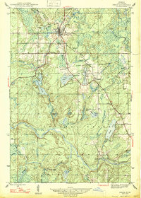 1947 Amasa1947 Print · USGSIron County's mining and timber landscape comes into focus shortly after the war, centered on the settlement of Amasa. Researchers can trace the legacy of local industry at the Warner Mine (abandoned), Porter Mine (abandoned), and the Casagranda Race Track.2 unique versions available
 - 1954 Map of Kenton, 1956 Print
 1954 Kenton1956 Print · USGSThe Upper Peninsula rail corridors and timberlands are well-defined in the mid-1950s, centering on the crossing of the Duluth South Shore and Atlantic. Researchers can locate historic sites like the Kenton Cemetery, Holmes Dam, and the old Lookout Tower.3 unique versions available
 - 1954 Map of Perch Lake, 1956 Print
 1954 Perch Lake1956 Print · USGSUpper Peninsula timberlands and glacial lakes are shown here during the mid-fifties at the meeting of Houghton, Baraga, and Iron Counties. Trace the Milwaukee Road rail line through Tunis or locate the Lookout Tower and Snake Rapids.3 unique versions available
 - 1958 Map of Iron River, 1968 Print
 1958 Iron River1968 Print · USGSThe Upper Peninsula in the late fifties is captured here as a landscape of timber, iron, and rail. Genealogists and historians can trace rail stops like Mass Station or explore the coastlines of Lake Gogebic and Keweenaw Bay.3 unique versions available
 - 1960 Map of Iron River
 1960 Iron River1960 Print · USGSThe Upper Peninsula’s western reaches are shown in the late fifties, featuring the industrial infrastructure of the Copper Country and the vast Ottawa National Forest. Researchers can trace the rail lines of the Milwaukee Road through settlements like Bruce Crossing and the White Pine Mine.
 - 1961 Map of Iron River
 1961 Iron River1961 Print · USGSThe Upper Peninsula and northern Wisconsin are shown here in the early 1960s, a landscape defined by the iron range and vast timberlands. Researchers can trace the legacy of mining and rail transport through Caspian, the Lac Du Flambeau Indian Reservation, and the Milwaukee Road.
 - 1967 Map of Iron River, 1968 Print
 1967 Iron River1968 Print · USGSThe Upper Peninsula and northern Wisconsin borderlands are shown here in the late sixties, a landscape of deep woods and iron-country rail lines. Genealogists and historians can trace the lakeside settlements of L'Anse and Ontonagon or follow the Soo Line through towns like Michigamme and Nestoria.
 - 1982 Map of Winslow Lake, 1983 Print
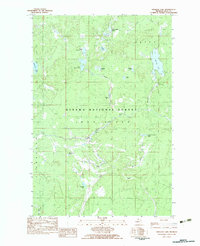 1982 Winslow Lake1983 Print · USGSIron County's forested lake country is documented in the early 1980s, centered on the Paint River and its tributaries. Researchers can trace old logging infrastructure at Holmes Dam or locate isolated landmarks like the Big Spring Hole and Winslow Lake.
 - 1982 Map of Glitter Lake, 1983 Print
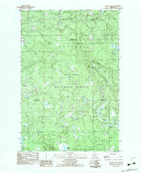 1982 Glitter Lake1983 Print · USGSUpper Michigan's lake country is captured here in the early eighties, spanning the wooded border between Houghton and Iron counties. Researchers can trace the water systems of the Ottawa National Forest, from Passmore Springs to remote shores like Glitter Lake and Lake Thirteen.
 - 1985 Map of Marten Lake, 1986 Print
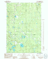 1985 Marten Lake1986 Print · USGSThe Upper Peninsula wilderness near the Houghton and Iron County line is captured here in the mid-1980s. Trace the remote waters of Lake Sainte Kathryn, locate the Roadside Spring by Kunze Lake, and explore the glacial landscape of the Ottawa National Forest.
 - 1985 Map of Tunis, 1986 Print
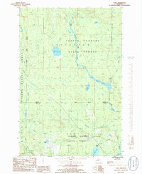 1985 Tunis1986 Print · USGSUpper Peninsula wilderness in the 1980s is captured here as it straddles the Baraga and Iron County lines. Researchers can trace remote forest outposts like Tunis and Park Siding among the extensive wetlands of Net River Flooding.
 - 1985 Map of Perch Lake, 1986 Print
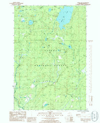 1985 Perch Lake1986 Print · USGSIron County’s wooded lake country is captured here in the mid-1980s, centered on the Perch Lake watershed and the Ottawa National Forest. Researchers can trace old family names and small-scale industry across sites like Hannah Webb Lake and a local Gravel Pit.
 - 1985 Map of Porter Lake, 1986 Print
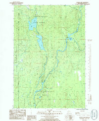 1985 Porter Lake1986 Print · USGSIron County in the mid-1980s is shown as a dense wilderness of public forests and interconnected waterways. Researchers can trace the path of the Porter River past landmarks like Chipmunk Falls, Snake Rapids, and the shoreline of Porter Lake.
Showing maps 1-25 of 87
Top cities near Bates Township
- Iron River historical maps
- Stambaugh historical maps
- Caspian historical maps
- Gaastra historical maps
- Alvin historical maps
Top neighborhoods of Bates Township
Frequently asked questions
- What are the different types of historical maps available for Bates Township?
- What is the oldest map of Bates Township?
- Where can I purchase historical maps of Bates Township for my home or office?
- Where can I download high-res historical maps of Bates Township?
- Are there historical topographic maps available for Bates Township?
- Is there historical aerial imagery available for Bates Township?
- Where are historical maps of Bates Township sourced from?