1980s Maps of Isabella County, Michigan
Explore 8 historic maps of Isabella County from the 1980s. These maps offer a rare glimpse into what life looked like during the 1980s — showing old roads, neighborhoods, homes, and landmarks that have changed or disappeared over time.
Whether you're researching your family's past, planning a metal detecting trip, or studying how Isabella County's landscape evolved across the 1980s, these high-resolution maps are a powerful tool for exploring the history of this region.
- Focus on a specific era: All maps on this page are from the 1980s, giving you a focused view of this time period.
- See what’s changed: Compare century-old streets, trails, and buildings to today's modern landscape using overlays and satellite layers.
- Research with precision: Use these maps for genealogy, historical research, land use analysis, or educational projects.
- View, download, or print: Maps are fully viewable online in high resolution, and can be downloaded or printed for your own records.
Start exploring Isabella County's history through authentic maps from the 1980s. This is your window into the past.
Isabella County, MI maps
(8)- 1983 Map of Woods, 1984 Print
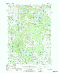 1983 Woods1984 Print · USGSIsabella County's varied landscape of state forests and glacial lakes is captured here during the early 1980s. Researchers can locate the Gilmore Church, trace the Chippewa River headwaters, or find family plots in Conley Cemetery and Township Cemetery.
 - 1983 Map of Clare, 1984 Print
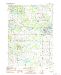 1983 Clare1984 Print · USGSClare and Farwell are captured in the early eighties at a crossroads of Michigan’s railroad and river networks. Genealogists and local historians can trace the Harrison Railroad Grade or locate burials at Surrey Cem and Township Cem.
 - 1984 Map of Lake
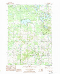 1984 Lake1984 Print · USGSIsabella and Clare counties are captured in the mid-1980s, showing a landscape defined by glacial lakes and small rural settlements. Researchers can locate family sites at North Brinton Cem or trace the early developments around Eight Point Lake and Brinton.
 - 1984 Map of Big Rapids
 1984 Big Rapids1984 Print · USGSMid-Michigan in the mid-eighties shows a balance of deep-woods conservation and riverfront industry centered on the Muskegon River. Genealogists and historians can trace rail-town development along the Chesapeake and Ohio or locate family sites near Idlewild, Reed City, and Forest Hill Cem.
 - 1984 Map of Midland, 1985 Print
 1984 Midland1985 Print · USGSMid-Michigan's industrial and forest lands come into focus in the mid-eighties, centered on the growing hubs of Midland and Mount Pleasant. Genealogists and historians can trace the Chesapeake and Ohio rail corridor through small towns like Rosebush and Edenville.2 unique versions available
 - 1985 Map of Cedar Springs
 1985 Cedar Springs1985 Print · USGSThe northern reaches of the Grand Rapids metro area meet the forests of the Manistee during the mid-eighties. Genealogists and historians can trace the paths of the Grand Trunk Western RR through Sparta or locate rural landmarks near Cedar Springs and Rockford.
 - 1985 Map of Alma
 1985 Alma1985 Print · USGSCentral Michigan in the mid-eighties shows a landscape of steady agricultural communities and vital rail corridors. Genealogists and local historians can trace family roots through the detailed grids of Alma, Ithaca, and Chesaning, or locate rural landmarks like Riverside Cem and Lumberjack Land Airport.2 unique versions available
 - 1986 Map of Cedar Springs, 1989 Print
 1986 Cedar Springs1989 Print · USGSThe northern suburbs of Grand Rapids meet the Manistee National Forest in the mid-1980s. Genealogists and historians can trace the rail-side growth of Howard City, Rockford, and Greenville along the C & O RR and Flat River.
End of results
Showing maps 1-8 of 8
Top cities of Isabella County
Frequently asked questions
- What are the different types of historical maps available for Isabella County?
- What is the oldest map of Isabella County?
- Where can I purchase historical maps of Isabella County for my home or office?
- Where can I download high-res historical maps of Isabella County?
- Are there historical topographic maps available for Isabella County?
- Is there historical aerial imagery available for Isabella County?
- Where are historical maps of Isabella County sourced from?