2020s Maps of Isabella County, Michigan
Explore 20 historic maps of Isabella County from the 2020s. These maps offer a rare glimpse into what life looked like during the 2020s — showing old roads, neighborhoods, homes, and landmarks that have changed or disappeared over time.
Whether you're researching your family's past, planning a metal detecting trip, or studying how Isabella County's landscape evolved across the 2020s, these high-resolution maps are a powerful tool for exploring the history of this region.
- Focus on a specific era: All maps on this page are from the 2020s, giving you a focused view of this time period.
- See what’s changed: Compare century-old streets, trails, and buildings to today's modern landscape using overlays and satellite layers.
- Research with precision: Use these maps for genealogy, historical research, land use analysis, or educational projects.
- View, download, or print: Maps are fully viewable online in high resolution, and can be downloaded or printed for your own records.
Start exploring Isabella County's history through authentic maps from the 2020s. This is your window into the past.
Isabella County, MI maps
(20)- 2023 Map of Alamando, 2023 Print
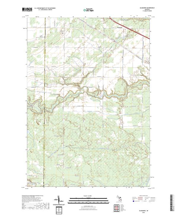 2023 Alamando2023 Print · USGSMidland County's rural townships are captured here in the early twenty-first century, showing a landscape defined by river confluences and country roads. Researchers can locate Warren Township Cem and trace the winding paths of the Salt River and Chippewa River.
 - 2023 Map of Leaton, 2023 Print
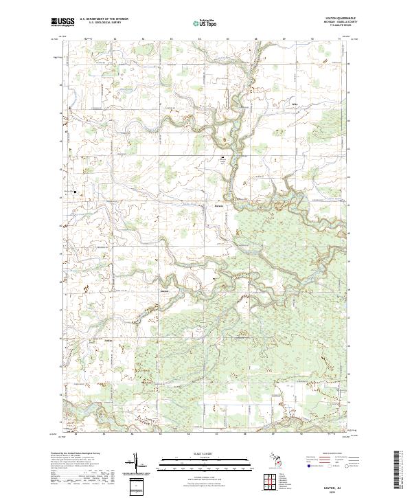 2023 Leaton2023 Print · USGSIsabella County's rural townships and water management systems are on full display in this modern survey. Researchers can locate family landmarks such as the Nottawa Indian Cem and trace the paths of Spring Creek and the Chippewa River.
 - 2023 Map of Pleasant Valley, 2023 Print
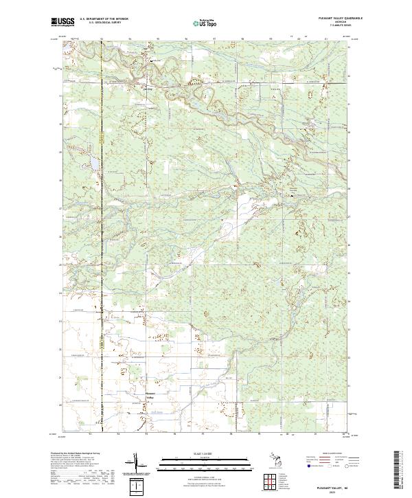 2023 Pleasant Valley2023 Print · USGSThe rural borders of Isabella and Midland Counties are captured here in the early twenty-first century. Researchers can trace family history through local sites like Kelly Cem or follow the paths of the Chippewa River and Little Salt Creek through the countryside.
 - 2023 Map of Mount Pleasant, 2023 Print
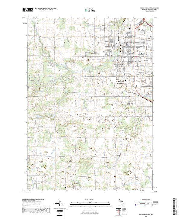 2023 Mount Pleasant2023 Print · USGSMount Pleasant and its surrounding Isabella County townships are shown here in the early twenty-first century, centered on the growing university campus. Researchers can trace the heritage of the area through several local burial sites, including Mission Creek Cem, Green Cem, and Riverside Cem.
 - 2023 Map of Loomis, 2023 Print
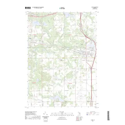
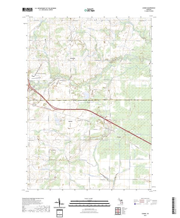 2023 Loomis2023 Print · USGSIsabella and Clare Counties meet here in recent years, where the drainage of the Tobacco River basin shapes the local farming economy. Researchers can trace family sites near Loomis, locate the Wise Cem, or study the corridor of the Pere Marquette Rd.
 - 2023 Map of Vestaburg, 2023 Print
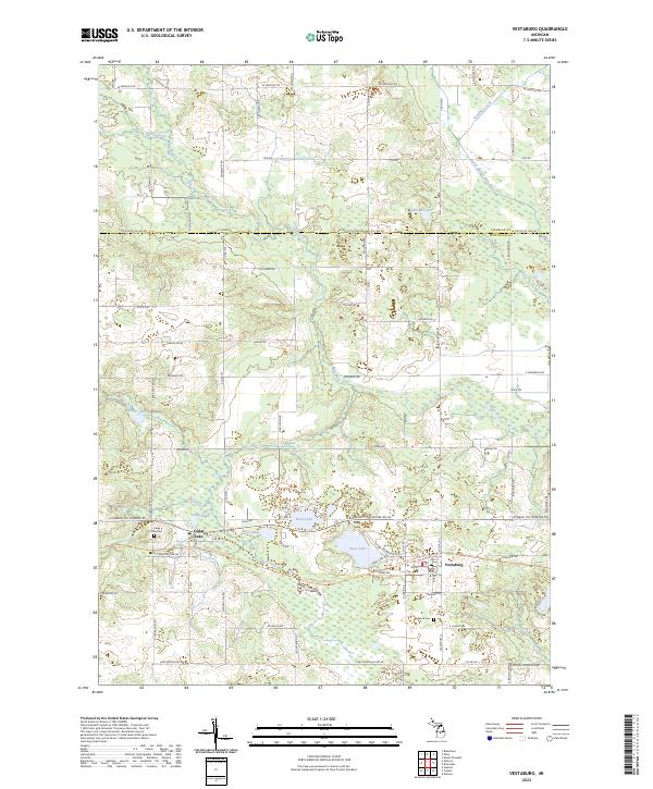 2023 Vestaburg2023 Print · USGSMontcalm County’s lakeland and quiet villages are captured here in the early twenty-first century. Researchers can trace local heritage at Cedar Lake Cem, locate the village of Vestaburg, and follow the Fred Meijer Heartland Trl across the terrain.
 - 2023 Map of Shepherd, 2023 Print
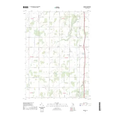
 2023 Shepherd2023 Print · USGSIsabella County in the 2020s remains a region of deep roots, anchored by the village of Shepherd and the northern outskirts of Mount Pleasant. Genealogists can trace family heritage through the Saint Vincent de Paul and Salt River cemeteries, or explore the area around Alembic and the Chippewa River.
 - 2023 Map of Riverdale, 2023 Print
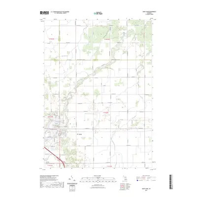
 2023 Riverdale2023 Print · USGSThe borderlands of Isabella and Gratiot counties come into focus in the 2020s, centered on the historic community of Riverdale. Researchers can locate several rural burial grounds like Irishtown Cem and Sibley Cem near the winding course of the Pine River.
 - 2023 Map of Blanchard, 2023 Print
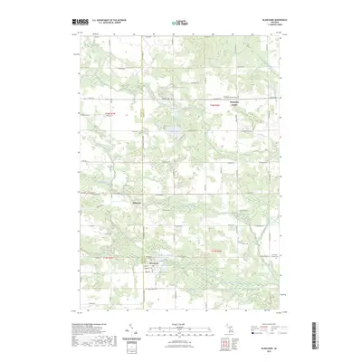 2023 Blanchard2023 Print · USGSCovers Isabella County, including Millbrook, Lake Isabella, and other nearby areas
 - 2023 Map of Coleman, 2023 Print
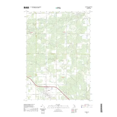 2023 Coleman2023 Print · USGSMidland and Isabella counties meet at Coleman in this modern survey of central Michigan's rural landscape. Genealogists and local historians can trace family properties along W Baker Rd or follow the old Railroad Grade and the banks of Bluff Creek.
 - 2023 Map of Weidman, 2023 Print
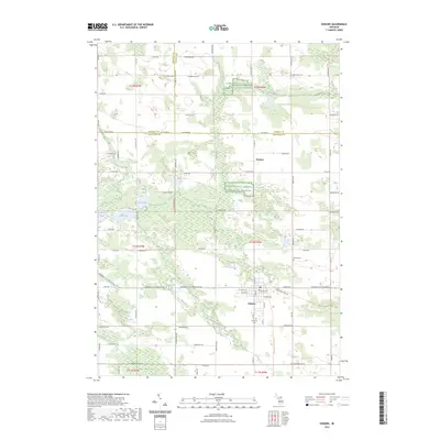
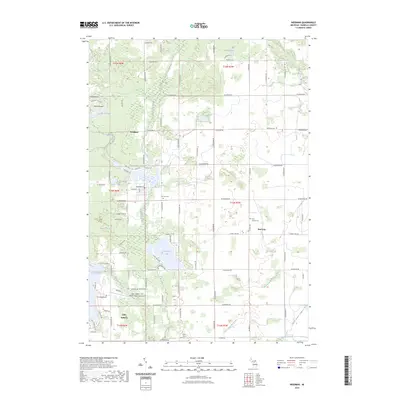 2023 Weidman2023 Print · USGSIsabella County's central townships are shown here in the 2020s, dominated by the residential developments around Lake Isabella and Weidman. Researchers can locate several historic burial sites like Saint Joseph Cem and Fairview Cem alongside the winding Chippewa River.
 - 2023 Map of Alma North, 2023 Print
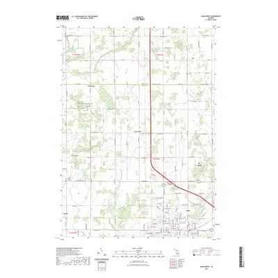 2023 Alma North2023 Print · USGSGratiot County, Michigan, as it appears in the early 2020s shows the continued growth of Alma and St. Louis alongside historic farmsteads. Trace the grounds of Alma College, find local family roots at Brady Cem, or follow the winding Pine River.
 - 2023 Map of Clare, 2023 Print
 2023 Clare2023 Print · USGSClare and Farwell sit at a historic crossroads in central Michigan, where water and rail once drove local industry. Trace family sites at Surrey Township Cem or Cherry Grove Cem, and follow the old rail corridor now known as the Pere Marquette State Trl.
 - 2023 Map of Winn, 2023 Print
 2023 Winn2023 Print · USGSIsabella County's rural heartland is meticulously detailed here in the 2020s, showing a landscape defined by the Chippewa River and quiet country crossroads. Researchers can locate historic burial sites like Saint Leo's Cem or trace the development around Winn and Deerfield Center.
 - 2023 Map of Saint Louis, 2023 Print
 2023 Saint Louis2023 Print · USGSThe riverfront community of St. Louis is shown in modern detail as it spans the borders of Gratiot, Isabella, and Midland counties. Genealogists can locate family landmarks such as Bethany Indian Cem, Oak Grove Cem, and the Jasper Township Cem.
 - 2023 Map of Woods, 2023 Print
 2023 Woods2023 Print · USGSThe village of Farwell and the settlement of Woods are documented here in the early 2020s, showing the local landscape of Clare and Isabella counties. Researchers can trace the South Branch Tobacco River, find the Gilmore Township Cem, and follow the Pere Marquette State Trl.
 - 2023 Map of Rosebush, 2023 Print
 2023 Rosebush2023 Print · USGSIsabella County as it appears in the early 2020s shows a landscape of steady agricultural heritage and established community centers. Researchers can trace local lineage through several sites like Baseline Indian Cem, Woodland Cem, and Saint Henrys Catholic Church.
 - 2023 Map of Sherman City, 2023 Print
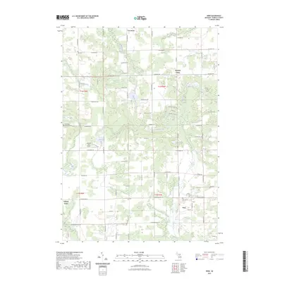
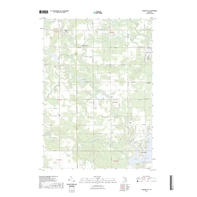 2023 Sherman City2023 Print · USGSThe rural border of Isabella and Mecosta counties is captured here in the early twenty-first century, showing a landscape defined by small crossroads and water. Researchers can trace family sites at Strong Cem or follow the development around Lake Isabella and Sherman City.
 - 2023 Map of Lake, 2023 Print
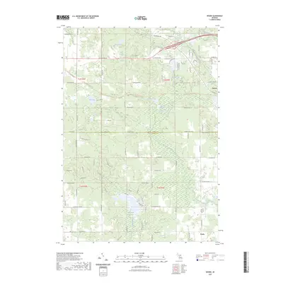
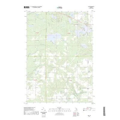 2023 Lake2023 Print · USGSIsabella County and its neighboring townships are captured here in a detailed contemporary portrait. Genealogists and local historians can locate early burial sites like Odd Fellows Cem and Fork Cem or trace the Pere Marquette State Trl.
 - 2023 Map of Edmore, 2023 Print
 2023 Edmore2023 Print · USGSMontcalm County agriculture and small-town life are preserved in this contemporary survey of the Edmore area. Genealogists and local historians can trace family locations near Edmore, Wyman, and the historic Vinewood Cem or Home Cem.
End of results
Showing maps 1-20 of 20
Top cities of Isabella County
Frequently asked questions
- What are the different types of historical maps available for Isabella County?
- What is the oldest map of Isabella County?
- Where can I purchase historical maps of Isabella County for my home or office?
- Where can I download high-res historical maps of Isabella County?
- Are there historical topographic maps available for Isabella County?
- Is there historical aerial imagery available for Isabella County?
- Where are historical maps of Isabella County sourced from?