Old Maps of Isabella County, Michigan for Academic Research
Study the evolution of Isabella County with 139 high-resolution historic maps. Whether you're teaching, researching, or modeling changes in land use, these maps provide essential visual documentation of urban, environmental, and geographic change.
- Analyze long-term change: Track patterns in development, transportation, and natural features.
- Ideal for environmental or urban studies: Support academic projects with primary historical map data.
- Use in the classroom or lab: Educators and researchers rely on these maps to bring historical context to life.
These maps are a powerful tool for teaching, research, and visualizing how Isabella County has changed over the decades.
Isabella County, MI maps
(139)- 1916 Map of Mount Pleasant
 1916 Mount Pleasant1916 Print · USGSIsabella County during the first World War is a landscape of established townships and dense rural school districts. Genealogists and historians can trace the Ann Arbor R.R. through Mount Pleasant or locate old community hubs like Gleaner Hall and Beal City.2 unique versions available
 - 1919 Map of Mount Pleasant
 1919 Mount Pleasant1919 Print · USGSIsabella County appears here at its agrarian peak after the Great War, showing a landscape filled with family-named schools and crossroads. Genealogists can trace property proximities to landmarks like Beal City, Rosebush, and the U.S. Indian Industrial School.2 unique versions available
 - 1930 Map of Shepherd
 1930 Shepherd1930 Print · USGSIsabella and Midland counties are shown during the 1930s oil boom, centered on the infrastructure around Oil City. Genealogists and researchers can trace family lands near dozens of rural schoolhouses like McNelly Sch or visit the Coleman Cem.3 unique versions available
 - 1935 Map of Alma, 1959 Print
 1935 Alma1959 Print · USGSGratiot County thrived as a rail-and-river hub in the mid-thirties, centered on the growing industrial and agricultural corridor between Alma and St Louis. Genealogists and historians can trace dozens of rural schoolhouses and family landmarks, from Jack Day Sch to the County Home near Ithaca.2 unique versions available
 - 1936 Map of Shepherd
 1936 Shepherd1936 Print · USGSCentral Michigan’s rural landscape comes alive in this mid-1930s survey of the Isabella and Midland county line. Genealogists can locate dozens of country schoolhouses like Polish Sch and early churches such as Geneva Hope Ch near the village of Shepherd.2 unique versions available
 - 1938 Map of Alma
 1938 Alma1938 Print · USGSThe Gratiot County landscape at the height of the New Deal era reveals a dense network of country schools and rail lines. Genealogists can trace family roots through numerous named sites like Jack Day Sch, Pine Grove Cem, and the County Home.2 unique versions available
 - 1943 Map of Mount Pleasant
 1943 Mount Pleasant1943 Print · USGSMid-century Isabella County comes to life here, showing a landscape still defined by its township schools and the winding Chippewa River. Researchers can locate the U S Indian Industrial Sch, the Pere Marquette rail corridor, and local landmarks like the Mint Mill.
 - 1954 Map of Midland, 1967 Print
 1954 Midland1967 Print · USGSMid-Michigan at the peak of the post-war era shows a landscape balancing industrial growth in Midland with the deep timberlands of the Manistee National Forest. Researchers can trace the legacy of the timber and rail era along the Pennsylvania RR or find family roots in river towns like Chesaning and Big Rapids.4 unique versions available
 - 1958 Map of Midland
 1958 Midland1958 Print · USGSCentral Michigan in the late fifties is captured here during a period of transition for its university towns and industrial hubs. Genealogists and researchers can trace family lines through old rail-stop towns like Breckenridge and Chesaning or locate property near the Muskegon River and Prairie Farm.
 - 1959 Map of Midland
 1959 Midland1959 Print · USGSMid-century Michigan comes alive in this survey of the central Lower Peninsula, from the streets of Grand Rapids to the Houghton Lake timberlands. Genealogists and rail fans can trace the Ann Arbor RR and Chesapeake and Ohio RR through towns like Big Rapids and Mount Pleasant.
 - 1959 Map of Lake, 1960 Print
 1959 Lake1960 Print · USGSOsceola and Mecosta Counties were a mix of timber-state forests and oil exploration during the late fifties. Researchers can trace rural landmarks from Sears to Brinton, including the County Home, local sites like Martin Sch, and the Chesapeake and Ohio rail line.2 unique versions available
 - 1959 Map of Clare, 1960 Print
 1959 Clare1960 Print · USGSClare and Farwell are captured here at the close of the 1950s, showing the vital rail junction where the Chesapeake and Ohio meets the Ann Arbor Railroad. Genealogists can trace family names through landmarks like the Old Township Cem, Maple Grove Ch, and Wilson Sch.2 unique versions available
 - 1964 Map of Edmore, 1965 Print
 1964 Edmore1965 Print · USGSThe village of Edmore is documented here in the mid-1960s at its junction with the Chesapeake and Ohio railroad. Genealogists and local historians can locate early landmarks such as Vinewood Cem, St Mary Ch, and the Cutler Savage Ch.
 - 1964 Map of Blanchard, 1965 Print
 1964 Blanchard1965 Print · USGSIsabella and Mecosta counties in the mid-1960s reveal a landscape of rural townships and rail-side villages. Researchers can trace family roots at Pine River Ch or Decker Cem and locate historic water features like the Blanchard Millpond.2 unique versions available
 - 1964 Map of Sherman City, 1965 Print
 1964 Sherman City1965 Print · USGSMid-century Isabella and Mecosta Counties are captured here as the rural landscape transitioned through an era of local resource extraction and agriculture. Researchers can locate the Sherman City Cemetery, the Forest Hill Church, and the winding course of the Chippewa River.3 unique versions available
 - 1965 Map of Vestaburg, 1966 Print
 1965 Vestaburg1966 Print · USGSMontcalm and Isabella counties appear here in the mid-1960s as a landscape of rural schoolhouses, small lakes, and steady rail traffic. Genealogists and historians can trace the foundations of local life at the Cedar Lake Academy, Richland Cem, and the village of Vestaburg.2 unique versions available
 - 1965 Map of Riverdale, 1967 Print
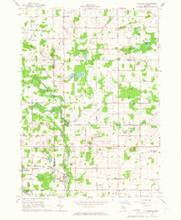 1965 Riverdale1967 Print · USGSThe Pine River valley and the Chesapeake and Ohio railroad define this mid-1960s landscape where Gratiot, Montcalm, and Isabella counties meet. Genealogists and local historians can trace rural roots at Rust and Hay Sch, Jerseyville Ch, and Sibley Cem.
 - 1966 Map of Midland
 1966 Midland1966 Print · USGSCentral Michigan in the mid-1960s shows a landscape of growing manufacturing hubs and active resource extraction. Genealogists and historians can trace the rail corridors of the Grand Trunk Western or locate family-named landmarks near Oil wells and the Muskegon River.
 - 1969 Map of Coleman, 1972 Print
 1969 Coleman1972 Print · USGSMidland and Isabella counties show a landscape of energy and agriculture during the late sixties. Trace the old industrial footprints of the West Beaverton Oil Field and the Chesapeake and Ohio rail lines near Coleman.2 unique versions available
 - 1969 Map of Loomis, 1972 Print
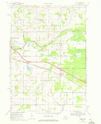 1969 Loomis1972 Print · USGSIsabella and Clare Counties are captured here in the late sixties as the local economy balanced rail transport and oil production. Genealogists and local historians can trace family locations near Loomis, Wise Cem, and the Wise Oil Field.2 unique versions available
 - 1973 Map of Winn, 1975 Print
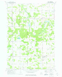 1973 Winn1975 Print · USGSIsabella County in the early seventies shows a landscape of steady rural life and river-valley geography. Genealogists and local historians can locate family landmarks like Union Cem, the Covered Bridge on the Chippewa, and the Isabella Indian Reservation Boundary.
 - 1973 Map of Shepherd, 1976 Print
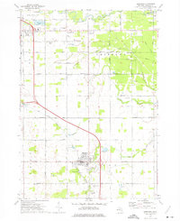 1973 Shepherd1976 Print · USGSShepherd and the surrounding Isabella County townships are seen here in the early seventies, caught between agricultural tradition and local industrial expansion. Researchers can trace historic church sites like Indian Ch and family burial plots at Salt River Cem or Township Cem.
 - 1973 Map of Mount Pleasant, 1976 Print
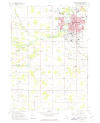 1973 Mount Pleasant1976 Print · USGSMount Pleasant and its surrounding townships are shown here in the early 1970s, just as the university campus and residential suburbs were expanding. Genealogists and local historians can trace the Indian Reservation Boundary or locate family plots in Calvary Cem and Lincoln Cem.
 - 1973 Map of Weidman, 1976 Print
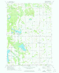 1973 Weidman1976 Print · USGSIsabella County in the early seventies shows a landscape of growing lake communities and rural townships. Researchers can locate family roots at St Joseph Cem or trace the early development of Weidman and Lake Isabella.
 - 1973 Map of Rosebush, 1976 Print
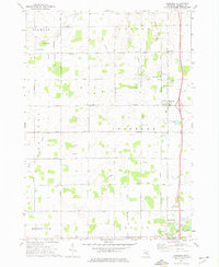 1973 Rosebush1976 Print · USGSIsabella County during the early seventies is shown here as a landscape of grid-patterned township roads and scattered oil production. Genealogists can trace family footprints at St Henrys Ch, Indian Cem, and the small settlement of Schofield.
Showing maps 1-25 of 139
Top cities of Isabella County
Frequently asked questions
- What are the different types of historical maps available for Isabella County?
- What is the oldest map of Isabella County?
- Where can I purchase historical maps of Isabella County for my home or office?
- Where can I download high-res historical maps of Isabella County?
- Are there historical topographic maps available for Isabella County?
- Is there historical aerial imagery available for Isabella County?
- Where are historical maps of Isabella County sourced from?