1940s Maps of Kalamazoo, Michigan
Explore 2 historic maps of Kalamazoo from the 1940s. These maps offer a rare glimpse into what life looked like during the 1940s — showing old roads, neighborhoods, homes, and landmarks that have changed or disappeared over time.
Whether you're researching your family's past, planning a metal detecting trip, or studying how Kalamazoo's landscape evolved across the 1940s, these high-resolution maps are a powerful tool for exploring the history of this region.
- Focus on a specific era: All maps on this page are from the 1940s, giving you a focused view of this time period.
- See what’s changed: Compare century-old streets, trails, and buildings to today's modern landscape using overlays and satellite layers.
- Research with precision: Use these maps for genealogy, historical research, land use analysis, or educational projects.
- View, download, or print: Maps are fully viewable online in high resolution, and can be downloaded or printed for your own records.
Start exploring Kalamazoo's history through authentic maps from the 1940s. This is your window into the past.
Kalamazoo, MI maps
(2)- 1943 Map of Kalamazoo
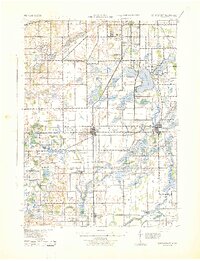
 1943 Kalamazoo1943 Print · USGSMid-century Kalamazoo and its northern satellite towns are shown here during a period of industrial and rail prominence. Genealogists can locate dozens of rural landmarks, from Nazareth Academy to local schoolhouses like Grand Prairie Sch and Star Sch.
 - 1943 Map of Schoolcraft
 1943 Schoolcraft1943 Print · USGSKalamazoo and St. Joseph counties are shown here during the early 1940s, a landscape defined by glacial lakes and the expansive Schoolcraft Prairie. Trace family roots at Vicksburg or locate historic rural schools like Lost Island Sch and Brick Sch.
End of results
Showing maps 1-2 of 2
Top cities near Kalamazoo
- Portage historical maps
- Pavilion historical maps
- Alamo historical maps
- Plainwell historical maps
- Otsego historical maps
- Mattawan historical maps
See more
Top neighborhoods of Kalamazoo
Frequently asked questions
- What are the different types of historical maps available for Kalamazoo?
- What is the oldest map of Kalamazoo?
- Where can I purchase historical maps of Kalamazoo for my home or office?
- Where can I download high-res historical maps of Kalamazoo?
- Are there historical topographic maps available for Kalamazoo?
- Is there historical aerial imagery available for Kalamazoo?
- Where are historical maps of Kalamazoo sourced from?