1900s (20th Century) Maps of Lapeer County, Michigan
Explore 43 historic maps of Lapeer County from the 1900s (20th Century). These maps offer a rare glimpse into what life looked like during the 1900s — showing old roads, neighborhoods, homes, and landmarks that have changed or disappeared over time.
Whether you're researching your family's past, planning a metal detecting trip, or studying how Lapeer County's landscape evolved across the 1900s, these high-resolution maps are a powerful tool for exploring the history of this region.
- Focus on a specific era: All maps on this page are from the 1900s, giving you a focused view of this time period.
- See what’s changed: Compare century-old streets, trails, and buildings to today's modern landscape using overlays and satellite layers.
- Research with precision: Use these maps for genealogy, historical research, land use analysis, or educational projects.
- View, download, or print: Maps are fully viewable online in high resolution, and can be downloaded or printed for your own records.
Start exploring Lapeer County's history through authentic maps from the 1900s. This is your window into the past.
Lapeer County, MI maps
(43)- 1914 Map of Armada
 1914 Armada1914 Print · USGSMacomb and St. Clair Counties are seen here in the years before the Great War as a productive agricultural landscape tied together by rail. Researchers can trace historic farmstead locations and early rural infrastructure, from Wolcotts Mill Pond to the busy Grand Trunk R. R. junctions at Armada and Richmond.
 - 1928 Map of Armada
 1928 Armada1928 Print · USGSMacomb and St. Clair counties are shown here in the early twentieth century as agriculture and rail travel dominated the landscape. Genealogists can trace family roots through specific locales like Doyle P.O., Sullicks Corners, and the mill at Wolcots Mill Pond.
 - 1943 Map of Metamora, 1964 Print
 1943 Metamora1964 Print · USGSLapeer County during the early 1940s shows a landscape of small villages and rural schools along the Michigan Central line. Genealogists can trace family names through landmarks like Harris Cem, Newark Sch, and Lake Minnewanna.
 - 1945 Map of Almont
 1945 Almont1945 Print · USGSAlmont and Dryden are the focal points of this mid-1940s survey of the Lapeer and Macomb county borders during a time of rural schoolhouses and family farms. Researchers can locate many local landmarks like Ferguson Cem, Rider Sch, and Neil Sch along the upper reaches of the Belle River.2 unique versions available
 - 1945 Map of Allenton
 1945 Allenton1945 Print · USGSSt. Clair County's farming heartland is captured here in the mid-1940s, showing a landscape of tight-knit rural communities and school districts. Genealogists can trace family locations near Allenton, Scotch Settlement, and several country schools like Gould Sch and Stoddard Sch.2 unique versions available
 - 1945 Map of Thornville
 1945 Thornville1945 Print · USGSLapeer County townships are shown here during the mid-forties, characterized by a dense landscape of glacial lakes and crossroads settlements. Researchers can pinpoint several country schoolhouses and four distinct burial grounds, including Foot Cem and South Attica Cem.3 unique versions available
 - 1945 Map of Hadley
 1945 Hadley1945 Print · USGSLapeer County at the end of the war reveals a quiet landscape of agricultural homesteads and numerous small lakes. Genealogists can trace family roots at Green Corners Cem or locate rural landmarks like Kipp Sch and the Sawmill near Sawmill Lake.2 unique versions available
 - 1946 Map of Metamora
 1946 Metamora1946 Print · USGSLapeer County was a landscape of small farms and numerous glacial lakes during the mid-1940s. Researchers can trace the Michigan Central rail corridor and locate community landmarks like Farmers Creek Cem, Camp Metamora, and several rural schools.2 unique versions available
 - 1952 Map of Allenton, 1953 Print
 1952 Allenton1953 Print · USGSIn the early fifties, the agricultural townships of Berlin and Mussey remained a landscape of rural schoolhouses and family cemeteries. Researchers can still locate landmarks like Gould Sch, West Berlin Ch, and the Scotch Settlement Cem.2 unique versions available
 - 1954 Map of Detroit
 1954 Detroit1954 Print · USGSThe Detroit metro and its Ontario neighbors are shown at the height of the mid-century industrial era, just as the suburbs were rapidly expanding. Researchers can trace the massive rail networks of the Wabash Railroad or locate landmarks like Grosse Ile and Selfridge Air Force Base.
 - 1954 Map of Flint, 1968 Print
 1954 Flint1968 Print · USGSThe industrial corridor and fertile Thumb region of Michigan come alive in this mid-century survey. Genealogists and historians can trace the rail networks of the Grand Trunk, locate established settlements like Bad Axe and Sandusky, or explore the 1950s shoreline along Saginaw Bay.4 unique versions available
 - 1958 Map of Flint
 1958 Flint1958 Print · USGSThe Michigan Thumb and the Saginaw Valley are captured here during the height of the post-war industrial era. Researchers can trace the complex rail networks of the Grand Trunk Western or locate mid-century landmarks like Lakeport State Park and the port at Bay City.2 unique versions available
 - 1961 Map of Brown City, 1963 Print
 1961 Brown City1963 Print · USGSThe rural borderlands of Sanilac, Lapeer, and St. Clair counties come alive in this early 1960s survey of the Michigan thumb's farming heartland. Trace the paths of the Chesapeake and Ohio railroad through Brown City or find ancestral sites like Valley Center Cem and Odelville Sch.2 unique versions available
 - 1961 Map of Capac, 1963 Print
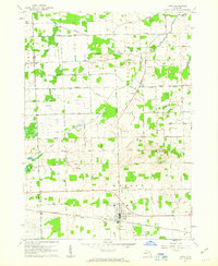 1961 Capac1963 Print · USGSAgricultural life in St. Clair County during the early sixties centers on the village of Capac and its extensive drainage network. Genealogists can trace local landmarks like Pine Hill Cem, the Lynn Corner Sch, and the Grand Trunk rail line.2 unique versions available
 - 1961 Map of Detroit, 1973 Print
 1961 Detroit1973 Print · USGSThe international border between Michigan and Ontario was a bustling industrial corridor in the early sixties. Researchers can trace the transit networks and riverfront infrastructure connecting Detroit to Windsor via the Detroit-Windsor Tunnel and major air hubs like Willow Run Airport.2 unique versions available
 - 1963 Map of Clifford, 1964 Print
 1963 Clifford1964 Print · USGSLife on the Tuscola and Lapeer county line in the early sixties centered on rail-connected villages and a network of rural schools. Genealogists and historians can trace the foundations of Silverwood, Clifford, and landmarks like St Patricks Cem or the Maple Grove Sch.
 - 1963 Map of Juhl, 1964 Print
 1963 Juhl1964 Print · USGSSanilac County's rural townships in the early sixties reveal a landscape of managed farmland and tight-knit communities. Genealogists and local historians can locate early landmarks such as the Juhl Cem, Flynn Ch, and the Red Star Community Building.
 - 1963 Map of Attica, 1964 Print
 1963 Attica1964 Print · USGSLapeer County's rural landscape is captured here in the early sixties, showing a transition between agricultural tradition and local recreation. Genealogists and historians can trace family roots through several district schoolhouses like Fish Lake Sch and the small settlements of Lum and Attica.2 unique versions available
 - 1963 Map of Mayville, 1964 Print
 1963 Mayville1964 Print · USGSThe rural borderlands of Tuscola and Lapeer counties are captured here in the early sixties, centered on the village of Mayville. Researchers can trace old family sites and rural landmarks like the Rich Ch, Frenzel Sch, and several historic burying grounds including Rich Cem.
 - 1963 Map of Marlette, 1964 Print
 1963 Marlette1964 Print · USGSMarlette and the surrounding farm country are captured here in the early sixties as the regional rail and drainage networks were fully matured. Genealogists and local historians can trace rural school districts like Brown School and Montgomery Sch or locate family sites near French Line Presbyterian Ch.2 unique versions available
 - 1963 Map of North Branch, 1964 Print
 1963 North Branch1964 Print · USGSLapeer County agriculture and rural life are captured here in the early sixties, centered on the village of North Branch. Genealogists can trace family names through landmarks like SS Peter and Paul Cem, Kings Mill, and the Five Lakes Sch.2 unique versions available
 - 1963 Map of Columbiaville, 1964 Print
 1963 Columbiaville1964 Print · USGSColumbiaville and Otter Lake appear here during the early sixties, a landscape of fertile farmland and managed waterways at the borders of three counties. Researchers can trace the New York Central Railroad corridor and locate local landmarks like Woodlawn Cem and Lakeville High Sch.2 unique versions available
 - 1963 Map of Burnside, 1964 Print
 1963 Burnside1964 Print · USGSLapeer County's rural townships are documented in the early sixties, showing the agricultural network of Burnside and Goodland. Local historians can trace family-named schools and cemeteries like Abbott Sch, Fox Cem, and the mid-century Drive-in Theater.2 unique versions available
 - 1963 Map of Elba, 1964 Print
 1963 Elba1964 Print · USGSLapeer and Genesee counties are captured here in the early sixties as the suburbs of Davison meet a landscape of glacial lakes and reservoirs. Genealogists and researchers can locate the German Sch, St Johns Cem, and the old rail stop at Elba.2 unique versions available
 - 1963 Map of Imlay City, 1964 Print
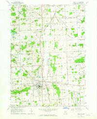 1963 Imlay City1964 Print · USGSImlay City and the surrounding Lapeer County farmlands are captured in the early sixties at a peak of rural development. Genealogists can locate family landmarks like Folsom Sch, Imlay Cem, and the Pentecostal Ch along the historic Grand Trunk Railroad route.2 unique versions available
Showing maps 1-25 of 43
Top cities of Lapeer County
Frequently asked questions
- What are the different types of historical maps available for Lapeer County?
- What is the oldest map of Lapeer County?
- Where can I purchase historical maps of Lapeer County for my home or office?
- Where can I download high-res historical maps of Lapeer County?
- Are there historical topographic maps available for Lapeer County?
- Is there historical aerial imagery available for Lapeer County?
- Where are historical maps of Lapeer County sourced from?