1980s Maps of Ahgosatown, Leelanau Township
Explore 2 historic maps of Ahgosatown from the 1980s. These maps offer a rare glimpse into what life looked like during the 1980s — showing old roads, neighborhoods, homes, and landmarks that have changed or disappeared over time.
Whether you're researching your family's past, planning a metal detecting trip, or studying how Ahgosatown's landscape evolved across the 1980s, these high-resolution maps are a powerful tool for exploring the history of this region.
- Focus on a specific era: All maps on this page are from the 1980s, giving you a focused view of this time period.
- See what’s changed: Compare century-old streets, trails, and buildings to today's modern landscape using overlays and satellite layers.
- Research with precision: Use these maps for genealogy, historical research, land use analysis, or educational projects.
- View, download, or print: Maps are fully viewable online in high resolution, and can be downloaded or printed for your own records.
Start exploring Ahgosatown's history through authentic maps from the 1980s. This is your window into the past.
Ahgosatown, Leelanau Township maps
(2)- 1983 Map of Omena, 1984 Print
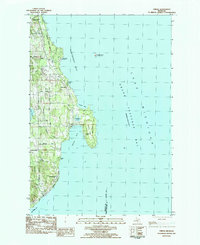 1983 Omena1984 Print · USGSLeelanau Peninsula’s eastern shore is captured here in the early eighties, showing a landscape of coastal settlements and lakeside camps. Trace family roots and local geography through Peshawbestown, the rails of the Leelanau Transit Company, and Omena Point.
 - 1984 Map of Charlevoix, 1985 Print
 1984 Charlevoix1985 Print · USGSNorthern Michigan’s coastal peninsulas and deep inland lakes are captured here in the mid-eighties, showing the region's unique maritime and rail connectivity. Researchers can trace historic family-named landmarks and infrastructure like Woolsey Memorial Airport, Barnard Ch, and the Chesapeake and Ohio RR.2 unique versions available
End of results
Showing maps 1-2 of 2
Top cities near Ahgosatown
- Peninsula Township historical maps
- Elmwood Charter Township historical maps
- Acme Township historical maps
- Whitewater Township historical maps
- Bingham historical maps
- Elk Rapids historical maps
See more
Frequently asked questions
- What are the different types of historical maps available for Ahgosatown?
- What is the oldest map of Ahgosatown?
- Where can I purchase historical maps of Ahgosatown for my home or office?
- Where can I download high-res historical maps of Ahgosatown?
- Are there historical topographic maps available for Ahgosatown?
- Is there historical aerial imagery available for Ahgosatown?
- Where are historical maps of Ahgosatown sourced from?