
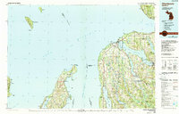
1984 Map of Charlevoix
USGS Topo · Published 1985About this map
Lake Michigan dominates this 1984 survey, framing the complex shorelines of the Leelanau Peninsula and the Grand Traverse Bay region. The map captures the specialized geography of the northern Lower Peninsula, where long, narrow inland waters like Torch Lake and Lake Charlevoix parallel the Great Lake coastline. Significant maritime landmarks are documented, including the South Fox Island Lighthouse and the Grand Traverse Light at Lighthouse Point.
Find a feature on this map
134 named features on this map. Tap any name to fly to it.
Don’t see what you’re looking for? This feature index may not catch every label — zoom into the map to look around manually.
Map Details
Editions of this 1984 Charlevoix Map
2 editions found
Other maps of this area

1954 · Central Lake
USGS Topo · 1:62,500

1954 · Charlevoix
USGS Topo · 1:62,500

1954 · Traverse City
USGS Topo · 1:250,000

1954 · Escanaba
USGS Topo · 1:250,000

1954 · Manitowoc
USGS Topo · 1:250,000

1955 · Gull Island
USGS Topo · 1:62,500

1955 · Cheboygan
USGS Topo · 1:250,000

1956 · Alba
USGS Topo · 1:62,500

1956 · Mancelona
USGS Topo · 1:62,500

1956 · North Manitou
USGS Topo · 1:62,500