Old Maps of Lenawee County, Michigan for Academic Research
Study the evolution of Lenawee County with 155 high-resolution historic maps. Whether you're teaching, researching, or modeling changes in land use, these maps provide essential visual documentation of urban, environmental, and geographic change.
- Analyze long-term change: Track patterns in development, transportation, and natural features.
- Ideal for environmental or urban studies: Support academic projects with primary historical map data.
- Use in the classroom or lab: Educators and researchers rely on these maps to bring historical context to life.
These maps are a powerful tool for teaching, research, and visualizing how Lenawee County has changed over the decades.
Lenawee County, MI maps
(155)- 1904 Map of Ann Arbor
 1904 Ann Arbor1904 Print · USGSEarly twentieth-century Washtenaw County comes to life through its dense network of interurban electric lines and steam railroads. Researchers can trace the layout of Ann Arbor, locate the Duck Lake School, or find vanished stops along the Michigan Central R. R. and Ann Arbor R. R..2 unique versions available
 - 1906 Map of Saline
 1906 Saline1906 Print · USGSSoutheastern Michigan at the start of the century was a landscape of thriving rail hubs and productive farm country. Trace the early tracks of the Lake Shore and Michigan Southern R R through the streets of Saline, Tecumseh, and the village of Clinton.4 unique versions available
 - 1908 Map of Ann Arbor
 1908 Ann Arbor1908 Print · USGSSoutheast Michigan at the turn of the century shows a landscape transitioning through the arrival of electric rail and the growth of the Huron River valley. Genealogists and researchers can trace old family lands near Saline, Ypsilanti, and Whitmore Lake, or follow the path of the Michigan Central RR.
 - 1911 Map of Wauseon, 1954 Print
 1911 Wauseon1954 Print · USGSFulton County and the Michigan-Ohio borderlands thrived as a major railroad hub in the early twentieth century. Researchers can trace numerous vanished district schools like Swamp Angel School and stop-points like Tedrow PO or Ottokee Sta.
 - 1911 Map of Swanton, 1956 Print
 1911 Swanton1956 Print · USGSNorthwest Ohio and the Michigan border are captured here just before the era of major highway expansion. Genealogists can trace early twentieth-century property locations near Metamora, Raab Corners, and numerous rural schoolhouses like Frogpond School.
 - 1913 Map of Wauseon
 1913 Wauseon1913 Print · USGSFulton County and the Michigan-Ohio border are shown here just before the Great War, during the peak of the region's rural school and rail networks. Genealogists can locate specific family-named landmarks and institutions like Tedrow PO, Ottokee, and the Swamp Angel School.2 unique versions available
 - 1913 Map of Alvordton
 1913 Alvordton1913 Print · USGSThe rural borderlands of Ohio and Michigan are captured here just after the turn of the century, showing a landscape of burgeoning rail junctions and tight-knit farming townships. Researchers can trace the heritage of vanished school districts and country houses of worship like Gray Church and the Mennonite Church near Archbold.3 unique versions available
 - 1914 Map of Swanton, 1937 Print
 1914 Swanton1937 Print · USGSThe Ohio-Michigan borderlands come alive in this era of peak rail transit and rural schoolhouse density. Genealogists and historians can trace family roots through numerous local landmarks like Metamora, Richfield Center, and uniquely named sites such as Huckleberry School or Frogpond School.
 - 1935 Map of Jackson
 1935 Jackson1935 Print · USGSThe rail and river networks of south-central Michigan are captured here in the mid-1930s as the area transitioned between agricultural roots and industrial growth. Genealogists can locate numerous country schools and landmarks like Putney Mill, Turkey Hall Sch, and Somerset Center.6 unique versions available
 - 1935 Map of Berkey
 1935 Berkey1935 Print · USGSLucas County farms and small crossroads settlements are captured here in the mid-1930s as the region transitioned from electric rail to highway travel. Researchers can trace family sites near Wolfinger Cem, the St Elizabeth Sch Richfield Center, and the industrial spur at Allen Junction.
 - 1939 Map of Berkey
 1939 Berkey1939 Print · USGSNorthwest Ohio at the end of the Depression reveals a landscape defined by rail transit and reclaimed wetlands. Trace the path of the Toledo and Western Railroad or locate family roots near Richfield Center and the Immaculate Conception Sch.3 unique versions available
 - 1939 Map of Jackson
 1939 Jackson1939 Print · USGSJackson and its southern lake country are captured here in the late 1930s, showing a landscape of burgeoning settlements and vital rail lines. Researchers can trace the heritage of local school districts and rural crossroads like Cement City, Somerset Center, and the Turkey Hall Sch.4 unique versions available
 - 1939 Map of Blissfield, 1958 Print
 1939 Blissfield1958 Print · USGSSoutheastern Michigan agriculture and industry are in full view during the late 1930s as a dense network of railroads and rivers connects small farm towns. Local historians can trace the locations of dozens of vanished schools like Ford Sch and rail junctions like Lenawee Junction.
 - 1941 Map of Blissfield
 1941 Blissfield1941 Print · USGSSoutheastern Michigan is captured here just before the war, showcasing a landscape defined by the winding Raisin River and its busy rail corridors. Genealogists and historians can trace dozens of country schoolhouses like Centennial Sch and family landmarks near Blissfield and Lenawee Junction.2 unique versions available
 - 1943 Map of Wauseon, 1944 Print
 1943 Wauseon1944 Print · USGSFulton County and the Michigan-Ohio border are shown during the mid-forties when steam rail and rural school districts still defined the local geography. Genealogists can trace family footprints across dozens of local landmarks like Ottokee, Winameg, and the uniquely named Swamp Angel Sch.
 - 1944 Map of Alvordton
 1944 Alvordton1944 Print · USGSSpanning the Michigan and Ohio border in the 1940s, this area shows a landscape of busy rail junctions and rural school districts. Genealogists can trace family roots through sites like Gray Church, Virginia School, or the settlements of Fayette and West Unity.
 - 1948 Map of Manchester, 1972 Print
 1948 Manchester1972 Print · USGSManchester and the Irish Hills region are shown here just after the war, when the New York Central rail line still connected these rural townships. Genealogists can trace dozens of local schoolhouses and churches, such as Sharon Hill Sch and North Sharon Ch.2 unique versions available
 - 1949 Map of Manchester
 1949 Manchester1949 Print · USGSSoutheast Michigan in the late 1940s reveals a patchwork of small-town centers and lakeside retreats connected by the New York Central rail line. Genealogists can trace family roots through dozens of local sites like Raymond Cem, Iron Creek Ch, and the McMahon Sch.3 unique versions available
 - 1951 Map of Berkey, 1952 Print
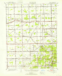 1951 Berkey1952 Print · USGSThis Lucas County landscape in the early fifties shows a rural community defined by family farms and the Michigan-Ohio border. Genealogists can locate family landmarks like the Wolfinger Cemetery, Sharples Church, and schools like Mulberry School.3 unique versions available
 - 1953 Map of Fort Wayne, 1963 Print
 1953 Fort Wayne1963 Print · USGSNortheast Indiana and its neighboring borderlands in Michigan and Ohio appear here during a peak era of rail and road expansion. Researchers can trace the massive rail networks of the Nickel Plate Road and Wabash or locate lakeside landmarks like Lake Wawasee and Clear Lake.4 unique versions available
 - 1954 Map of Detroit
 1954 Detroit1954 Print · USGSThe Detroit metro and its Ontario neighbors are shown at the height of the mid-century industrial era, just as the suburbs were rapidly expanding. Researchers can trace the massive rail networks of the Wabash Railroad or locate landmarks like Grosse Ile and Selfridge Air Force Base.
 - 1956 Map of Fort Wayne
 1956 Fort Wayne1956 Print · USGSThe tri-state borderlands of Indiana, Michigan, and Ohio are captured here in the mid-fifties, centered on the growing industrial hub of Fort Wayne. Researchers can trace the heavy rail lines of the New York Central and Pennsylvania alongside prominent water features like Lake Wawasee and the Maumee River.2 unique versions available
 - 1956 Map of Toledo, 1968 Print
 1956 Toledo1968 Print · USGSNorthwest Ohio and the Lake Erie shoreline are shown in detail during the late fifties, showcasing a landscape of heavy industry, railroads, and island communities. Genealogists and historians can trace rail networks like the Chesapeake & Ohio RR or locate landmarks such as the Erie Proving Ground and Kelleys Island.4 unique versions available
 - 1958 Map of Grand Rapids, 1973 Print
 1958 Grand Rapids1973 Print · USGSSouthern Michigan at the peak of the postwar era shows a landscape of burgeoning cities and new interstate highways. Trace family roots and regional growth in Grand Rapids, Battle Creek, and the glacial lake country around Gun Lake or Gull Lake.2 unique versions available
 - 1960 Map of Morenci, 1961 Print
 1960 Morenci1961 Print · USGSMorenci and the surrounding borderlands of Michigan and Ohio are shown here in the early sixties, as rail lines and rural townships defined the local economy. Genealogists can trace family names through Oak Grove Cemetery, East Chesterfield Ch, and the crossroads at Oakshade.3 unique versions available
Showing maps 1-25 of 155
Top cities of Lenawee County
- Adrian historical maps
- Tecumseh historical maps
- Rollin Township historical maps
- Hudson historical maps
- Morenci historical maps
- Addison historical maps
See more
Frequently asked questions
- What are the different types of historical maps available for Lenawee County?
- What is the oldest map of Lenawee County?
- Where can I purchase historical maps of Lenawee County for my home or office?
- Where can I download high-res historical maps of Lenawee County?
- Are there historical topographic maps available for Lenawee County?
- Is there historical aerial imagery available for Lenawee County?
- Where are historical maps of Lenawee County sourced from?