1960s Maps of Clark Township, Michigan
Explore 7 historic maps of Clark Township from the 1960s. These maps offer a rare glimpse into what life looked like during the 1960s — showing old roads, neighborhoods, homes, and landmarks that have changed or disappeared over time.
Whether you're researching your family's past, planning a metal detecting trip, or studying how Clark Township's landscape evolved across the 1960s, these high-resolution maps are a powerful tool for exploring the history of this region.
- Focus on a specific era: All maps on this page are from the 1960s, giving you a focused view of this time period.
- See what’s changed: Compare century-old streets, trails, and buildings to today's modern landscape using overlays and satellite layers.
- Research with precision: Use these maps for genealogy, historical research, land use analysis, or educational projects.
- View, download, or print: Maps are fully viewable online in high resolution, and can be downloaded or printed for your own records.
Start exploring Clark Township's history through authentic maps from the 1960s. This is your window into the past.
Clark Township, MI maps
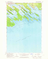
(7)- 1964 Map of Albany Island, 1965 Print
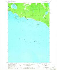 1964 Albany Island1965 Print · USGSThe eastern Upper Peninsula shoreline meets the waters of Lake Huron in this mid-1960s survey of Chippewa County. Trace the wild coastal terrain of Munuscong State Forest and the protected waters of Albany Harbor and Big Trout Lake.3 unique versions available
 - 1964 Map of Stalwart, 1965 Print
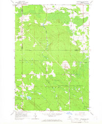
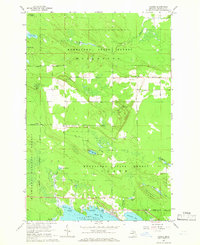
 1964 Stalwart1965 Print · USGSThe eastern Upper Peninsula is shown in the mid-1960s, documenting the rural community of Stalwart and the surrounding wilderness. Genealogists and historians can locate the Stalwart Cem and Fairground, or trace family-named waters like McAdams Lake and Sam Taylor Lake.
 - 1964 Map of Prentiss Bay, 1965 Print
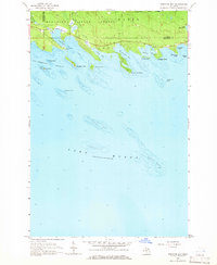 1964 Prentiss Bay1965 Print · USGSThe northern shores of Lake Huron appear in detail during the mid-1960s, showing the intersection of Mackinac and Chippewa counties. Genealogists and maritime historians can trace coastal features like Cedar Campus Camp, the Light at Martin Reef, and the many inlets of Prentiss Bay.2 unique versions available
 - 1964 Map of Pickford SE, 1966 Print
 1964 Pickford SE1966 Print · USGSUpper Peninsula timber and quarrying operations are detailed in this mid-sixties survey of the Mackinac County interior. Genealogists and researchers can locate family sites at Cedarville, the Bethel Ch, and the isolated Hannah Cem along the Industrial Railroad.2 unique versions available
 - 1964 Map of Goose Island, 1966 Print
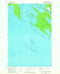 1964 Goose Island1966 Print · USGSThe Les Cheneaux archipelago comes alive in this mid-century survey of the Michigan coastline near Hessel. Researchers can trace waterfront property near Patrick Landing, locate Edgewood Cem, or explore the many inlets of Marquette Island.2 unique versions available
 - 1964 Map of Cedarville, 1966 Print
 1964 Cedarville1966 Print · USGSThe intricate Les Cheneaux archipelago in the mid-1960s highlights the maritime and industrial pulse of the Upper Peninsula. Trace the Industrial Railroad to Port Dolomite or locate family landmarks on La Salle Island and Patrick Landing.2 unique versions available
 - 1964 Map of Hessel, 1966 Print
 1964 Hessel1966 Print · USGSUpper Peninsula shoreline life and forest management meet in this mid-sixties survey of Mackinac County. Researchers can trace family history through Italian Hill Cemetery, find the old Hessel Landing Field, and locate small settlements like Fenlons.2 unique versions available
End of results
Showing maps 1-7 of 7
Top cities near Clark Township
Top neighborhoods of Clark Township
- Port Dolomite historical maps
- Patrick Landing historical maps
- Hessel historical maps
- Cedarville historical maps
Frequently asked questions
- What are the different types of historical maps available for Clark Township?
- What is the oldest map of Clark Township?
- Where can I purchase historical maps of Clark Township for my home or office?
- Where can I download high-res historical maps of Clark Township?
- Are there historical topographic maps available for Clark Township?
- Is there historical aerial imagery available for Clark Township?
- Where are historical maps of Clark Township sourced from?