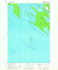
1964 Map of Goose Island
USGS Topo · Published 1966About this map
Marquette Island and the intricate archipelago of the Les Cheneaux Islands dominate this coastal survey of Northern Michigan's waterfront. The village of Hessel sits at the northern edge, serving as a gateway to the complex network of channels and bays that define this portion of Lake Huron. The landscape is a mix of protected maritime passages like the Les Cheneaux Channel and the expansive timberlands of the Hiawatha National Forest.
Find a feature on this map
38 named features on this map. Tap any name to fly to it.
Don’t see what you’re looking for? This feature index may not catch every label — zoom into the map to look around manually.
Map Details
Editions of this 1964 Goose Island Map
2 editions found
Other maps of this area

1931 · Pickford SE
USGS Topo · 1:31,680

1932 · St Ignace NE
USGS Topo · 1:31,680

1954 · Sault Sainte Marie
USGS Topo · 1:250,000

1955 · Cheboygan
USGS Topo · 1:250,000

1956 · Sault Sainte Marie
USGS Topo · 1:250,000

1957 · Sault Sainte Marie
USGS Topo · 1:250,000

1958 · Cheboygan
USGS Topo · 1:250,000

1958 · Sault Sainte Marie
USGS Topo · 1:250,000

1964 · Round Island
USGS Topo · 1:24,000
1964 · Pickford SE
USGS Topo · 1:24,000