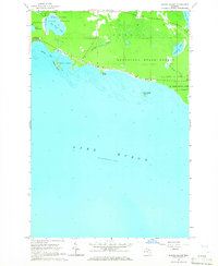
1964 Map of Albany Island
USGS Topo · Published 1965About this map
Munuscong State Forest dominates the northern shoreline of Lake Huron in this mid-century survey of the Upper Peninsula’s eastern edge. The map captures a transition from the dense woodlands of the interior to the complex maritime landscape of Albany Bay and Albany Harbor. Offshore, Albany Island and Saddlebag Island emerge from the depth soundings and shoals of Lake Huron, which provided critical navigational context for the U.S. Lake Survey at the time. Inland water bodies like Big Trout Lake and the marshy edges of Cranberry Lake feed small tributaries such as Trout Cr and Albany Creek. Public recreation is established at the eastern edge of the sheet within De Tour State Park, featuring a dedicated Campground and nearby Roadside Park along the coastal route.
Find a feature on this map
22 named features on this map. Tap any name to fly to it.
Don’t see what you’re looking for? This feature index may not catch every label — zoom into the map to look around manually.
Map Details
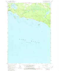
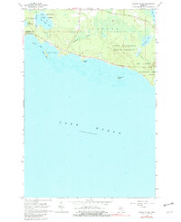
Editions of this 1964 Albany Island Map
3 editions found
Other maps of this area

1954 · Alpena
USGS Topo · 1:250,000

1954 · Sault Sainte Marie
USGS Topo · 1:250,000

1955 · Cheboygan
USGS Topo · 1:250,000

1956 · Sault Sainte Marie
USGS Topo · 1:250,000

1957 · Alpena
USGS Topo · 1:250,000

1957 · Sault Sainte Marie
USGS Topo · 1:250,000

1958 · Cheboygan
USGS Topo · 1:250,000

1958 · Alpena
USGS Topo · 1:250,000

1958 · Sault Sainte Marie
USGS Topo · 1:250,000

1961 · Blind River
USGS Topo · 1:250,000