2020s Maps of Ishpeming Township, Michigan
Explore 6 historic maps of Ishpeming Township from the 2020s. These maps offer a rare glimpse into what life looked like during the 2020s — showing old roads, neighborhoods, homes, and landmarks that have changed or disappeared over time.
Whether you're researching your family's past, planning a metal detecting trip, or studying how Ishpeming Township's landscape evolved across the 2020s, these high-resolution maps are a powerful tool for exploring the history of this region.
- Focus on a specific era: All maps on this page are from the 2020s, giving you a focused view of this time period.
- See what’s changed: Compare century-old streets, trails, and buildings to today's modern landscape using overlays and satellite layers.
- Research with precision: Use these maps for genealogy, historical research, land use analysis, or educational projects.
- View, download, or print: Maps are fully viewable online in high resolution, and can be downloaded or printed for your own records.
Start exploring Ishpeming Township's history through authentic maps from the 2020s. This is your window into the past.
Ishpeming Township, MI maps
(6)- 2023 Map of Buckroe, 2023 Print
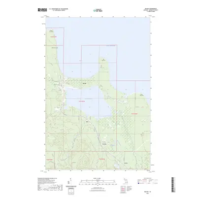
 2023 Buckroe2023 Print · USGSMarquette County's shoreline and wilderness are documented in this contemporary survey of the Lake Superior coast. Researchers can trace historical access via Gold Mine Rd and locate landmarks like Little Garlic Falls and the settlement of Birch.
 - 2023 Map of Negaunee NW, 2023 Print
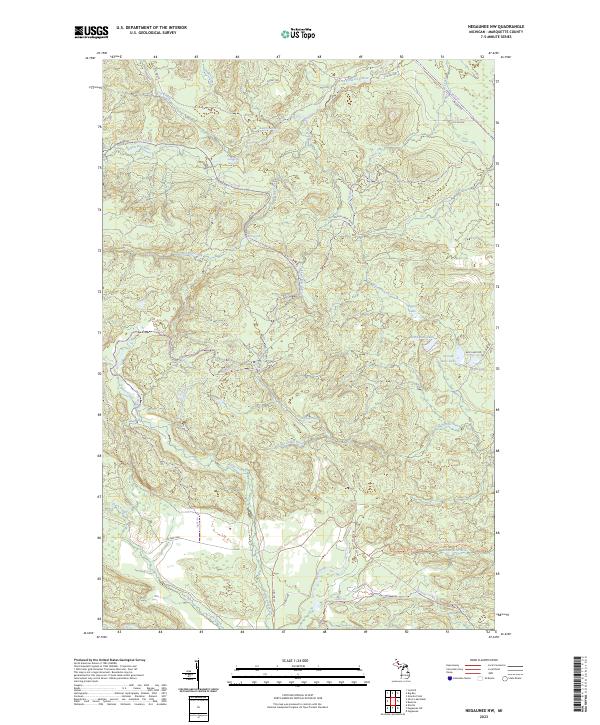 2023 Negaunee NW2023 Print · USGSMarquette County's northern wilderness is shown in the early twenty-first century, where water and trail networks define the land. Trace the path of the North Country National Scenic Trl and find remote landmarks like Yellow Dog River Falls or the waters of Regan Lake.
 - 2023 Map of Big Bay, 2023 Print
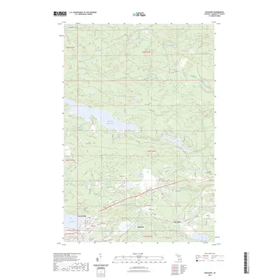
 2023 Big Bay2023 Print · USGSBig Bay and the shores of Lake Superior are captured here in the early twenty-first century, showing a landscape defined by deep woods and coastal points. Researchers can trace local landmarks like Big Bay Cem, the waters of Lake Independence, and the remote settlement of Antlers.
 - 2023 Map of Negaunee, 2023 Print
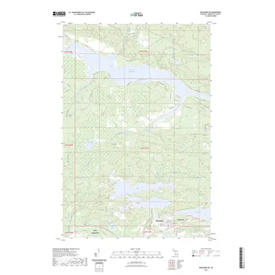
 2023 Negaunee2023 Print · USGSMarquette County's iron country and river basins are captured in the 2020s, showing the modern layout of Negaunee and Eagle Mills. Trace the industrial heritage along the LS & I RR or locate family sites near Negaunee Cem and Teal Lake.
 - 2023 Map of Negaunee SW, 2023 Print
 2023 Negaunee SW2023 Print · USGSMarquette County's iron country is surveyed here in the early twenty-first century, showing the established communities of Ishpeming and Negaunee. Genealogists and hikers can trace the Ishpeming Cem or follow the North Country National Scenic Trl past Deer Lake.
 - 2023 Map of Ishpeming, 2023 Print
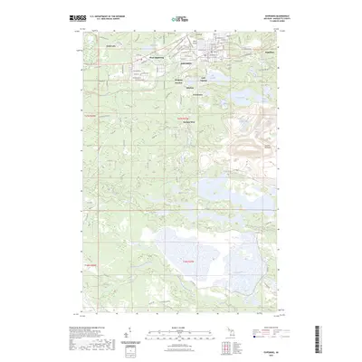 2023 Ishpeming2023 Print · USGSIshpeming and the Marquette Iron Range are shown here during the early 2020s, detailing a landscape defined by mining history and rugged terrain. Researchers can trace the layout of historic settlements like National Mine and Frenchtown or locate landmarks such as Pilot Knob and White City Falls.
End of results
Showing maps 1-6 of 6
Top cities near Ishpeming Township
- Marquette historical maps
- Ishpeming historical maps
- Negaunee historical maps
- Humboldt historical maps
- Palmer historical maps
- Big Bay historical maps
Top neighborhoods of Ishpeming Township
Frequently asked questions
- What are the different types of historical maps available for Ishpeming Township?
- What is the oldest map of Ishpeming Township?
- Where can I purchase historical maps of Ishpeming Township for my home or office?
- Where can I download high-res historical maps of Ishpeming Township?
- Are there historical topographic maps available for Ishpeming Township?
- Is there historical aerial imagery available for Ishpeming Township?
- Where are historical maps of Ishpeming Township sourced from?