Old Maps of Marquette Township, Michigan for Metal Detecting
Plan your next treasure hunt with 41 historic maps of Marquette Township. Find old homesites, ghost towns, trails, and gathering spots that may be lost to time — perfect for identifying promising metal detecting locations.
- Locate forgotten sites: Uncover places like long-lost settlements, abandoned rail lines, or gathering spots.
- Plan better hunts: Use map overlays combined with LiDAR or satellite views to narrow in on historically rich areas.
- Made for detectorists: Thousands of hobbyists use these maps to discover relics, coins, and hidden history.
Use these historic maps to boost your research and find new opportunities beneath the surface of Marquette Township.
Marquette Township, MI maps
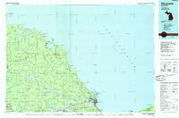
(41)- 1907 Map of Marquette
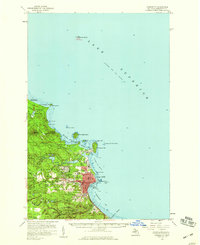
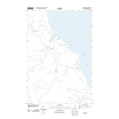
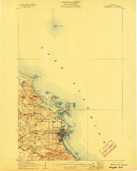 1907 Marquette1907 Print · USGSMarquette and its Lake Superior shoreline appear here during a period of heavy industrial growth in the early twentieth century. Researchers can trace the complex rail networks of the Marquette and Southeastern and locate landmarks like the State Prison and Powder Works.3 unique versions available
 - 1932 Map of Harvey NW
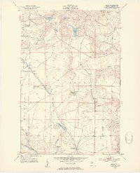
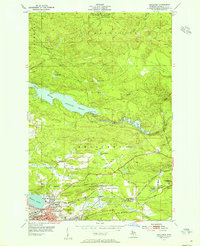
 1932 Harvey NW1932 Print · USGSMarquette County's central interior is captured in the early 1930s just as aerial surveying began to transform mapping. Genealogists can locate family-named landmarks and civic hubs like Sands PO, Sands Sch Nº 2, and the settlement at Cascade.
 - 1952 Map of Sands, 1954 Print
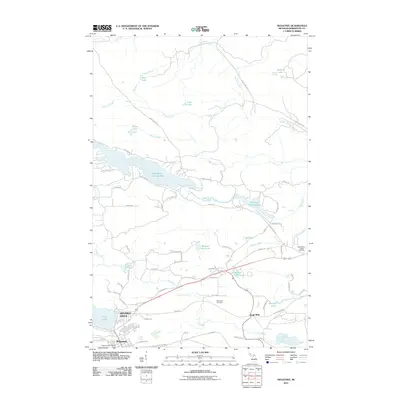
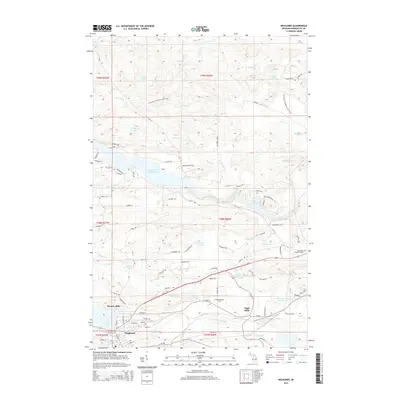
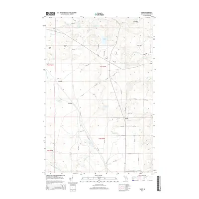
 1952 Sands1954 Print · USGSMarquette County’s interior during the early fifties shows a rugged landscape defined by the Chicago and North Western rail line and iron-rich highlands. Trace the vanished footprints of old stops at Sands Station and Gentian, or locate family landmarks near Harvey Lake and Pelesier Lake.4 unique versions available
 - 1952 Map of Gwinn, 1954 Print
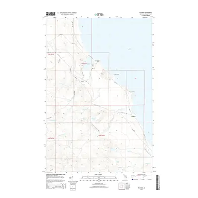
 1952 Gwinn1954 Print · USGSMarquette County's iron country and the Lake Superior shoreline are captured here in the early fifties during a period of industrial transition. Genealogists and industrial historians can trace the inactive Stephenson Mine, the Little Lake (Forsyth P O) settlement, and rural schools like June Sch.5 unique versions available
 - 1953 Map of Marquette NW, 1955 Print
 1953 Marquette NW1955 Print · USGSThe Lake Superior shoreline north of Marquette is captured here in the early fifties, showing a remote stretch of forest and rock. Trace the coastal navigation points from the Light on Granite Island to the mouth of Harlow Creek.2 unique versions available
 - 1953 Map of Negaunee, 1955 Print
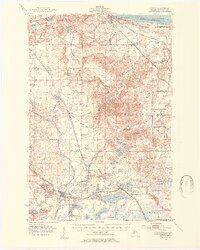
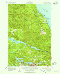
 1953 Negaunee1955 Print · USGSMid-century Marquette County reveals a landscape defined by the iron industry and rail expansion. Genealogists and industrial historians can trace the workings of the Mather Mine B, locate the Negaunee Cemetery, or follow the Lake Superior and Ishpeming railroad.4 unique versions available
 - 1954 Map of Marquette, 1955 Print
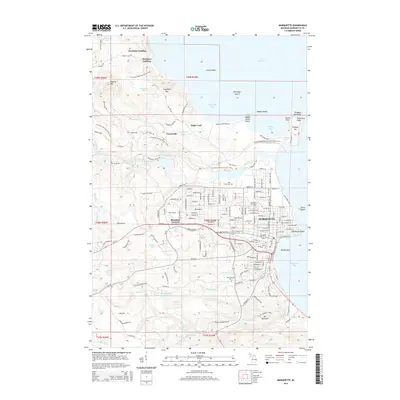
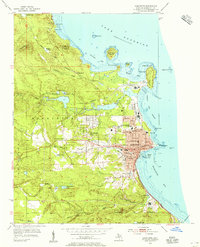 1954 Marquette1955 Print · USGSMid-century Marquette shows its development as a regional hub for education, industry, and maritime commerce along Lake Superior. Genealogists and historians can trace local institutions like Northern Michigan College, Marquette State Prison, and St Michael Sch.6 unique versions available
 - 1954 Map of Negaunee, 1955 Print
 1954 Negaunee1955 Print · USGSIron mining and hydroelectric power define the Marquette Range in the mid-fifties. Genealogists and industrial historians can trace the workings of the Mather Mine A, the Eagle Mills settlement, and the Morgan Heights Sanatorium.3 unique versions available
 - 1954 Map of Marquette, 1959 Print
 1954 Marquette1959 Print · USGSMarquette's harbor and lakeside settlement are shown in detail during the mid-fifties, when the city was a center of regional education and industry. Genealogists and historians can trace the foundations of Northern Michigan College or locate family sites near Park Cemetery and Brookton Corners.
 - 1958 Map of Marquette, 1968 Print
 1958 Marquette1968 Print · USGSThe Upper Peninsula’s central corridor is captured here in the mid-twentieth century as mining and timber industries thrived alongside new military installations. Genealogists and historians can trace the rail lines of the Soo Line Railroad through settlements like Gwinn, Turin, and Chatham.2 unique versions available
 - 1960 Map of Marquette
 1960 Marquette1960 Print · USGSUpper Peninsula mining and maritime commerce reach their peak in the late fifties across the Lake Superior shoreline. Genealogists and historians can locate remote settlements like Big Bay and Dukes, while tracing the Cyr Mine and the active rail lines of the Lake Superior and Ishpeming railroad.
 - 1961 Map of Marquette
 1961 Marquette1961 Print · USGSUpper Peninsula life in the early sixties centered on the iron docks and timber stands of the Lake Superior shore. Genealogists and historians can trace rail-to-port connections via the Lake Superior and Ishpeming Railroad and locate active sites like Republic Mine or the K.I. Sawyer Air Force Base.
 - 1968 Map of Marquette, 1977 Print
 1968 Marquette1977 Print · USGSThe Upper Peninsula iron range and Lake Superior coastline are captured here in the late sixties. Genealogists and historians can trace the rail-to-port infrastructure and the Cold War presence of K I Sawyer Air Force Base alongside towns like Ishpeming and Munising.
 - 1983 Map of Gwinn
 1983 Gwinn1983 Print · USGSThe heart of Michigan's Marquette Iron Range is captured here during the 1980s, when mining and military operations defined the local landscape. Genealogists and industrial historians can trace the tracks of the Chicago and North Western to the National Mine or the airman's life at K I Sawyer Air Force Base.2 unique versions available
 - 1985 Map of Buckroe
 1985 Buckroe1985 Print · USGSMarquette County's rugged Lake Superior coastline is captured here in the mid-1980s, showcasing a landscape of state forests and quiet river outlets. You can trace the Old Railroad Grade past Garlic Mountain or locate the old Sawmill and the settlement at Buckroe.
 - 1985 Map of Marquette
 1985 Marquette1985 Print · USGSThe iron mining country of Michigan's Upper Peninsula is shown here during the mid-1980s as industrial transport networks connected the interior to the coast. Researchers can trace historic rail lines like the Soo Line and Ls&I or locate local landmarks like Holy Cross Cem and Northern Michigan University.3 unique versions available
 - 2011 Map of Sands, 2011 Print
 2011 Sands2011 Print · USGSCovers Marquette Township, including Sands, Sands Township, and other nearby areas
 - 2011 Map of Marquette NW, 2011 Print
 2011 Marquette NW2011 Print · USGSCovers Marquette Township, including Marquette County, United States, and other nearby areas
 - 2011 Map of Marquette, 2011 Print
 2011 Marquette2011 Print · USGSCovers Marquette Township, including Marquette, Trowbridge Park, and other nearby areas
 - 2011 Map of Buckroe, 2011 Print
 2011 Buckroe2011 Print · USGSCovers Marquette Township, including Ishpeming Township, Halfway Village, and other nearby areas
 - 2011 Map of Negaunee, 2011 Print
 2011 Negaunee2011 Print · USGSCovers Marquette Township, including Negaunee, Ishpeming Township, and other nearby areas
 - 2014 Map of Negaunee, 2014 Print
 2014 Negaunee2014 Print · USGSCovers Marquette Township, including Negaunee, Ishpeming Township, and other nearby areas
 - 2014 Map of Marquette, 2014 Print
 2014 Marquette2014 Print · USGSCovers Marquette Township, including Marquette, Trowbridge Park, and other nearby areas
 - 2014 Map of Sands, 2014 Print
 2014 Sands2014 Print · USGSCovers Marquette Township, including Sands, Sands Township, and other nearby areas
 - 2014 Map of Buckroe, 2014 Print
 2014 Buckroe2014 Print · USGSCovers Marquette Township, including Ishpeming Township, Halfway Village, and other nearby areas
Showing maps 1-25 of 41
Top cities near Marquette Township
- Marquette historical maps
- Ishpeming historical maps
- Negaunee historical maps
- Sands historical maps
- Trowbridge Park historical maps
- Palmer historical maps
See more
Top neighborhoods of Marquette Township
- Sugar Loaf historical maps
- Forestville historical maps
- Buckroe historical maps
- Freeman Landing historical maps
- Wetmore Landing historical maps
- Trowbridge Park historical maps
See more
Frequently asked questions
- What are the different types of historical maps available for Marquette Township?
- What is the oldest map of Marquette Township?
- Where can I purchase historical maps of Marquette Township for my home or office?
- Where can I download high-res historical maps of Marquette Township?
- Are there historical topographic maps available for Marquette Township?
- Is there historical aerial imagery available for Marquette Township?
- Where are historical maps of Marquette Township sourced from?