1900s (20th Century) Maps of Faithorn Township, Michigan
Explore 12 historic maps of Faithorn Township from the 1900s (20th Century). These maps offer a rare glimpse into what life looked like during the 1900s — showing old roads, neighborhoods, homes, and landmarks that have changed or disappeared over time.
Whether you're researching your family's past, planning a metal detecting trip, or studying how Faithorn Township's landscape evolved across the 1900s, these high-resolution maps are a powerful tool for exploring the history of this region.
- Focus on a specific era: All maps on this page are from the 1900s, giving you a focused view of this time period.
- See what’s changed: Compare century-old streets, trails, and buildings to today's modern landscape using overlays and satellite layers.
- Research with precision: Use these maps for genealogy, historical research, land use analysis, or educational projects.
- View, download, or print: Maps are fully viewable online in high resolution, and can be downloaded or printed for your own records.
Start exploring Faithorn Township's history through authentic maps from the 1900s. This is your window into the past.
Faithorn Township, MI maps
(12)- 1939 Map of Pembine, 1941 Print
 1939 Pembine1941 Print · USGSThe Menominee River borderlands in the late thirties showcase a landscape of granite quarries, rail junctions, and river falls. Trace early settlements and infrastructure including Pembine, the Chalk Hill Dam, and the St Anthony Cem.2 unique versions available
 - 1947 Map of Pembine
 1947 Pembine1947 Print · USGSMarinette County was a landscape of stone quarries and timber-line railroads just after World War II. Researchers can trace rural life through sites like Dixon Sch, the Reformatory Quarry, and the Mission Chapel near Kremlin.
 - 1954 Map of Escanaba, 1967 Print
 1954 Escanaba1967 Print · USGSThe Upper Peninsula and Door County shorelines meet here in the mid-fifties, showing the vital maritime and timber networks of the Great Lakes. Researchers can trace historic rail lines, old fire lookouts like the Stonington Fire Tower, and island settlements such as Washington Island.2 unique versions available
 - 1957 Map of Escanaba
 1957 Escanaba1957 Print · USGSThe Upper Peninsula and Door County shorelines meet in the mid-fifties, capturing a landscape of timber, iron, and maritime trade. Genealogists and local historians can trace the Chicago & North Western RR through settlements like Hermansville or locate St Vitals Church and the Potawatome Indian Reservation.
 - 1958 Map of Escanaba
 1958 Escanaba1958 Print · USGSNorthern Lake Michigan maritime commerce and timberlands are captured here in the mid-fifties. Genealogists and historians can trace rail networks like the Escanaba and Lake Superior or locate island settlements such as Detroit Harbor and Fish Creek.
 - 1963 Map of Pembine, 1964 Print
 1963 Pembine1964 Print · USGSThe Menominee River borderlands thrive in the early sixties as a crossroads of the Soo Line and Chicago and North Western railroads. Historians can trace the local landscape through landmarks like Smalley Falls, Mission Chapel, and the old Lookout Tower.2 unique versions available
 - 1963 Map of Powers, 1964 Print
 1963 Powers1964 Print · USGSUpper Peninsula timber and rail towns define this mid-century landscape in Menominee County. Genealogists can trace family names through the Swedish Cem and Powers Cem, while the CHICAGO AND NORTH WESTERN line links depots at Nadeau and Carney.
 - 1982 Map of Escanaba
 1982 Escanaba1982 Print · USGSUpper Peninsula timber and mining country come to life in this early 1980s survey of the lakefront and forest interior. Trace family roots and industrial history through settlements like Norway and Gladstone, or locate the Appleton Mine and Fernwood Cem near the rail lines.
 - 1982 Map of Miscauno Island, 1983 Print
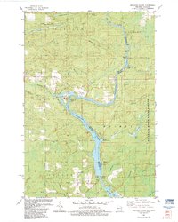 1982 Miscauno Island1983 Print · USGSThe Menominee River forms the interstate border in the early eighties, winding through a landscape of timber and hydroelectric power. Researchers can locate White Rapids Cem, the Chalk Hill Dam, and the recreation grounds of Miscauno Island.
 - 1982 Map of Faithorn, 1983 Print
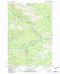 1982 Faithorn1983 Print · USGSThis borderland region along the Menominee River was a junction of rail and river industry in the early 1980s. Genealogists and local historians can locate Hillcrest Cem, trace the Old Railroad Grade, and explore the settlement at Faithorn.
 - 1989 Map of Cunard
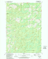 1989 Cunard1989 Print · USGSMenominee County’s northern woods and waterways are captured here during the late 1980s. Genealogists and local historians can trace family-named water features like Mullen Spring and Carlson Creek or locate the rural outposts of Cunard and Blom.
 - 1989 Map of Banat
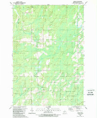 1989 Banat1989 Print · USGSMenominee County during the late eighties reveals the legacy of logging and settlement within the Escanaba River State Forest. Local historians can trace the paths of the Old Railroad Grade and find small hamlets like Banat and Nathan.
End of results
Showing maps 1-12 of 12
Top cities near Faithorn Township
- Norway historical maps
- Nadeau historical maps
- Pembine historical maps
- Amberg historical maps
- Waucedah historical maps
- Beecher historical maps
See more
Top neighborhoods of Faithorn Township
Frequently asked questions
- What are the different types of historical maps available for Faithorn Township?
- What is the oldest map of Faithorn Township?
- Where can I purchase historical maps of Faithorn Township for my home or office?
- Where can I download high-res historical maps of Faithorn Township?
- Are there historical topographic maps available for Faithorn Township?
- Is there historical aerial imagery available for Faithorn Township?
- Where are historical maps of Faithorn Township sourced from?