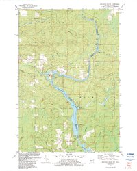
1982 Map of Miscauno Island
USGS Topo · Published 1983About this map
The Menominee River serves as a winding border between Wisconsin and Michigan in the early 1980s, anchoring a landscape defined by hydro-electric power and recreational retreats. At the heart of the map lies Miscauno Island, featuring a Golf Course and adjacent Landing Strip, signaling the area's development as a regional destination. Further south, the Chalk Hill Dam and its associated Powerplant illustrate the industrial utility of the river, which also supports multiple recreational sites like Chalk Hill Recreational Area 4.
Find a feature on this map
53 named features on this map. Tap any name to fly to it.
Don’t see what you’re looking for? This feature index may not catch every label — zoom into the map to look around manually.
Map Details
Editions of this 1982 Miscauno Island Map
This is the sole edition of this map. No revisions or reprints were ever made.
Other maps of this area

1939 · Pembine
USGS Topo · 1:48,000

1942 · Wausaukee
USGS Topo · 1:48,000

1947 · Pembine
USGS Topo · 1:48,000

1947 · Wausaukee
USGS Topo · 1:48,000

1949 · Stephenson
USGS Topo · 1:48,000

1954 · Escanaba
USGS Topo · 1:250,000

1957 · Escanaba
USGS Topo · 1:250,000

1958 · Escanaba
USGS Topo · 1:250,000

1963 · Pembine
USGS Topo · 1:62,500

1963 · Powers
USGS Topo · 1:62,500