Old Maps of Beach Grove, Ingallston Township for Genealogy
Trace your family roots with 11 historic maps of Beach Grove. These high-res maps reveal old neighborhoods, homesites, landmarks, and streets — helping you uncover where your ancestors lived and how the area evolved over time.
- Explore historic neighborhoods: Identify where your relatives may have lived in the 1800s or 1900s.
- Compare maps over time: Trace the changes in streets, buildings, and landmarks for multi-generational research.
- Perfect for genealogy & ancestry research: Used by family historians and researchers to map out lineage and migration.
These maps are an incredible resource for exploring your personal connection to Beach Grove's past.
Beach Grove, Ingallston Township maps
(11)- 1954 Map of Escanaba, 1967 Print
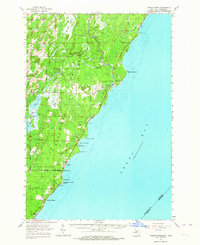
 1954 Escanaba1967 Print · USGSThe Upper Peninsula and Door County shorelines meet here in the mid-fifties, showing the vital maritime and timber networks of the Great Lakes. Researchers can trace historic rail lines, old fire lookouts like the Stonington Fire Tower, and island settlements such as Washington Island.2 unique versions available
 - 1957 Map of Escanaba
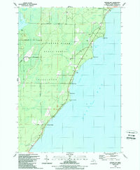
 1957 Escanaba1957 Print · USGSThe Upper Peninsula and Door County shorelines meet in the mid-fifties, capturing a landscape of timber, iron, and maritime trade. Genealogists and local historians can trace the Chicago & North Western RR through settlements like Hermansville or locate St Vitals Church and the Potawatome Indian Reservation.
 - 1958 Map of Escanaba
 1958 Escanaba1958 Print · USGSNorthern Lake Michigan maritime commerce and timberlands are captured here in the mid-fifties. Genealogists and historians can trace rail networks like the Escanaba and Lake Superior or locate island settlements such as Detroit Harbor and Fish Creek.
 - 1963 Map of Cedar River, 1964 Print
 1963 Cedar River1964 Print · USGSThe Menominee County shoreline comes alive in the early 1960s, showing the quiet coastal settlements and timberlands along Green Bay. Researchers can trace family sites from Johnson Landing up to Cedar River, and locate landmarks like the Dominican House of Studies or the Cedar River Cem.3 unique versions available
 - 1981 Map of Marinette, 1982 Print
 1981 Marinette1982 Print · USGSThe Menominee River valley and Door County peninsula are captured here in the early 1980s, showcasing the region's timber and maritime foundations. Researchers can trace historic shorelines from Fish Creek to Deathdoor Bluff or locate inland landmarks like Lake Noquebay and Kangaroo Lake.
 - 1989 Map of Arthur Bay
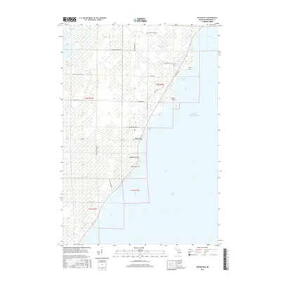
 1989 Arthur Bay1989 Print · USGSThe Menominee County shoreline in the late eighties shows a landscape of state forest and small coastal settlements. Genealogists and researchers can trace the roads near Cedarville, Beach Grove, and the seasonal camps at Johnson Landing.
 - 2011 Map of Arthur Bay, 2011 Print
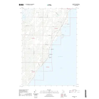
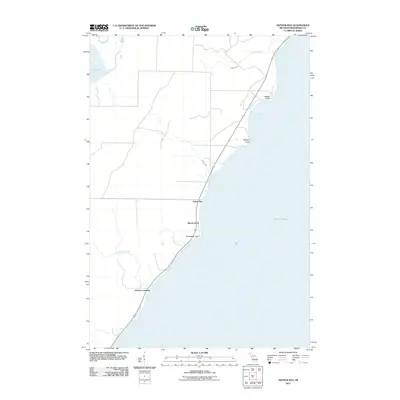 2011 Arthur Bay2011 Print · USGSCovers Beach Grove, including Johnson Landing, Ingallston Township, and other nearby areas
 - 2014 Map of Arthur Bay, 2014 Print
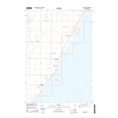 2014 Arthur Bay2014 Print · USGSCovers Beach Grove, including Johnson Landing, Ingallston Township, and other nearby areas
 - 2017 Map of Arthur Bay, 2017 Print
 2017 Arthur Bay2017 Print · USGSCovers Beach Grove, including Johnson Landing, Ingallston Township, and other nearby areas
 - 2019 Map of Arthur Bay, 2019 Print
 2019 Arthur Bay2019 Print · USGSCovers Beach Grove, including Johnson Landing, Ingallston Township, and other nearby areas
 - 2023 Map of Arthur Bay, 2023 Print
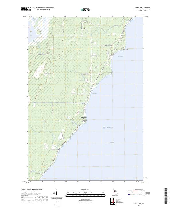 2023 Arthur Bay2023 Print · USGSThe Menominee County shoreline comes into focus during the early twenty-first century, showing the coastal hamlets and wetlands of the Upper Peninsula. Genealogists and local historians can trace land use through features like Beach Grove, Harbor Point, and Cherry Ridge Logging Rd.
End of results
Showing maps 1-11 of 11
Top cities near Beach Grove
- Marinette historical maps
- Menominee historical maps
- Peshtigo historical maps
- Porterfield historical maps
- Baileys Harbor historical maps
- Ingallston historical maps
See more
Frequently asked questions
- What are the different types of historical maps available for Beach Grove?
- What is the oldest map of Beach Grove?
- Where can I purchase historical maps of Beach Grove for my home or office?
- Where can I download high-res historical maps of Beach Grove?
- Are there historical topographic maps available for Beach Grove?
- Is there historical aerial imagery available for Beach Grove?
- Where are historical maps of Beach Grove sourced from?