Old Maps of Ingallston Township, Michigan
Explore 41 old maps of Ingallston Township, spanning from 1939 to today. These high-resolution historic maps reveal how streets, neighborhoods, landmarks, and natural features evolved over time — perfect for genealogy, metal detecting, research, and local history exploration.
What you can do with these maps:
- See how Ingallston Township changed over time: Compare historical maps to modern-day views to trace roads, homesites, rail lines & more.
- View detailed metadata: Each map includes creators, publishers, year, scale, and archive source.
- Overlay maps with satellite & LiDAR: Visualize the past alongside modern tools to explore terrain & human change.
- Trusted historical sources: Maps sourced from the USGS, Library of Congress, and other archives.
- Access maps your way: View online, download high-res files, or order prints for personal or research use.
Start exploring old maps of Ingallston Township to uncover forgotten places, hidden landmarks, and the deep history beneath your feet.
Ingallston Township, MI maps
(41)- 1939 Map of Marinette
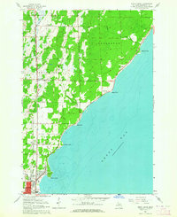
 1939 Marinette1939 Print · USGSThe Green Bay shoreline and the Menominee River border come to life in the late 1930s as industrial and rural landscapes intersect. Genealogists can trace family footprints through numerous rural schools like Garfield Sch and Columbus Sch or the settlement at Winesville.
 - 1949 Map of Stephenson
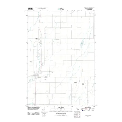
 1949 Stephenson1949 Print · USGSThe Menominee River borderlands are shown in detail during the late 1940s, highlighting the transition from timber extraction to settled rural life. Researchers can trace the Old Logging Railroad Grade and locate community landmarks like the McAllister Sch and Goll Cem.
 - 1954 Map of Escanaba, 1967 Print
 1954 Escanaba1967 Print · USGSThe Upper Peninsula and Door County shorelines meet here in the mid-fifties, showing the vital maritime and timber networks of the Great Lakes. Researchers can trace historic rail lines, old fire lookouts like the Stonington Fire Tower, and island settlements such as Washington Island.2 unique versions available
 - 1957 Map of Escanaba
 1957 Escanaba1957 Print · USGSThe Upper Peninsula and Door County shorelines meet in the mid-fifties, capturing a landscape of timber, iron, and maritime trade. Genealogists and local historians can trace the Chicago & North Western RR through settlements like Hermansville or locate St Vitals Church and the Potawatome Indian Reservation.
 - 1958 Map of Escanaba
 1958 Escanaba1958 Print · USGSNorthern Lake Michigan maritime commerce and timberlands are captured here in the mid-fifties. Genealogists and historians can trace rail networks like the Escanaba and Lake Superior or locate island settlements such as Detroit Harbor and Fish Creek.
 - 1961 Map of Chambers Island, 1963 Print
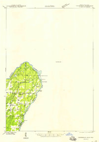
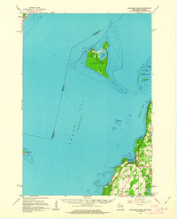 1961 Chambers Island1963 Print · USGSThe Door Peninsula and its surrounding islands are captured here in the early sixties, showing a maritime landscape of isolated lighthouses and small coastal settlements. Genealogists and local historians can locate St Johns Cem, Sunny Point Sch, and the Chambers Island Lighthouse.2 unique versions available
 - 1963 Map of Cedar River, 1964 Print
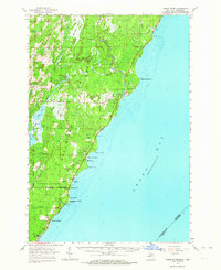 1963 Cedar River1964 Print · USGSThe Menominee County shoreline comes alive in the early 1960s, showing the quiet coastal settlements and timberlands along Green Bay. Researchers can trace family sites from Johnson Landing up to Cedar River, and locate landmarks like the Dominican House of Studies or the Cedar River Cem.3 unique versions available
 - 1963 Map of Birch Creek, 1964 Print
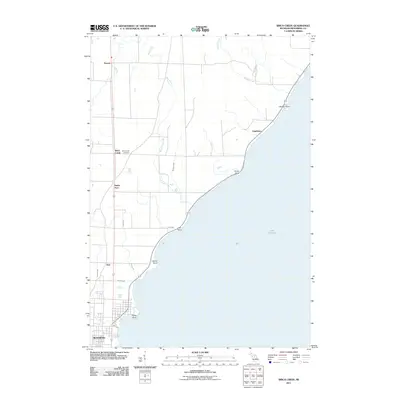
 1963 Birch Creek1964 Print · USGSThe Menominee County shoreline comes alive in the early sixties as a mix of growing neighborhoods and rural outposts. Genealogists can trace family roots through several local landmarks like Evergreen Sch, Grant Sch, and the community at Birch Creek.2 unique versions available
 - 1963 Map of Stephenson, 1965 Print
 1963 Stephenson1965 Print · USGSThe Menominee River borderlands in the early sixties reveal a network of rail-side timber and farming towns. Genealogists can trace family roots at the Danish Cem, St Marks Ch, or the rural McAllister Sch near the Grand Rapids Dam.
 - 1963 Map of Marinette, 1965 Print
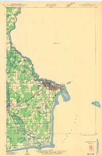
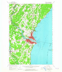 1963 Marinette1965 Print · USGSThe industrial twin cities of the Michigan-Wisconsin border are captured here in the early sixties, centered on the Menominee River and Green Bay coast. Genealogists and historians can trace rail lines, rural schoolhouses like Hamilton Sch, and family sites at Riverside Cem.
 - 1981 Map of Marinette, 1982 Print
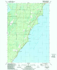
 1981 Marinette1982 Print · USGSThe Menominee River valley and Door County peninsula are captured here in the early 1980s, showcasing the region's timber and maritime foundations. Researchers can trace historic shorelines from Fish Creek to Deathdoor Bluff or locate inland landmarks like Lake Noquebay and Kangaroo Lake.
 - 1982 Map of Wallace, 1983 Print
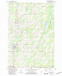
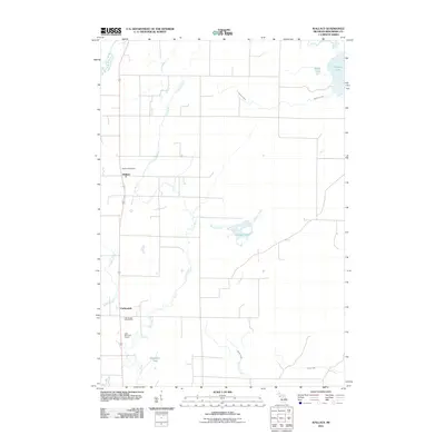
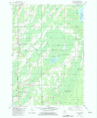 1982 Wallace1983 Print · USGSUpper Peninsula timberlands and small settlements are captured here in the early 1980s, centered on the Chicago and North Western rail corridor. Genealogists and local historians can trace rural roots at Bethel Mission Ch, Mellen Sch, and the community of Carbondale.
 - 1982 Map of Stephenson, 1983 Print
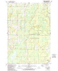
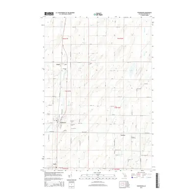
 1982 Stephenson1983 Print · USGSSettlements along the railroad corridor in Menominee County thrived in the early 1980s as the regional timber and agricultural economy matured. Genealogists can trace family names and local sites at Stephenson Cem, Bethlehem Ch, and the small community of Belgiumtown.
 - 1989 Map of North Lake
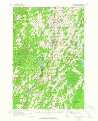
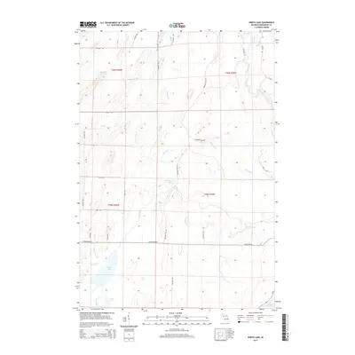
 1989 North Lake1989 Print · USGSMenominee County’s northern woods and waterways are captured here in the late eighties, showing a landscape defined by state-managed forests and remote lake systems. Researchers can trace the courses of Cedar River and Walton River or locate family landmarks near Westman Lake and Hoglund Lake.
 - 1989 Map of Arthur Bay
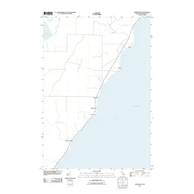
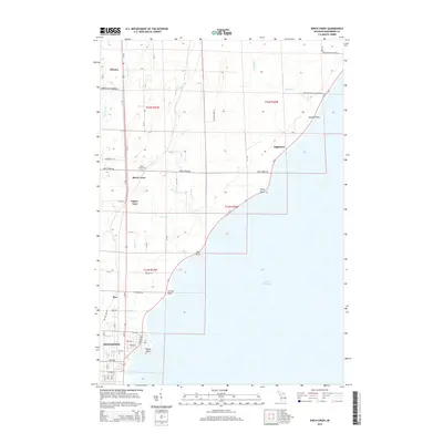
 1989 Arthur Bay1989 Print · USGSThe Menominee County shoreline in the late eighties shows a landscape of state forest and small coastal settlements. Genealogists and researchers can trace the roads near Cedarville, Beach Grove, and the seasonal camps at Johnson Landing.
 - 2011 Map of North Lake, 2011 Print
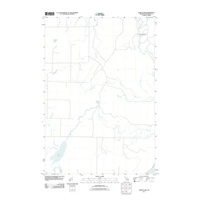 2011 North Lake2011 Print · USGSCovers Ingallston Township, including Daggett Township, Stephenson Township, and other nearby areas
 - 2011 Map of Wallace, 2011 Print
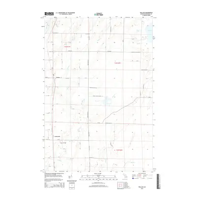
 2011 Wallace2011 Print · USGSCovers Ingallston Township, including Carbondale, Wallace, and other nearby areas
 - 2011 Map of Stephenson, 2011 Print
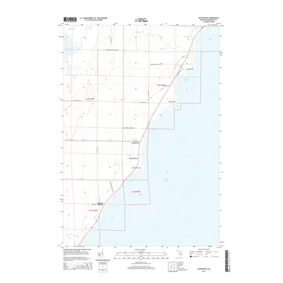
 2011 Stephenson2011 Print · USGSCovers Ingallston Township, including Stephenson, Daggett, and other nearby areas
 - 2011 Map of Birch Creek, 2011 Print
 2011 Birch Creek2011 Print · USGSCovers Ingallston Township, including Menominee, Ingallston, and other nearby areas
 - 2011 Map of Arthur Bay, 2011 Print
 2011 Arthur Bay2011 Print · USGSCovers Ingallston Township, including Beach Grove, Johnson Landing, and other nearby areas
 - 2014 Map of Wallace, 2014 Print
 2014 Wallace2014 Print · USGSCovers Ingallston Township, including Carbondale, Wallace, and other nearby areas
 - 2014 Map of North Lake, 2014 Print
 2014 North Lake2014 Print · USGSCovers Ingallston Township, including Daggett Township, Stephenson Township, and other nearby areas
 - 2014 Map of Stephenson, 2014 Print
 2014 Stephenson2014 Print · USGSCovers Ingallston Township, including Stephenson, Daggett, and other nearby areas
 - 2014 Map of Birch Creek, 2014 Print
 2014 Birch Creek2014 Print · USGSCovers Ingallston Township, including Menominee, Ingallston, and other nearby areas
 - 2014 Map of Arthur Bay, 2014 Print
 2014 Arthur Bay2014 Print · USGSCovers Ingallston Township, including Beach Grove, Johnson Landing, and other nearby areas
Showing maps 1-25 of 41
Top cities near Ingallston Township
- Marinette historical maps
- Menominee historical maps
- Peshtigo historical maps
- Porterfield historical maps
- Ingallston historical maps
- Stephenson historical maps
See more
Top neighborhoods of Ingallston Township
- Beach Grove historical maps
- Johnson Landing historical maps
- Arthur Bay historical maps
- Ingallston historical maps
Frequently asked questions
- What are the different types of historical maps available for Ingallston Township?
- What is the oldest map of Ingallston Township?
- Where can I purchase historical maps of Ingallston Township for my home or office?
- Where can I download high-res historical maps of Ingallston Township?
- Are there historical topographic maps available for Ingallston Township?
- Is there historical aerial imagery available for Ingallston Township?
- Where are historical maps of Ingallston Township sourced from?