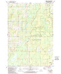
1989 Map of North Lake
USGS Topo · Published 1989About this map
Escanaba River State Forest dominates this landscape in Menominee County, reflecting a late twentieth-century environment defined by vast public lands and timber management. The map reveals a dense network of watercourses and wetlands, including the meandering Cedar River and the smaller Walton River that snake through the forest floor. These waterways, along with features like Hoglund Lake and Kessler Lake, illustrate the complex drainage patterns of this region near Green Bay.
Find a feature on this map
20 named features on this map. Tap any name to fly to it.
Don’t see what you’re looking for? This feature index may not catch every label — zoom into the map to look around manually.
Map Details
Editions of this 1989 North Lake Map
This is the sole edition of this map. No revisions or reprints were ever made.
Other maps of this area

1949 · Stephenson
USGS Topo · 1:48,000

1954 · Escanaba
USGS Topo · 1:250,000

1957 · Escanaba
USGS Topo · 1:250,000

1958 · Escanaba
USGS Topo · 1:250,000

1963 · Bark River
USGS Topo · 1:62,500

1963 · Powers
USGS Topo · 1:62,500

1963 · Cedar River
USGS Topo · 1:62,500

1963 · Stephenson
USGS Topo · 1:62,500

1981 · Marinette
USGS Topo · 1:100,000

1982 · Escanaba
USGS Topo · 1:100,000
Featured Places
- Ingallston Township, MI
- Cedarville Township, MI
- Daggett Township, MI
- Stephenson Township, MI
- Menominee County, MI