2020s Maps of Ingallston Township, Michigan
Explore 6 historic maps of Ingallston Township from the 2020s. These maps offer a rare glimpse into what life looked like during the 2020s — showing old roads, neighborhoods, homes, and landmarks that have changed or disappeared over time.
Whether you're researching your family's past, planning a metal detecting trip, or studying how Ingallston Township's landscape evolved across the 2020s, these high-resolution maps are a powerful tool for exploring the history of this region.
- Focus on a specific era: All maps on this page are from the 2020s, giving you a focused view of this time period.
- See what’s changed: Compare century-old streets, trails, and buildings to today's modern landscape using overlays and satellite layers.
- Research with precision: Use these maps for genealogy, historical research, land use analysis, or educational projects.
- View, download, or print: Maps are fully viewable online in high resolution, and can be downloaded or printed for your own records.
Start exploring Ingallston Township's history through authentic maps from the 2020s. This is your window into the past.
Ingallston Township, MI maps
(6)- 2022 Map of Chambers Island NW, 2022 Print
 2022 Chambers Island NW2022 Print · USGSCoastal Wisconsin and Michigan boundaries meet in these waters during the early twenty-first century, centered on the expanse of Green Bay. Local historians can trace the shoreline of Chambers Island and locate land features like Sand Point and Million Dollar Rd.
 - 2023 Map of Stephenson, 2023 Print
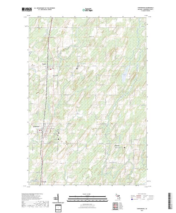 2023 Stephenson2023 Print · USGSUpper Peninsula farming and rail communities are captured here in the early twenty-first century along the Little Cedar River. Genealogists can trace family roots through sites like Stephenson Cem, Palestine, and the Bethlehem Covenant Cem.
 - 2023 Map of Wallace, 2023 Print
 2023 Wallace2023 Print · USGSMenominee County is depicted in this recent survey, showing the rural communities of Wallace and Carbondale amid a complex network of Upper Peninsula waterways. Researchers can trace family road names and local landmarks like Mission Church No 14 Ln or the shores of Hayward Lake.
 - 2023 Map of Arthur Bay, 2023 Print
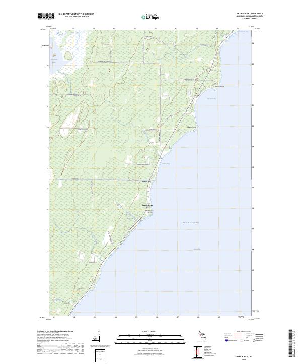 2023 Arthur Bay2023 Print · USGSThe Menominee County shoreline comes into focus during the early twenty-first century, showing the coastal hamlets and wetlands of the Upper Peninsula. Genealogists and local historians can trace land use through features like Beach Grove, Harbor Point, and Cherry Ridge Logging Rd.
 - 2023 Map of Birch Creek, 2023 Print
 2023 Birch Creek2023 Print · USGSThe Menominee County shoreline comes into focus during the early twenty-first century, showing the transition from rural woodlands to the city's edge. Researchers can locate the Birch Creek Cem and trace coastal landmarks like Stony Point and Beattie Point.
 - 2023 Map of North Lake, 2023 Print
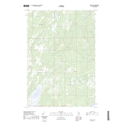 2023 North Lake2023 Print · USGSMenominee County’s wetlands and river systems are meticulously documented in the early twenty-first century as the landscape transitions toward Green Bay. Researchers can trace rural property access and drainage via Westman Lake, Durrow Marsh, and family-named routes like Horvath Road H 1.
End of results
Showing maps 1-6 of 6
Top cities near Ingallston Township
- Marinette historical maps
- Menominee historical maps
- Peshtigo historical maps
- Porterfield historical maps
- Ingallston historical maps
- Stephenson historical maps
See more
Top neighborhoods of Ingallston Township
- Beach Grove historical maps
- Johnson Landing historical maps
- Arthur Bay historical maps
- Ingallston historical maps
Frequently asked questions
- What are the different types of historical maps available for Ingallston Township?
- What is the oldest map of Ingallston Township?
- Where can I purchase historical maps of Ingallston Township for my home or office?
- Where can I download high-res historical maps of Ingallston Township?
- Are there historical topographic maps available for Ingallston Township?
- Is there historical aerial imagery available for Ingallston Township?
- Where are historical maps of Ingallston Township sourced from?