Old Maps of Monroe Charter Township, Michigan for Hiking & Exploration
Hike through history with 37 historic maps of Monroe Charter Township. Explore old trails, ghost towns, and forgotten backroads — perfect for outdoor adventurers and local explorers.
- Rediscover forgotten places: Map out old mining camps, roads, and footpaths that no longer exist on modern maps.
- Layer with modern tools: Combine with LiDAR or satellite views to plan hikes through historical terrain.
- Made for exploration: Popular among hikers, overlanders, and local history lovers.
Use these maps to find adventure and explore the hidden past of Monroe Charter Township.
Monroe Charter Township, MI maps
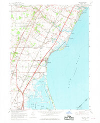
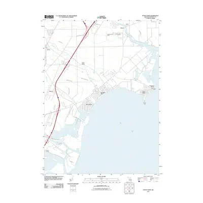
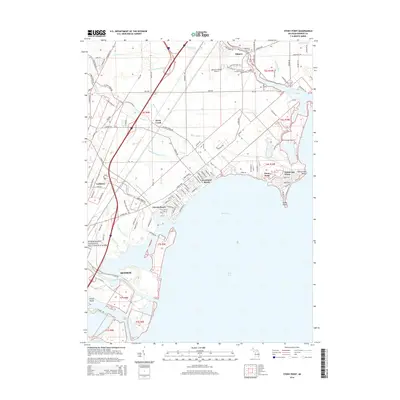
(37)- 1912 Map of Monroe
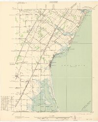
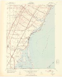
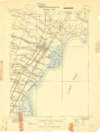 1912 Monroe1912 Print · USGSMonroe County before the First World War was a landscape defined by its strategic lakefront positioning and a massive concentration of competing railroads. Genealogists can trace the early footprints of Monroe, Brest P.O., and Erie while following local landmarks like Sandy Creek and Plum Creek.
 - 1914 Map of Monroe, 1928 Print
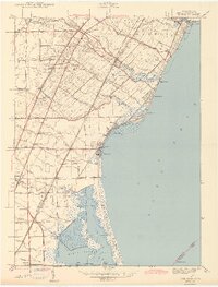
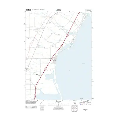
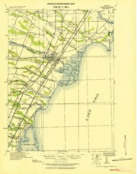 1914 Monroe1928 Print · USGSCoastal Michigan between Detroit and Toledo is shown here in the early twentieth century as a bustling hub of rail and river commerce. Genealogists and historians can trace the paths of six different railroads through Monroe and locate the old Brest Post Office near Point Aux Peaux.
 - 1927 Map of Monroe
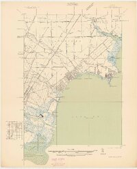
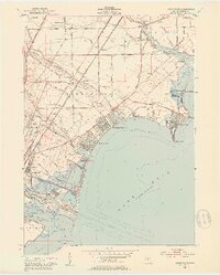
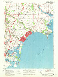
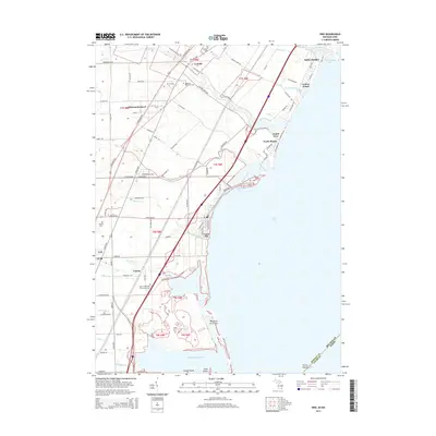
 1927 Monroe1927 Print · USGSMonroe and the surrounding Lake Erie shoreline are shown here during the late 1930s as a thriving industrial and rail corridor. Researchers can locate family landmarks like the Monroe Co Cem, Strasburg Sch, and the notable Monroe Co Infirmary.
 - 1936 Map of Stony Point
 1936 Stony Point1936 Print · USGSMonroe County’s Lake Erie shoreline was a burgeoning corridor of summer beaches and rail transport in the mid-1930s. Genealogists and researchers can trace family-named schools like Loranger Sch and Masserant Sch, or locate the historic St Charles Cem near Oldport.2 unique versions available
 - 1936 Map of Erie
 1936 Erie1936 Print · USGSCoastal Monroe County in the mid-1930s shows a landscape of lakeside resorts and busy rail corridors heading toward the Ohio line. Genealogists and local historians can locate early twentieth-century landmarks like San Freal Sch, Luna Pier, and the Roselawn Memorial Cem.
 - 1942 Map of Stony Point
 1942 Stony Point1942 Print · USGSMonroe County's Lake Erie shoreline was a thriving mix of coastal resorts and rail infrastructure in the 1940s. Researchers can trace family sites at St. Charles Cem, explore coastal developments like Woodland Beach, or locate rural landmarks like Scrabble Hollow Sch.2 unique versions available
 - 1942 Map of Monroe
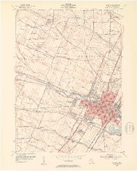
 1942 Monroe1942 Print · USGSMonroe and its riverfront townships are shown here in the early 1940s, revealing a busy rail corridor and the city's growth. Genealogists can trace family sites like Sandy Creek Cem, St Marys Academy, and the County Infirmary.2 unique versions available
 - 1943 Map of Erie
 1943 Erie1943 Print · USGSThe Lake Erie shoreline in the early 1940s reveals a landscape of coastal marshes, growing beach communities, and vital rail corridors. Genealogists can locate family landmarks such as La Salle Cem and numerous country schools like San Freal Sch and Moran Sch.3 unique versions available
 - 1952 Map of Erie, 1953 Print
 1952 Erie1953 Print · USGSThe Lake Erie shoreline in the early fifties shows a landscape defined by coastal resorts, marshlands, and heavy rail. Genealogists can locate family sites at Roselawn Memorial Cemetery or trace the rural school system at Keeney Sch and Agnew Sch.3 unique versions available
 - 1952 Map of Stony Point, 1953 Print
 1952 Stony Point1953 Print · USGSThe western shores of Lake Erie show a bustling post-war era of beachside communities and industrial expansion near Monroe. Genealogists and local historians can trace the development of Woodland Beach, the grounds of Sterling State Park, and rural sites like Old St Charles Cem.2 unique versions available
 - 1952 Map of Monroe, 1954 Print
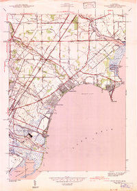
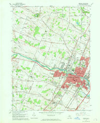
 1952 Monroe1954 Print · USGSMonroe and its surrounding townships thrive in the early fifties as a hub of Lake Erie commerce and industry. Researchers can trace the layout of family neighborhoods and local landmarks like St Marys Academy, Tamarack, and the Custer Airport.2 unique versions available
 - 1956 Map of Toledo, 1968 Print
 1956 Toledo1968 Print · USGSNorthwest Ohio and the Lake Erie shoreline are shown in detail during the late fifties, showcasing a landscape of heavy industry, railroads, and island communities. Genealogists and historians can trace rail networks like the Chesapeake & Ohio RR or locate landmarks such as the Erie Proving Ground and Kelleys Island.4 unique versions available
 - 1961 Map of Toledo
 1961 Toledo1961 Print · USGSThe western basin of Lake Erie and the industrial heart of Northern Ohio are captured here during the post-war era. Researchers can trace historical rail lines like the New York Central or locate landmarks like the Erie Ordnance Depot and Pelee Island.
 - 1967 Map of Monroe, 1969 Print
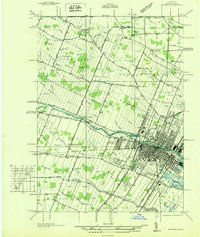
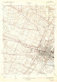
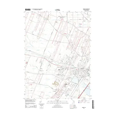
 1967 Monroe1969 Print · USGSMonroe and its surrounding townships show a mix of industrial growth and rural tradition during the late sixties. Genealogists can trace family names through several burial grounds, including McIntyre Cem and Woodland Cem, while mapping the expansion of South Monroe.3 unique versions available
 - 1967 Map of Erie, 1969 Print
 1967 Erie1969 Print · USGSThe Lake Erie shoreline in the late sixties reveals a landscape of industrial power and lakeside recreation at the Michigan-Ohio border. Researchers can trace the rail lines of the Penn Central, locate the St Joseph Sch in Erie, or explore the coastal reaches of the Woodtick Peninsula.2 unique versions available
 - 1967 Map of Stony Point, 1969 Print
 1967 Stony Point1969 Print · USGSMonroe County’s Lake Erie shoreline is a dense patchwork of mid-century suburban beaches and heavy industry. Genealogists and local historians can trace family roots through the Old St Charles Cem, explore early aviation at Marshall Airport, or locate small rural hubs like Oldport.3 unique versions available
 - 1986 Map of Toledo
 1986 Toledo1986 Print · USGSGreater Toledo and the Lake Erie shoreline are captured here in the mid-eighties, showcasing a massive network of industrial waterways and rail lines. You can trace the path of the Maumee River past Rossford or explore the conservation lands at Ottawa National Wildlife Refuge.2 unique versions available
 - 2011 Map of Stony Point OE S, 2011 Print
 2011 Stony Point OE S2011 Print · USGSCovers Monroe Charter Township, including Lucas County, Monroe County, and other nearby areas
 - 2011 Map of Monroe, 2011 Print
 2011 Monroe2011 Print · USGSCovers Monroe Charter Township, including Frenchtown Charter Township, Monroe, and other nearby areas
 - 2011 Map of Stony Point, 2011 Print
 2011 Stony Point2011 Print · USGSCovers Monroe Charter Township, including Frenchtown Charter Township, Monroe, and other nearby areas
 - 2011 Map of Erie, 2011 Print
 2011 Erie2011 Print · USGSCovers Monroe Charter Township, including LaSalle, LaSalle Township, and other nearby areas
 - 2014 Map of Erie, 2014 Print
 2014 Erie2014 Print · USGSCovers Monroe Charter Township, including LaSalle, LaSalle Township, and other nearby areas
 - 2014 Map of Monroe, 2014 Print
 2014 Monroe2014 Print · USGSCovers Monroe Charter Township, including Frenchtown Charter Township, Monroe, and other nearby areas
 - 2014 Map of Stony Point, 2014 Print
 2014 Stony Point2014 Print · USGSCovers Monroe Charter Township, including Frenchtown Charter Township, Monroe, and other nearby areas
 - 2014 Map of Stony Point OE S, 2014 Print
 2014 Stony Point OE S2014 Print · USGSCovers Monroe Charter Township, including Lucas County, Monroe County, and other nearby areas
Showing maps 1-25 of 37
Top cities near Monroe Charter Township
- Toledo historical maps
- Brownstown Charter Township historical maps
- Bedford Township historical maps
- Frenchtown Charter Township historical maps
- Monroe historical maps
- Oregon historical maps
See more
Top neighborhoods of Monroe Charter Township
- Patterson Gardens historical maps
- Bolles Harbor historical maps
- Avalon Beach historical maps
- South Monroe historical maps
- West Monroe historical maps
- Carrington Farms historical maps
See more
Frequently asked questions
- What are the different types of historical maps available for Monroe Charter Township?
- What is the oldest map of Monroe Charter Township?
- Where can I purchase historical maps of Monroe Charter Township for my home or office?
- Where can I download high-res historical maps of Monroe Charter Township?
- Are there historical topographic maps available for Monroe Charter Township?
- Is there historical aerial imagery available for Monroe Charter Township?
- Where are historical maps of Monroe Charter Township sourced from?