1970s Maps of Montcalm County, Michigan
Explore 8 historic maps of Montcalm County from the 1970s. These maps offer a rare glimpse into what life looked like during the 1970s — showing old roads, neighborhoods, homes, and landmarks that have changed or disappeared over time.
Whether you're researching your family's past, planning a metal detecting trip, or studying how Montcalm County's landscape evolved across the 1970s, these high-resolution maps are a powerful tool for exploring the history of this region.
- Focus on a specific era: All maps on this page are from the 1970s, giving you a focused view of this time period.
- See what’s changed: Compare century-old streets, trails, and buildings to today's modern landscape using overlays and satellite layers.
- Research with precision: Use these maps for genealogy, historical research, land use analysis, or educational projects.
- View, download, or print: Maps are fully viewable online in high resolution, and can be downloaded or printed for your own records.
Start exploring Montcalm County's history through authentic maps from the 1970s. This is your window into the past.
Montcalm County, MI maps
(8)- 1972 Map of Greenville West, 1974 Print
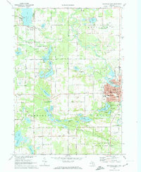 1972 Greenville West1974 Print · USGSGreenville and the surrounding townships of Montcalm and Spencer are shown here during a period of steady growth in the 1970s. Genealogists can locate family sites at Forest Home Cemetery or trace the path of the Chesapeake and Ohio rail line.2 unique versions available
 - 1972 Map of Belding, 1974 Print
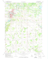 1972 Belding1974 Print · USGSThe Ionia County countryside is captured here in the early seventies, centered on the river-fed industrial core and rural townships. Researchers can trace family history through landmarks like Seeley Church of God, River Ridge Cem, and the old Chesapeake and Ohio rail line.
 - 1972 Map of Greenville East, 1974 Print
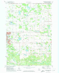 1972 Greenville East1974 Print · USGSMontcalm County enters the early seventies as a landscape of productive gravel pits and quiet wetlands transitioning into the Flat River State Game Area. Researchers can trace the Grand Trunk Western rail line through Millers Station or locate local landmarks like Cedar Crest School and the Township Cemetery.
 - 1972 Map of Sheridan, 1974 Print
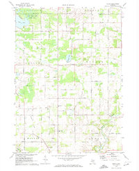
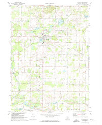 1972 Sheridan1974 Print · USGSMontcalm County in the early seventies shows a landscape defined by small-town rail commerce and a cluster of inland lakes. Genealogists can locate family landmarks like Township Cem, Sunny Hill, and the tracks of the Grand Trunk Western.
 - 1972 Map of Shiloh, 1974 Print
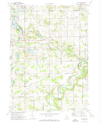
 1972 Shiloh1974 Print · USGSIonia and Montcalm counties are shown in the early seventies, centered on rural farming communities and the local school system. Researchers can trace family-named roads and sites like Higbee Cem, Shiloh, and the Old Grade railroad bed.
 - 1972 Map of Smyrna, 1974 Print
 1972 Smyrna1974 Print · USGSIonia and Kent counties come alive in this early 1970s survey, showing the rural landscapes around the Flat River before modern expansion. Genealogists can trace family names through the Otisco Cem and Mason Cem, or locate the historic Whites Bridge (Covered) and the Smyrna settlement.
 - 1976 Map of Howard City NW, 1979 Print
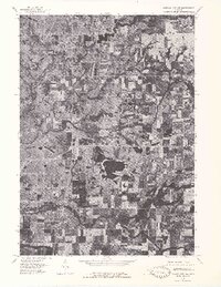 1976 Howard City NW1979 Print · USGSMontcalm County farmland and river valleys are captured in detail in the mid-seventies, showing the region's rural character. Trace the meandering Little Muskegon River and explore the historic footprints of Morley and Howard City.
 - 1976 Map of Howard City NE, 1979 Print
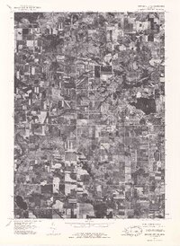 1976 Howard City NE1979 Print · USGSMontcalm County farmland and the village of Lakeview are captured during the mid-seventies in this detailed aerial orthophoto. Researchers can trace the development of the lakeshore around Tamarack Lake and follow the path of Tamarack Creek.
End of results
Showing maps 1-8 of 8
Top cities of Montcalm County
- Greenville historical maps
- Stanton historical maps
- Carson City historical maps
- Sheridan historical maps
Frequently asked questions
- What are the different types of historical maps available for Montcalm County?
- What is the oldest map of Montcalm County?
- Where can I purchase historical maps of Montcalm County for my home or office?
- Where can I download high-res historical maps of Montcalm County?
- Are there historical topographic maps available for Montcalm County?
- Is there historical aerial imagery available for Montcalm County?
- Where are historical maps of Montcalm County sourced from?