
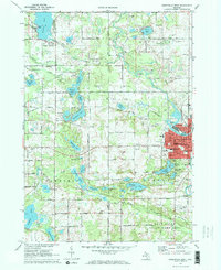
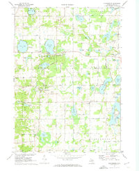
1972 Map of Greenville West
USGS Topo · Published 1974About this map
The Flat River winds through the eastern portion of this landscape, anchoring the city of Greenville and its surrounding townships in the early 1970s. The urban grid of the city is well-defined, featuring civic landmarks like City Hall, the Hospital, and the Fairground, while the Chesapeake and Ohio railroad corridor tracks northward toward Gowen. This region is a transition between the developing outskirts of Greenville and the natural wetlands to the west, where countless glacial lakes including Lincoln Lake, Ziegenfuss Lake, and Thomas Lake dot the terrain.
Find a feature on this map
105 named features on this map. Tap any name to fly to it.
Don’t see what you’re looking for? This feature index may not catch every label — zoom into the map to look around manually.
Map Details
Editions of this 1972 Greenville West Map
2 editions found
Other maps of this area

1954 · Midland
USGS Topo · 1:250,000

1958 · Midland
USGS Topo · 1:250,000

1959 · Midland
USGS Topo · 1:250,000

1959 · Howard City
USGS Topo · 1:62,500

1964 · Langston
USGS Topo · 1:24,000

1966 · Midland
USGS Topo · 1:250,000
1972 · Belding
USGS Topo · 1:24,000
1972 · Greenville East
USGS Topo · 1:24,000
1972 · Evans
USGS Topo · 1:24,000
1972 · Cannonsburg
USGS Topo · 1:24,000