1930s Maps of Oakland County, Michigan
Explore 16 historic maps of Oakland County from the 1930s. These maps offer a rare glimpse into what life looked like during the 1930s — showing old roads, neighborhoods, homes, and landmarks that have changed or disappeared over time.
Whether you're researching your family's past, planning a metal detecting trip, or studying how Oakland County's landscape evolved across the 1930s, these high-resolution maps are a powerful tool for exploring the history of this region.
- Focus on a specific era: All maps on this page are from the 1930s, giving you a focused view of this time period.
- See what’s changed: Compare century-old streets, trails, and buildings to today's modern landscape using overlays and satellite layers.
- Research with precision: Use these maps for genealogy, historical research, land use analysis, or educational projects.
- View, download, or print: Maps are fully viewable online in high resolution, and can be downloaded or printed for your own records.
Start exploring Oakland County's history through authentic maps from the 1930s. This is your window into the past.
Oakland County, MI maps
(16)- 1934 Map of Detroit
 1934 Detroit1934 Print · USGSThe Detroit riverfront and its rising industrial suburbs are captured here during the peak of the automotive boom. Genealogists and historians can trace the early footprints of the Ford Motor Co and local landmarks like Olivet Cemetery or the State Fair Grounds.
 - 1936 Map of Warren
 1936 Warren1936 Print · USGSThe Macomb and Oakland county line in the mid-1930s shows a landscape of small townships and early subdivisions. Genealogists can trace family roots through numerous local schools like Berz Sch or find historic burials at Warren Cem and Memorial Park Cem.
 - 1936 Map of Birmingham
 1936 Birmingham1936 Print · USGSOakland County was undergoing a massive suburban transformation in the mid-thirties as the Detroit metropolitan area expanded northward. Trace the early development of Birmingham and Royal Oak, and find vanished landmarks like Charing Cross Sta or the Log Cabin High Sch.
 - 1936 Map of Wixom
 1936 Wixom1936 Print · USGSOakland County's lake district is documented here in the mid-1930s, showing the intersection of rural agriculture and growing recreation. Trace family history at Wixom Cem or locate former landmarks like Stone Sch and the Pere Marquette rail line.
 - 1936 Map of Highland
 1936 Highland1936 Print · USGSOakland County's lake-rich landscape is captured in the mid-1930s, showing the early residential development around White Lake and the Huron River. Genealogists and local historians can trace the locations of the White Lake Center Sch, Seven Harbors, and the historic White Lake Cem.
 - 1936 Map of Clarkston
 1936 Clarkston1936 Print · USGSOakland County during the mid-1930s shows a landscape of interconnected lakes and early suburban growth near the Clinton River. Genealogists and local historians can trace schoolhouse locations like Dublin Sch and Granger Sch, or explore the rail-era infrastructure of the Grand Trunk Western.
 - 1936 Map of Rochester
 1936 Rochester1936 Print · USGSOakland County was witnessing a surge in residential planning during the mid-1930s as new subdivisions began to fill the space between established towns. Genealogists and historians can trace numerous rural schoolhouses like Ross Sch and Hamlin Sch, or explore the early footprints of the Dodge Subdivision and Rochester.
 - 1936 Map of Washington
 1936 Washington1936 Print · USGSMacomb County townships were transitioning from rural agriculture to automotive industry in the mid-1930s. Genealogists and historians can trace the Packard Proving Grounds, Ferry Morse Seed Co Farms, and old burial sites like Washington Cem.
 - 1936 Map of Redford
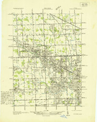 1936 Redford1936 Print · USGSNorthwestern Detroit suburbs emerge from farm tracts during the mid-1930s, showing early neighborhoods and grid-road expansion. Genealogists can find numerous burial grounds like Grand Lawn Cem and landmarks such as Bell Br Community Ch and the Redford Post Office.
 - 1936 Map of Highland Park
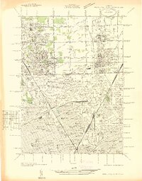 1936 Highland Park1936 Print · USGSGreater Detroit and the enclaves of Highland Park and Hamtramck are captured here in the mid-1930s as urban growth pushes north. Researchers can pinpoint early neighborhoods, local schools like Henry Ford Sch, and the grounds of the Michigan State Fair.
 - 1936 Map of Salem
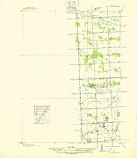 1936 Salem1936 Print · USGSNorthwestern Wayne County and southern Oakland County are captured in the mid-1930s before postwar suburbanization. Genealogists and local researchers can trace old family section lines and find landmark institutions like the Maybury Sanitarium and West Novi Sch.
 - 1936 Map of Walled Lake
 1936 Walled Lake1936 Print · USGSOakland County's lake country is captured here in the mid-1930s, showing a landscape defined by seasonal recreation and rural institutions. Genealogists and local historians can locate early landmarks like Commerce Cem, the State Tuberculosis Sanitarium, and the lakeside Walled Lake Amusement Park.
 - 1936 Map of Pontiac South
 1936 Pontiac South1936 Print · USGSOakland County was rapidly evolving into a premier suburban and recreational district in the mid-1930s. Genealogists and local historians can trace legacy estates and institutions like St Marys College and Polish Seminary, Cranbrook Sch, and the Pine Lake Cem.2 unique versions available
 - 1936 Map of Northville
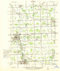 1936 Northville1936 Print · USGSNorthwest Wayne and southwest Oakland counties are captured here in the mid-1930s as the grid of mile roads and institutions matured. Researchers can trace family history at Rural Hill Cem or explore early landmarks like the US Fish Hatchery and Wayne County Training Sch.
 - 1936 Map of Pontiac North
 1936 Pontiac North1936 Print · USGSMid-century Oakland County is captured here at the cusp of modern suburbanization, where traditional townships meet the growing industrial city. Genealogists can locate family names and sites like Clintonville, Perry Mount Park Cem, and many local schools including Hallstead Sch.
 - 1936 Map of Royal Oak
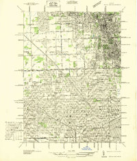 1936 Royal Oak1936 Print · USGSOakland County was rapidly developing north of Detroit during the mid-1930s, as residential grids expanded over former farmland. Genealogists can locate family homes near Southfield Ch or trace the early layout of Lathrup and Huntington Woods.
End of results
Showing maps 1-16 of 16
Top cities of Oakland County
- Troy historical maps
- Farmington Hills historical maps
- Rochester Hills historical maps
- Southfield historical maps
- Waterford Township historical maps
- Novi historical maps
See more
Frequently asked questions
- What are the different types of historical maps available for Oakland County?
- What is the oldest map of Oakland County?
- Where can I purchase historical maps of Oakland County for my home or office?
- Where can I download high-res historical maps of Oakland County?
- Are there historical topographic maps available for Oakland County?
- Is there historical aerial imagery available for Oakland County?
- Where are historical maps of Oakland County sourced from?