
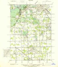
1936 Map of Pontiac South
USGS Topo · Published 1936About this map
Cass Lake and Pine Lake anchor a landscape defined by its abundant water and emerging recreational character in the mid-1930s. The region is dotted with numerous private clubs and estates, including the Bloomfield Hills Country Club and Oakland Hills Country Club, signaling the area's development as an affluent suburban retreat. Educational and religious institutions are prominent landmarks, such as St Marys College and Polish Seminary overlooking Orchard Lake and the distinctive Cranbrook Sch.
Find a feature on this map
112 named features on this map. Tap any name to fly to it.
Don’t see what you’re looking for? This feature index may not catch every label — zoom into the map to look around manually.
Map Details
Editions of this 1936 Pontiac South Map
2 editions found
Other maps of this area

1905 · Wayne
USGS Topo · 1:62,500

1905 · Detroit
USGS Topo · 1:62,500

1907 · Pontiac
USGS Topo · 1:62,500

1908 · Rochester
USGS Topo · 1:62,500

1912 · Wayne
USGS Topo · 1:62,500

1918 · Detroit
USGS Topo · 1:62,500

1924 · Detroit
USGS Topo · 1:62,500

1934 · Detroit
USGS Topo · 1:62,500

1936 · Birmingham
USGS Topo · 1:31,680

1936 · Clarkston
USGS Topo · 1:31,680