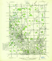
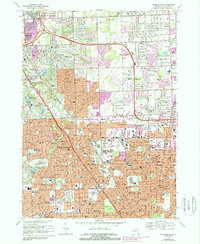
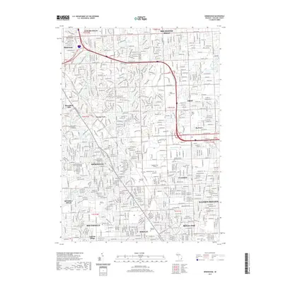
1936 Map of Birmingham
USGS Topo · Published 1936About this map
The Grand Trunk Western railroad serves as a central spine for the rapidly developing communities north of Detroit in this mid-1930s survey. The landscape is a mix of established townships and burgeoning suburban residential tracts, characterized by an extensive grid of numbered mile roads from Twelvemile Rd to South Blvd. The area around Birmingham and Bloomfield Hills is particularly detailed, showing the layout of early country clubs and private schools like the Kingswood Sch and Brookside Sch.
Find a feature on this map
86 named features on this map. Tap any name to fly to it.
Don’t see what you’re looking for? This feature index may not catch every label — zoom into the map to look around manually.
Map Details
Editions of this 1936 Birmingham Map
This is the sole edition of this map. No revisions or reprints were ever made.
Historical Maps of Troy Through Time
10 maps found
1936 Birmingham
Oakland County, MI
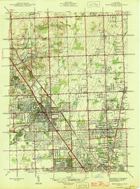
1945 Birmingham
Oakland County, MI
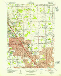
1952 Birmingham
Oakland County, MI
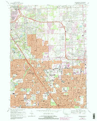
1968 Birmingham
Oakland County, MI
1981 Birmingham
Oakland County, MI
2011 Birmingham
Oakland County, MI
2014 Birmingham
Oakland County, MI
2017 Birmingham
Oakland County, MI
2019 Birmingham
Oakland County, MI
2023 Birmingham
Oakland County, MI