
1924 Map of Detroit
USGS Topo · Published 1924About this map
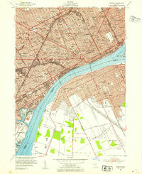
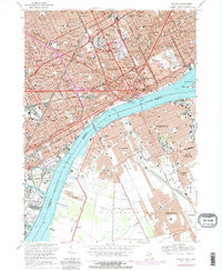
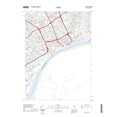
The industrial ascent of the Detroit region is captured here during a period of massive manufacturing expansion. Heavy industry centers on the Rouge River corridor, anchored by the massive Ford Motor Co. Blast Furnaces and the Ford Shipbldg. Plant in the Springwells and Ecorse areas. North of the city core, automotive giants like Dodge Bros. and Maxwell Motor Co. mark the transition from rural townships to a dense urban grid. This 1924 update, based on 1912 fieldwork with revisions through 1918, documents the city just as its streetcar and rail networks were being fully integrated. A complex web of lines, including the Detroit and Northwestern Electric R. R. and the Detroit United Ry., weaves between established settlements like Dearborn and Royal Oak, showing the transportation infrastructure that fueled the city's rapid outward growth into Redford and Hamtramck.
Find a feature on this map
61 named features on this map. Tap any name to fly to it.
Don’t see what you’re looking for? This feature index may not catch every label — zoom into the map to look around manually.
Map Details
Editions of this 1924 Detroit Map
This is the sole edition of this map. No revisions or reprints were ever made.
Historical Maps of Detroit Through Time
20 maps found

1905 Detroit
Wayne County, MI

1918 Detroit
Wayne County, MI
1924 Detroit
Wayne County, MI

1934 Detroit
Wayne County, MI

1937 Detroit
Wayne County, MI

1940 Detroit
Wayne County, MI

1947 Detroit
Wayne County, MI
1952 Detroit
Wayne County, MI

1954 Detroit
Wayne County, MI

1954 Detroit
Wayne County, MI

1961 Detroit
Wayne County, MI

1965 Detroit
Wayne County, MI
1968 Detroit
Wayne County, MI

1985 Detroit
Wayne County, MI

1989 Detroit
Wayne County, MI
2011 Detroit
Wayne County, MI
2014 Detroit
Wayne County, MI

2017 Detroit
Wayne County, MI

2019 Detroit
Wayne County, MI
2023 Detroit
Wayne County, MI