Old Maps of Ogemaw County, Michigan for Metal Detecting
Plan your next treasure hunt with 105 historic maps of Ogemaw County. Find old homesites, ghost towns, trails, and gathering spots that may be lost to time — perfect for identifying promising metal detecting locations.
- Locate forgotten sites: Uncover places like long-lost settlements, abandoned rail lines, or gathering spots.
- Plan better hunts: Use map overlays combined with LiDAR or satellite views to narrow in on historically rich areas.
- Made for detectorists: Thousands of hobbyists use these maps to discover relics, coins, and hidden history.
Use these historic maps to boost your research and find new opportunities beneath the surface of Ogemaw County.
Ogemaw County, MI maps
(105)- 1954 Map of Traverse City, 1965 Print
 1954 Traverse City1965 Print · USGSNorthern Michigan’s vast lakeshores and timberlands are captured here in the mid-fifties, showing the region before the modern interstate era. Genealogists and researchers can trace rail connections like the Detroit and Mackinac RR or find old communities such as Suttons Bay, Elk Rapids, and Prudenville.4 unique versions available
 - 1954 Map of Tawas City, 1968 Print
 1954 Tawas City1968 Print · USGSCoastal life along Lake Huron was defined by a mix of military aviation and hydroelectric power in the mid-fifties. Researchers can trace the river dams like Cooke Dam, the layout of Wurtsmith AFB, and the coastal mining operations at Alabaster.4 unique versions available
 - 1958 Map of Traverse City
 1958 Traverse City1958 Print · USGSNorthern Lower Michigan was a landscape of vast state forests and burgeoning lakeside retreats in the late fifties. Genealogists and historians can trace the rail corridors of the Ann Arbor RR and find established settlements from Elk Rapids to Houghton Lake.2 unique versions available
 - 1958 Map of Tawas City
 1958 Tawas City1958 Print · USGSThe Lake Huron shoreline and northern Michigan timberlands come into focus in the late fifties, during the expansion of the Cold War. Genealogists and historians can trace rail lines like the Detroit and Mackinac, find regional landmarks like the Lumbermans Memorial Monument, and locate coastal facilities including Wurtsmith AFB.2 unique versions available
 - 1963 Map of Luzerne, 1964 Print
 1963 Luzerne1964 Print · USGSOscoda County's forested interior is captured here in the early 1960s, showing the intersection of three major state and national forests. Genealogists and outdoorsmen can trace the early layout of Luzerne, the local Cem, and landmarks like the Luzerne Lookout Tower.
 - 1965 Map of Damon, 1966 Print
 1965 Damon1966 Print · USGSOgemaw County's forest lands and oil fields are captured here in the mid-1960s, showing the intersection of industry and natural conservation. Genealogists can locate family names at Damon Cem and Rose Cem, or trace the winding Old Railroad Grade.
 - 1965 Map of St. Helen NE, 1966 Print
 1965 St. Helen NE1966 Print · USGSOgemaw County's transition from timber harvesting to recreational forest is evident in this mid-sixties survey. Researchers can trace historic land use through the Old Railroad Grade, find family sites near Fisk Cem, and locate the Oil Well and Claypit that supported the local economy.2 unique versions available
 - 1965 Map of West Branch, 1966 Print
 1965 West Branch1966 Print · USGSThe Ogemaw County seat and its rural surroundings are captured in the mid-1960s as the rail and river networks defined local life. Trace family roots at St Josephs Cem, locate the old Miller Sch, or explore the tracks of the New York Central railroad.3 unique versions available
 - 1965 Map of Ogemaw Springs, 1966 Print
 1965 Ogemaw Springs1966 Print · USGSOgemaw County in the mid-1960s reveals a landscape of state forests, rail lines, and scattered rural landmarks. Genealogists and local historians can locate the Beaver Lake Cem, the Pleasant Hill Sch, and a notable Indian Mound near Ogemaw Springs.2 unique versions available
 - 1965 Map of Selkirk, 1966 Print
 1965 Selkirk1966 Print · USGSIn the mid-1960s, this portion of Ogemaw County was a mix of protected state forests and active rural communities centered on the Rifle River. Researchers can trace the locations of many local institutions, including Selkirk, Churchill Sch, and several Aboriginal Earthworks.2 unique versions available
 - 1965 Map of Rose City, 1967 Print
 1965 Rose City1967 Print · USGSOgemaw County thrived as a destination for forestry and recreation in the mid-sixties, centered on the growing community of Rose City. Local historians can trace family-named sites like Fayettes Corner, explore the Old Railroad Grade, and locate the Lane Heights Cem near Lupton.3 unique versions available
 - 1968 Map of Prescott, 1971 Print
 1968 Prescott1971 Print · USGSNorthern Michigan in the late sixties reveals a landscape of rural villages and energy extraction. Trace local family history at Richland Cem or follow the Old Railroad Grade past Prescott and the Oil Wells near Maple Ridge.
 - 1968 Map of Sage Lake, 1971 Print
 1968 Sage Lake1971 Print · USGSThe Ogemaw and Iosco county line area comes to life in the late 1960s, showing a landscape defined by the expansive Sage Lake and the Ogemaw State Forest. Genealogists and local historians can trace family locations near Logan Corners, Logan Cemetery, and the Church of the Nazarene.
 - 1968 Map of South Branch, 1971 Print
 1968 South Branch1971 Print · USGSOgemaw County in the late sixties reveals a landscape of dense state and national forests and numerous glacial lakes. Genealogists and historians can locate South Branch and Goodar, trace the South Branch Au Sable River, and find the Oak Grove Cem.2 unique versions available
 - 1968 Map of Skidway Lake, 1971 Print
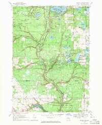 1968 Skidway Lake1971 Print · USGSIn the late sixties, the Ogemaw County lakes region was a burgeoning center for recreation and industry. Researchers can trace the Old Railroad Grade near Alger, locate the Clayton Oil and Gas Field, and find local landmarks like St Stephens Ch.
 - 1968 Map of Sterling NW, 1971 Print
 1968 Sterling NW1971 Print · USGSNorthern Michigan's forested interior is captured in the late sixties, showing the intersection of Ogemaw, Gladwin, and Arenac counties. Genealogists and historians can trace the Bourret Cem or locate the Gustafson Airport and the Penn Central rail line.
 - 1969 Map of Edwards, 1971 Print
 1969 Edwards1971 Print · USGSCentral Michigan's lake-studded woodlands are captured here in the late sixties at the intersection of Ogemaw, Roscommon, and Gladwin counties. Genealogists and local historians can trace family-named routes and community landmarks like Edwards Cem, Oak Grove Ch, and the settlement of Edwards.
 - 1972 Map of Goodar, 1975 Print
 1972 Goodar1975 Print · USGSThe northern Michigan woods of the early seventies are captured here during a period of steady forestry and recreation. Researchers can trace legacy timber routes like the Old RR Grade and locate features such as Goodar, Hughes Lake, and a Flowing Well.3 unique versions available
 - 1972 Map of Mack Lake, 1975 Print
 1972 Mack Lake1975 Print · USGSThe Oscoda County woods in the early seventies reveal a landscape of forest management and scattered glacial lakes. Researchers can trace the Old RR Grade, find the Hughes Lake Lookout Tower, or locate Brainard Springs.3 unique versions available
 - 1972 Map of Island Lake, 1975 Print
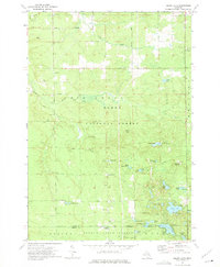 1972 Island Lake1975 Print · USGSOscoda and Ogemaw counties are shown here in the early 1970s, a landscape defined by state and federal forest lands. Researchers can trace historic intersections like Union Corners, find the Paul Bunyan Camp, and locate the Old Railroad Grade.2 unique versions available
 - 1983 Map of Houghton Lake, 1984 Print
 1983 Houghton Lake1984 Print · USGSIn the early 1980s, the Michigan heartland around Houghton Lake was a patchwork of state forest and growing lakeside resorts. Genealogists and historians can trace the development of communities like West Branch and Rose City alongside landmarks like Roscommon County Airfield.
 - 1983 Map of Hubbard Lake, 1984 Print
 1983 Hubbard Lake1984 Print · USGSThe shorelines of Alcona and Alpena Counties come to life in this early 1980s overview of the Lake Huron coast and its deep timberlands. Researchers can trace historic rail routes like the Detroit and Mackinac or locate quiet inland hubs such as Barton City and Killmaster.
 - 1983 Map of Grayling, 1984 Print
 1983 Grayling1984 Print · USGSIn the early eighties, this Northern Michigan interior was a hub for forestry, military training, and river recreation. Researchers can trace the sprawling boundaries of Camp Grayling and locate historic markers like Hartwick Pines and Otsego Lake.2 unique versions available
 - 1984 Map of Tawas City, 1985 Print
 1984 Tawas City1985 Print · USGSNortheast Michigan's shoreline and forest interior are captured here in the mid-eighties, from the active runways of Wurtsmith Air Force Base to the quiet waters of Tawas Bay. Genealogists and local historians can locate rural landmarks like Skunk Sch, the Welcome Church, and the route of the Detroit and Mackinac railroad.3 unique versions available
 - 1989 Map of Traverse City, 1990 Print
 1989 Traverse City1990 Print · USGSNorthern Michigan’s lake-country and forest lands are captured in the late eighties as seasonal tourism and timber hubs expanded. Genealogists and historians can trace the routes of the Ann Arbor RR, the boundaries of Camp Grayling, and settlements like Elk Rapids and Manton.
Showing maps 1-25 of 105
Top cities of Ogemaw County
Frequently asked questions
- What are the different types of historical maps available for Ogemaw County?
- What is the oldest map of Ogemaw County?
- Where can I purchase historical maps of Ogemaw County for my home or office?
- Where can I download high-res historical maps of Ogemaw County?
- Are there historical topographic maps available for Ogemaw County?
- Is there historical aerial imagery available for Ogemaw County?
- Where are historical maps of Ogemaw County sourced from?