Old Maps of Greenland Township, Michigan for Genealogy
Trace your family roots with 57 historic maps of Greenland Township. These high-res maps reveal old neighborhoods, homesites, landmarks, and streets — helping you uncover where your ancestors lived and how the area evolved over time.
- Explore historic neighborhoods: Identify where your relatives may have lived in the 1800s or 1900s.
- Compare maps over time: Trace the changes in streets, buildings, and landmarks for multi-generational research.
- Perfect for genealogy & ancestry research: Used by family historians and researchers to map out lineage and migration.
These maps are an incredible resource for exploring your personal connection to Greenland Township's past.
Greenland Township, MI maps
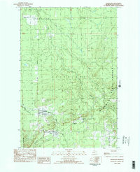
(57)- 1949 Map of Rockland, 1965 Print
 1949 Rockland1965 Print · USGSThe Ontonagon copper country is shown in the late 1940s, a period when rail lines still connected remote settlements like Wainola and Paynesville. Local researchers can trace family landmarks like Wainola Ch, Rockland Cem, and the old Military Bridge.2 unique versions available
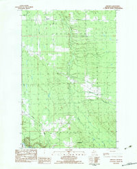
 - 1950 Map of Greenland, 1956 Print
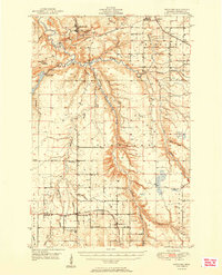
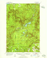
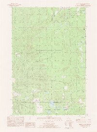
 1950 Greenland1956 Print · USGSThe Upper Peninsula copper country is seen here at mid-century, where logging camps and mining operations defined the inland landscape. Researchers can trace the Copper Range Railroad and find historic sites like Adventure Mine or the remote Abbott-Fox Camp.2 unique versions available
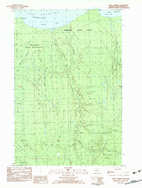
 - 1951 Map of Rockland
 1951 Rockland1951 Print · USGSThe copper country of Ontonagon County comes alive in this mid-century survey of the Rockland and Bruce Crossing area. Genealogists and local historians can trace early railroad lines and find sites like Irish Hollow Cem, Wainola Ch, and the Gardner Lookout Tower.2 unique versions available
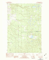
 - 1951 Map of Greenland
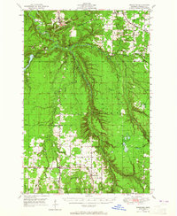
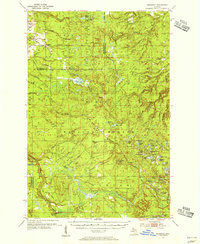
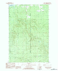
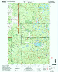
 1951 Greenland1951 Print · USGSIn the early fifties, Michigan’s Copper Country was a landscape of remote timber camps and maturing mining towns. Genealogists and industrial historians can trace the Copper Range RR through Greenland and Mass, or locate old work sites like Hilger Camp and the Adventure Mine.2 unique versions available
 - 1954 Map of Rousseau, 1956 Print
 1954 Rousseau1956 Print · USGSHoughton and Ontonagon counties in the mid-1950s reveal a landscape defined by forestry and the reach of the rail lines. Researchers can trace the routes of the Chicago Milwaukee St Paul and Pacific Railroad and find sites like the Michigan College of Mining Forestry Camp and Rousseau.3 unique versions available
 - 1954 Map of Winona, 1956 Print
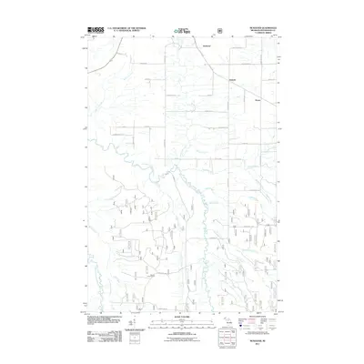
 1954 Winona1956 Print · USGSIn the mid-1950s, the Copper Country south of Houghton was a landscape of industrial mines and deep forests. Genealogists and historians can trace the foundations of Winona, locate the Winona Mine, and find rural landmarks like the Misery Bay Sch and Simar Landing Field.3 unique versions available
 - 1958 Map of Iron River, 1968 Print
 1958 Iron River1968 Print · USGSThe Upper Peninsula in the late fifties is captured here as a landscape of timber, iron, and rail. Genealogists and historians can trace rail stops like Mass Station or explore the coastlines of Lake Gogebic and Keweenaw Bay.3 unique versions available
 - 1960 Map of Iron River
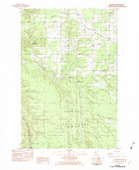
 1960 Iron River1960 Print · USGSThe Upper Peninsula’s western reaches are shown in the late fifties, featuring the industrial infrastructure of the Copper Country and the vast Ottawa National Forest. Researchers can trace the rail lines of the Milwaukee Road through settlements like Bruce Crossing and the White Pine Mine.
 - 1961 Map of Iron River
 1961 Iron River1961 Print · USGSThe Upper Peninsula and northern Wisconsin are shown here in the early 1960s, a landscape defined by the iron range and vast timberlands. Researchers can trace the legacy of mining and rail transport through Caspian, the Lac Du Flambeau Indian Reservation, and the Milwaukee Road.
 - 1967 Map of Iron River, 1968 Print
 1967 Iron River1968 Print · USGSThe Upper Peninsula and northern Wisconsin borderlands are shown here in the late sixties, a landscape of deep woods and iron-country rail lines. Genealogists and historians can trace the lakeside settlements of L'Anse and Ontonagon or follow the Soo Line through towns like Michigamme and Nestoria.
 - 1979 Map of Ontonagon, 1991 Print
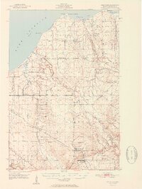
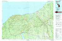 1979 Ontonagon1991 Print · USGSThe Western Upper Peninsula coastline and copper country are captured here during the late twentieth century. Genealogists and historians can trace the rail-and-river network connecting settlements like White Pine, Lake Mine, and Bruce Crossing.
 - 1982 Map of McKeever, 1983 Print
 1982 McKeever1983 Print · USGSTimber country in Ontonagon County during the late seventies centers on the Escanaba and Lake Superior rail line. Trace local roots at Wainola, Mass Station, and McKeever, or locate landmarks like Wainola Ch and Three Rapids.
 - 1982 Map of Greenland, 1983 Print
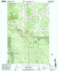
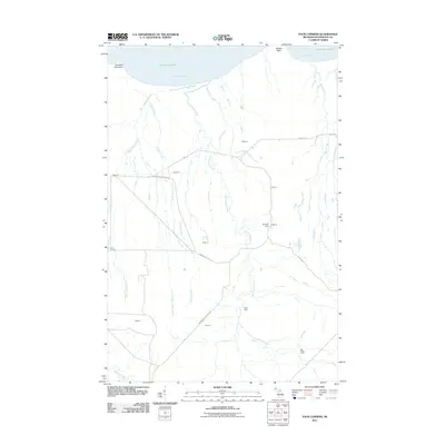
 1982 Greenland1983 Print · USGSOntonagon County copper country is captured here in the early eighties, centered on the mining-era settlements of Greenland and Mass. Trace family history and local industry at Maple Grove Cem, Lake Mine, and the logging outposts of Abbott-Fox Camp.2 unique versions available
 - 1982 Map of Firesteel, 1983 Print
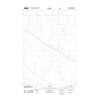
 1982 Firesteel1983 Print · USGSThe Upper Peninsula timber and river country comes into focus in the early eighties. Researchers can trace the water network of Flintsteel River and find isolated sites like Camp 4 and the settlement of Firesteel.
 - 1982 Map of Four Corners, 1983 Print
 1982 Four Corners1983 Print · USGSCoastal Ontonagon County is captured here in the early eighties, showing a landscape defined by state forest lands and tribal borders. Researchers can trace the network of logging outposts and camps like Hilger Camp, Old Hilger Camp, and Penegors Camp.
 - 1982 Map of Rousseau, 1983 Print
 1982 Rousseau1983 Print · USGSUpper Peninsula timber country is captured here in the early eighties, showing the remote settlements and logging remnants of Ontonagon County. Genealogists and hikers can trace the Old RR Grade and locate long-standing landmarks like Rousseau, Pori, and the Cem.
 - 1982 Map of Winona South, 1983 Print
 1982 Winona South1983 Print · USGSUpper Peninsula copper country and timberlands are documented here in the early 1980s as industry and nature overlap. Local historians can trace the old Railroad grade, locate the Woodland Cemetery, and identify mining remnants like Tailings near Winona.
 - 1982 Map of Winona North, 1983 Print
 1982 Winona North1983 Print · USGSThe Upper Peninsula shoreline and the timberlands of Stanton are captured here in the early 1980s. Local researchers can trace the roads near Winona, locate the Townhall at Misery Bay, and find remote outposts like Camp 18 and Ahola.
 - 1991 Map of L'Anse
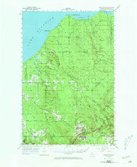
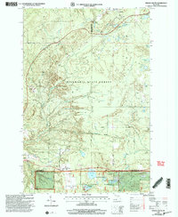
 1991 L'Anse1991 Print · USGSUpper Peninsula life in the early nineties centered on the waters of Keweenaw Bay and the timber-rich highlands of the Huron Mountains. Genealogists and researchers can trace the rail-and-road connections between L'Anse, Baraga, and smaller communities like Pequaming and Assinins.2 unique versions available
 - 1999 Map of McKeever, 2004 Print
 1999 McKeever2004 Print · USGSUpper Peninsula timberlands and river valleys are captured here at the close of the twentieth century. Genealogists and hikers can trace the North Country National Scenic Trail or locate family sites near Wainola Ch and Mass Station.
 - 1999 Map of Winona South, 2004 Print
 1999 Winona South2004 Print · USGSUpper Peninsula copper country and timberlands meet in this late-twentieth-century study of the Ontonagon and Houghton county line. You can trace the remnants of local industry at the Mine Shaft and Tailings or locate family roots at the Woodland Cemetery and Winona.
 - 1999 Map of Rousseau, 2004 Print
 1999 Rousseau2004 Print · USGSUpper Peninsula timberlands and small settlements are preserved here as they appeared just before the turn of the millennium. Genealogists and outdoor historians can trace old routes near Rousseau, the local Cem, and the recreation sites at Bob Lake.
 - 2011 Map of Four Corners, 2011 Print
 2011 Four Corners2011 Print · USGSCovers Greenland Township, including Ontonagon Township, Bohemia Township, and other nearby areas
 - 2011 Map of McKeever, 2011 Print
 2011 McKeever2011 Print · USGSCovers Greenland Township, including Rockland Township, Wainola, and other nearby areas
 - 2011 Map of Firesteel, 2011 Print
 2011 Firesteel2011 Print · USGSCovers Greenland Township, including Ontonagon Township, Rockland Township, and other nearby areas
Showing maps 1-25 of 57
Top cities near Greenland Township
Top neighborhoods of Greenland Township
- Lake Mine historical maps
- Wasas historical maps
- Wainola historical maps
- McKeever historical maps
- Mass City historical maps
- Greenland historical maps
Frequently asked questions
- What are the different types of historical maps available for Greenland Township?
- What is the oldest map of Greenland Township?
- Where can I purchase historical maps of Greenland Township for my home or office?
- Where can I download high-res historical maps of Greenland Township?
- Are there historical topographic maps available for Greenland Township?
- Is there historical aerial imagery available for Greenland Township?
- Where are historical maps of Greenland Township sourced from?