2020s Maps of Evart Township, Michigan
Explore 4 historic maps of Evart Township from the 2020s. These maps offer a rare glimpse into what life looked like during the 2020s — showing old roads, neighborhoods, homes, and landmarks that have changed or disappeared over time.
Whether you're researching your family's past, planning a metal detecting trip, or studying how Evart Township's landscape evolved across the 2020s, these high-resolution maps are a powerful tool for exploring the history of this region.
- Focus on a specific era: All maps on this page are from the 2020s, giving you a focused view of this time period.
- See what’s changed: Compare century-old streets, trails, and buildings to today's modern landscape using overlays and satellite layers.
- Research with precision: Use these maps for genealogy, historical research, land use analysis, or educational projects.
- View, download, or print: Maps are fully viewable online in high resolution, and can be downloaded or printed for your own records.
Start exploring Evart Township's history through authentic maps from the 2020s. This is your window into the past.
Evart Township, MI maps
(4)- 2023 Map of Evart, 2023 Print
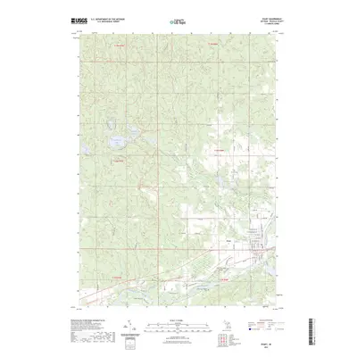 2023 Evart2023 Print · USGSEvart and the Muskegon River valley are captured here in a period of modern stability. Genealogists and local historians can trace family plots at German Cem or follow the historic rail corridor now known as the Pere Marquette State Trl.
 - 2023 Map of Chippewa Lake North, 2023 Print
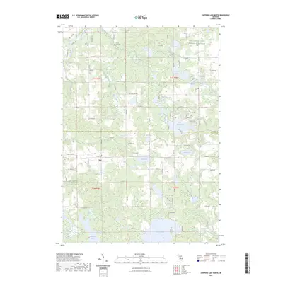 2023 Chippewa Lake North2023 Print · USGSMecosta and Osceola Counties are shown here in the early 2020s, highlighting a landscape of sprawling glacial lakes and rural settlements. Researchers can locate family sites at Proctor Family Cem and Pioneer Cem or trace the winding course of the Muskegon River.
 - 2023 Map of Merrill Lake, 2023 Print
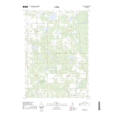 2023 Merrill Lake2023 Print · USGSThe village of Barryton and the surrounding lake country appear in high detail during the early 2020s. Researchers can locate family heritage sites like Sparks Cem or trace the winding course of the North Branch Chippewa River.
 - 2023 Map of Sears, 2023 Print
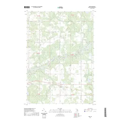 2023 Sears2023 Print · USGSOsceola County's rural landscape is captured here in the 2020s, showing the intersection of river life and agricultural history. You can trace family roots at Sylvan Cem or follow the historic rail corridor now preserved as the Pere Marquette State Trl.
End of results
Showing maps 1-4 of 4
Top cities near Evart Township
- Big Rapids historical maps
- Reed City historical maps
- Evart historical maps
- Barryton historical maps
- Hersey historical maps
- LeRoy historical maps
Frequently asked questions
- What are the different types of historical maps available for Evart Township?
- What is the oldest map of Evart Township?
- Where can I purchase historical maps of Evart Township for my home or office?
- Where can I download high-res historical maps of Evart Township?
- Are there historical topographic maps available for Evart Township?
- Is there historical aerial imagery available for Evart Township?
- Where are historical maps of Evart Township sourced from?