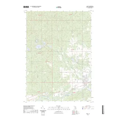
2023 Map of Evart
USGS Topo · Published 2023About this map
Evart sits at the intersection of river and rail history, positioned along a major bend of the Muskegon River. The landscape is defined by the legacy of the regional timber and transport corridors, most notably represented by the Pere Marquette State Trl which follows a former railroad grade through the heart of town. To the north and west, the terrain transitions into a dense network of kettle lakes and ponds, including Horsehead Lake and the connected waters of Strawberry Lake and Little Strawberry Lake.
Find a feature on this map
49 named features on this map. Tap any name to fly to it.
Don’t see what you’re looking for? This feature index may not catch every label — zoom into the map to look around manually.
Map Details
Editions of this 2023 Evart Map
This is the sole edition of this map. No revisions or reprints were ever made.
Other maps of this area

1954 · Traverse City
USGS Topo · 1:250,000

1954 · Midland
USGS Topo · 1:250,000

1957 · Cadillac South
USGS Topo · 1:62,500

1957 · Marion
USGS Topo · 1:62,500

1958 · Traverse City
USGS Topo · 1:250,000

1958 · Midland
USGS Topo · 1:250,000

1959 · Midland
USGS Topo · 1:250,000

1959 · Lake
USGS Topo · 1:62,500

1959 · Evart
USGS Topo · 1:62,500

1966 · Midland
USGS Topo · 1:250,000