Old Maps of Evart Township, Michigan for Genealogy
Trace your family roots with 32 historic maps of Evart Township. These high-res maps reveal old neighborhoods, homesites, landmarks, and streets — helping you uncover where your ancestors lived and how the area evolved over time.
- Explore historic neighborhoods: Identify where your relatives may have lived in the 1800s or 1900s.
- Compare maps over time: Trace the changes in streets, buildings, and landmarks for multi-generational research.
- Perfect for genealogy & ancestry research: Used by family historians and researchers to map out lineage and migration.
These maps are an incredible resource for exploring your personal connection to Evart Township's past.
Evart Township, MI maps
(32)- 1954 Map of Midland, 1967 Print
 1954 Midland1967 Print · USGSMid-Michigan at the peak of the post-war era shows a landscape balancing industrial growth in Midland with the deep timberlands of the Manistee National Forest. Researchers can trace the legacy of the timber and rail era along the Pennsylvania RR or find family roots in river towns like Chesaning and Big Rapids.4 unique versions available
 - 1958 Map of Midland
 1958 Midland1958 Print · USGSCentral Michigan in the late fifties is captured here during a period of transition for its university towns and industrial hubs. Genealogists and researchers can trace family lines through old rail-stop towns like Breckenridge and Chesaning or locate property near the Muskegon River and Prairie Farm.
 - 1959 Map of Midland
 1959 Midland1959 Print · USGSMid-century Michigan comes alive in this survey of the central Lower Peninsula, from the streets of Grand Rapids to the Houghton Lake timberlands. Genealogists and rail fans can trace the Ann Arbor RR and Chesapeake and Ohio RR through towns like Big Rapids and Mount Pleasant.
 - 1959 Map of Lake, 1960 Print
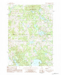
 1959 Lake1960 Print · USGSOsceola and Mecosta Counties were a mix of timber-state forests and oil exploration during the late fifties. Researchers can trace rural landmarks from Sears to Brinton, including the County Home, local sites like Martin Sch, and the Chesapeake and Ohio rail line.2 unique versions available
 - 1959 Map of Evart, 1960 Print
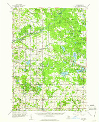
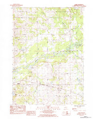
 1959 Evart1960 Print · USGSOsceola and Mecosta counties are shown here in the late fifties, featuring the rail hubs and river valleys that shaped the region's growth. Genealogists and historians can locate rural schools like Watson Sch, the Osceola Oil Field, and family landmarks such as Crapo Cem.3 unique versions available
 - 1966 Map of Midland
 1966 Midland1966 Print · USGSCentral Michigan in the mid-1960s shows a landscape of growing manufacturing hubs and active resource extraction. Genealogists and historians can trace the rail corridors of the Grand Trunk Western or locate family-named landmarks near Oil wells and the Muskegon River.
 - 1983 Map of Evart, 1984 Print
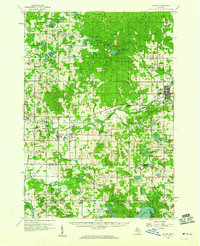
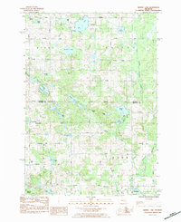
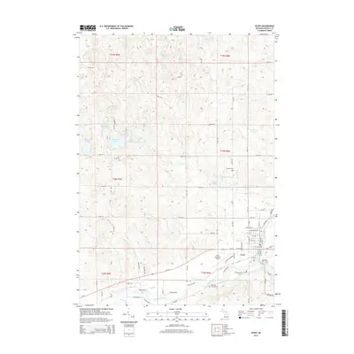
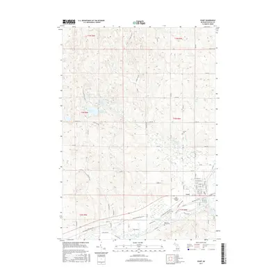
 1983 Evart1984 Print · USGSOsceola County in the early eighties was a hub of rail and river activity centered on the community of Evart. Researchers can trace the legacy of local settlements through the German Cem, the Chesapeake and Ohio line, and Sacred Heart Ch.
 - 1983 Map of Chippewa Lake North, 1984 Print
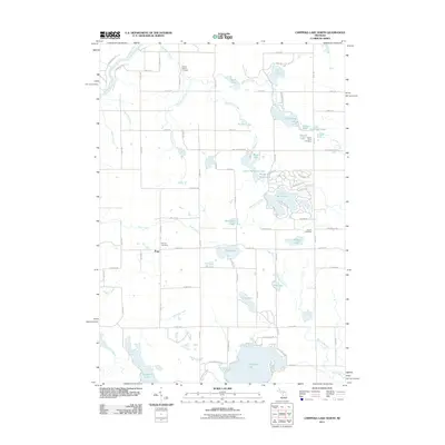
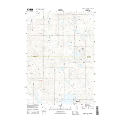
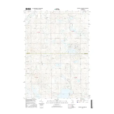
 1983 Chippewa Lake North1984 Print · USGSThe glacial lakes and timberlands along the Osceola and Mecosta border are captured here in the early eighties. Researchers can trace rural lineages at Pioneer Cem, Chippewa Cem, and the remote banks of Lake Miramichi.
 - 1984 Map of Sears
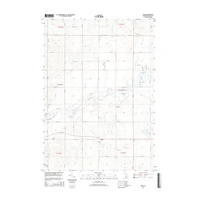
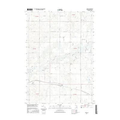
 1984 Sears1984 Print · USGSOsceola County is shown in the mid-1980s as a landscape of rural townships and river bends. Genealogists can locate several local cemeteries like Forest Hill Cem and Sylvan Cem or trace the Chesapeake and Ohio rail line past Sears.
 - 1984 Map of Big Rapids
 1984 Big Rapids1984 Print · USGSMid-Michigan in the mid-eighties shows a balance of deep-woods conservation and riverfront industry centered on the Muskegon River. Genealogists and historians can trace rail-town development along the Chesapeake and Ohio or locate family sites near Idlewild, Reed City, and Forest Hill Cem.
 - 1984 Map of Merrill Lake
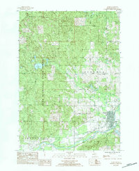
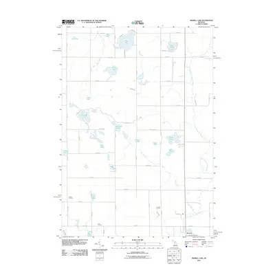
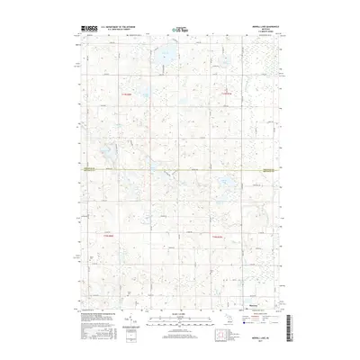
 1984 Merrill Lake1984 Print · USGSThe village of Barryton and the surrounding glacial lake country are captured here in the mid-eighties. Researchers can locate rural landmarks like Sparks Cemetery, Barryton Church, and numerous named waters including Negaunee Lake and Rattail Lake.
 - 1991 Map of Big Rapids
 1991 Big Rapids1991 Print · USGSWest Michigan’s river valleys and timberlands are charted here during the early nineties, centered on the Big Rapids corridor. Researchers can trace the path of the C & O RR through settlements like Reed City, Baldwin, and White Cloud.
 - 2011 Map of Evart, 2011 Print
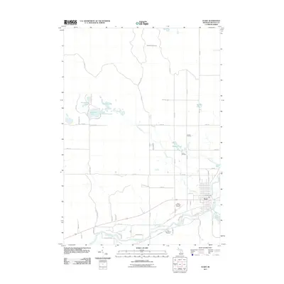 2011 Evart2011 Print · USGSCovers Evart Township, including Evart, Cedar Township, and other nearby areas
 - 2011 Map of Sears, 2011 Print
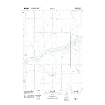 2011 Sears2011 Print · USGSCovers Evart Township, including Sears, Middle Branch Township, and other nearby areas
 - 2011 Map of Chippewa Lake North, 2011 Print
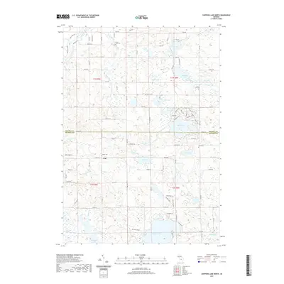
 2011 Chippewa Lake North2011 Print · USGSCovers Evart Township, including Chippewa Township, Pogy, and other nearby areas
 - 2011 Map of Merrill Lake, 2011 Print
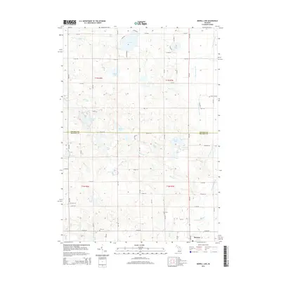
 2011 Merrill Lake2011 Print · USGSCovers Evart Township, including Barryton, Chippewa Township, and other nearby areas
 - 2014 Map of Merrill Lake, 2014 Print
 2014 Merrill Lake2014 Print · USGSCovers Evart Township, including Barryton, Chippewa Township, and other nearby areas
 - 2014 Map of Sears, 2014 Print
 2014 Sears2014 Print · USGSCovers Evart Township, including Sears, Middle Branch Township, and other nearby areas
 - 2014 Map of Evart, 2014 Print
 2014 Evart2014 Print · USGSCovers Evart Township, including Evart, Cedar Township, and other nearby areas
 - 2014 Map of Chippewa Lake North, 2014 Print
 2014 Chippewa Lake North2014 Print · USGSCovers Evart Township, including Chippewa Township, Pogy, and other nearby areas
 - 2017 Map of Evart, 2017 Print
 2017 Evart2017 Print · USGSCovers Evart Township, including Evart, Cedar Township, and other nearby areas
 - 2017 Map of Sears, 2017 Print
 2017 Sears2017 Print · USGSCovers Evart Township, including Sears, Middle Branch Township, and other nearby areas
 - 2017 Map of Merrill Lake, 2017 Print
 2017 Merrill Lake2017 Print · USGSCovers Evart Township, including Barryton, Chippewa Township, and other nearby areas
 - 2017 Map of Chippewa Lake North, 2017 Print
 2017 Chippewa Lake North2017 Print · USGSCovers Evart Township, including Chippewa Township, Pogy, and other nearby areas
 - 2019 Map of Chippewa Lake North, 2019 Print
 2019 Chippewa Lake North2019 Print · USGSCovers Evart Township, including Chippewa Township, Pogy, and other nearby areas
Showing maps 1-25 of 32
Top cities near Evart Township
- Big Rapids historical maps
- Reed City historical maps
- Evart historical maps
- Barryton historical maps
- Hersey historical maps
- LeRoy historical maps
Frequently asked questions
- What are the different types of historical maps available for Evart Township?
- What is the oldest map of Evart Township?
- Where can I purchase historical maps of Evart Township for my home or office?
- Where can I download high-res historical maps of Evart Township?
- Are there historical topographic maps available for Evart Township?
- Is there historical aerial imagery available for Evart Township?
- Where are historical maps of Evart Township sourced from?