1970s Maps of Schoolcraft County, Michigan
Explore 20 historic maps of Schoolcraft County from the 1970s. These maps offer a rare glimpse into what life looked like during the 1970s — showing old roads, neighborhoods, homes, and landmarks that have changed or disappeared over time.
Whether you're researching your family's past, planning a metal detecting trip, or studying how Schoolcraft County's landscape evolved across the 1970s, these high-resolution maps are a powerful tool for exploring the history of this region.
- Focus on a specific era: All maps on this page are from the 1970s, giving you a focused view of this time period.
- See what’s changed: Compare century-old streets, trails, and buildings to today's modern landscape using overlays and satellite layers.
- Research with precision: Use these maps for genealogy, historical research, land use analysis, or educational projects.
- View, download, or print: Maps are fully viewable online in high resolution, and can be downloaded or printed for your own records.
Start exploring Schoolcraft County's history through authentic maps from the 1970s. This is your window into the past.
Schoolcraft County, MI maps
(20)- 1972 Map of Hughes Point, 1974 Print
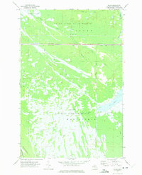
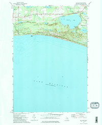
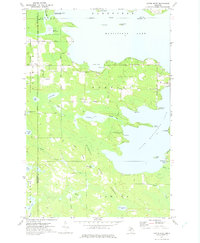
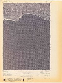 1972 Hughes Point1974 Print · USGSUpper Peninsula shoreline and wetlands are documented here in the early seventies, just as modern hydrographic surveys were updated. Trace the rugged coastal features of Island Harbor, Port Island, and the secluded waters of Batty Doe Lake within the Mackinac State Forest.2 unique versions available
 - 1972 Map of Seul Choix Point, 1975 Print
 1972 Seul Choix Point1975 Print · USGSThe northern shores of Lake Michigan come into focus in the early 1970s, showing a rugged peninsula defined by maritime safety and heavy industry. Trace the historic Lighthouse and Coast Guard Sta at Seul Choix Point alongside the massive Quarry works near Milakokia River.
 - 1972 Map of Merwin Lake, 1975 Print
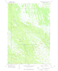
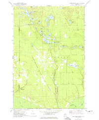
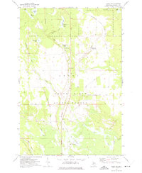
 1972 Merwin Lake1975 Print · USGSThe Manistique River floodplain in Schoolcraft County is shown in the early seventies, dominated by the state forest and winding river oxbows. Genealogists and local historians can locate the Woods Sch, Woods Cem, and traces of the Riverside Truck Trail.
 - 1972 Map of Blaney Park, 1975 Print
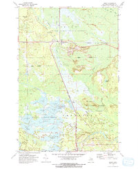
 1972 Blaney Park1975 Print · USGSSchoolcraft County’s resort and timber lands are captured here in the early 1970s, showcasing the development around Mueller Township. Genealogists and researchers can trace local family landmarks like Maple Grove Ch or follow the Soo Line rail history through Blaney Junction and Parkington.
 - 1972 Map of Hardwood Island, 1975 Print
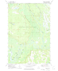
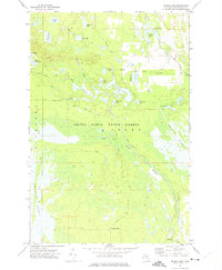
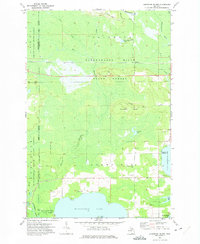 1972 Hardwood Island1975 Print · USGSLuce and Schoolcraft counties are shown in the early 1970s, a landscape defined by the vast northern forests and the clear shores of the Manistique lakes. Genealogists and historians can locate the West Lakefield Cem, the Soo Line rail stops at Danaher, and the landings along North Manistique Lake.2 unique versions available
 - 1972 Map of Driggs Lake SE, 1975 Print
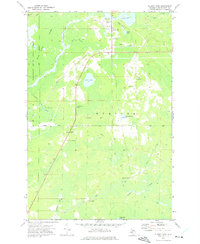
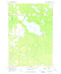
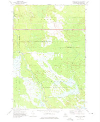 1972 Driggs Lake SE1975 Print · USGSSchoolcraft County’s managed wetlands and timberlands are captured here in the early 1970s. Trace the complex water diversions through the Seney National Wildlife Refuge and follow the route of the Soo Line across the Grand Sable State Forest.
 - 1972 Map of Manistique East, 1975 Print
 1972 Manistique East1975 Print · USGSManistique and its northern Lake Michigan harbor are captured here in the early 1970s, showcasing the intersection of the Upper Peninsula's timber and maritime industries. Genealogists and local historians can locate the Fairview Sch, trace the Soo Line tracks, and find the Fairview Cemetery near the city center.
 - 1972 Map of Marsh Creek Pool, 1975 Print
 1972 Marsh Creek Pool1975 Print · USGSIn the early seventies, the central Upper Peninsula was a landscape of managed wetlands and vast conservation tracts. Researchers can trace the hydraulic engineering of the Seney National Wildlife Refuge and the winding course of the Manistique River.
 - 1972 Map of Walsh, 1975 Print
 1972 Walsh1975 Print · USGSSchoolcraft County’s wild interior is captured here in the early seventies, where the massive Seney wetlands meet the state forest. Track the industrial footprint of the Soo Line railroad and discover managed water features like Pool C-3 and the Walsh Ditch.
 - 1972 Map of Marsh Creek Pool NW, 1975 Print
 1972 Marsh Creek Pool NW1975 Print · USGSSchoolcraft County's marshlands and river systems are captured in the early seventies during a period of active conservation. Researchers can trace the winding West Branch Manistique River and locate backcountry landmarks like West Branch Campground and Tucker Lake.2 unique versions available
 - 1972 Map of Seney, 1975 Print
 1972 Seney1975 Print · USGSThe Upper Peninsula marshlands are captured here in the early 1970s, showcasing the extensive water management systems of the Seney National Wildlife Refuge. Researchers can trace the legacy of regional transport through the SOO LINE railroad and the OLD RAILROAD GRADE near Seney.2 unique versions available
 - 1972 Map of Smith Lake, 1975 Print
 1972 Smith Lake1975 Print · USGSUpper Peninsula wetlands and timberlands are captured here in the early seventies, showing the vast Manistique River State Forest. Researchers can trace old logging routes like the Truck Trail and find landmarks such as the Mennonite Ch and Kleystads Slough.
 - 1972 Map of Gulliver, 1975 Print
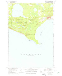
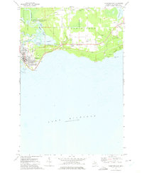
 1972 Gulliver1975 Print · USGSThe Lake Michigan shoreline and the village of Gulliver are documented in the early seventies, showing a landscape shaped by the SOO LINE railroad and local gravel industry. Researchers can trace the Emergency Landing Field in Doyle Township and family recreation spots like Township Park.2 unique versions available
 - 1972 Map of Tahquamenon Lakes, 1975 Print
 1972 Tahquamenon Lakes1975 Print · USGSLuce County’s lake country is captured here in the early 1970s, showing a vast network of timber roads and forest lands. Researchers can trace the layout of the Laketon settlement and find numerous small water bodies like Camp 7 Lake and Fur Farm Lake.
 - 1972 Map of Germfask, 1975 Print
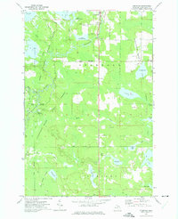 1972 Germfask1975 Print · USGSSchoolcraft County’s timber and wetlands are captured in the early seventies, where the Manistique River divides managed wildlife pools and state forests. Researchers can locate legacy burial grounds like Old Germfask Cem and Blaney Cem or the small settlement of Gagnon.
 - 1972 Map of Sunken Lake, 1975 Print
 1972 Sunken Lake1975 Print · USGSThe Grand Sable State Forest in the early seventies shows a landscape defined by the winding Fox River and secluded glacial lakes. Researchers can locate remote sites like Fox River Campground, Sunken Lake, and the winding Little Fox River as they appeared before modern development.2 unique versions available
 - 1972 Map of Driggs Lake, 1975 Print
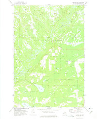
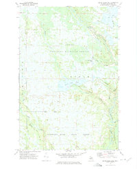
 1972 Driggs Lake1975 Print · USGSSchoolcraft County in the early seventies shows a wilderness of wetlands and glacial lakes within the Grand Sable State Forest. Trace the paths of the Driggs River and find remote sites like Wardles Landing Field or Howards Camp.
 - 1972 Map of Seney NW, 1975 Print
 1972 Seney NW1975 Print · USGSSchoolcraft County’s timber and water history is preserved here in the early seventies, just as the region transitioned toward recreation. Trace the Old Railroad Grade and explore named water bodies like The Spreads and Dutch Fred Lake.
 - 1972 Map of Milakokia Lake, 1975 Print
 1972 Milakokia Lake1975 Print · USGSUpper Peninsula timber and mining operations define this corner of Mackinac County in the 1970s. Researchers can trace the industrial footprint of the large Quarry, find the location of Pike Lake Station, and follow the path of the Soo Line and an Old Railroad Grade.
 - 1972 Map of Curtis West, 1975 Print
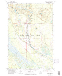
 1972 Curtis West1975 Print · USGSMackinac County's lakeland region comes into focus during the early seventies, showing the gateway between the Manistique Lakes. Genealogists and historians can trace the Old Railroad Grade, find the Sandpit Cem, and explore the settlement of Curtis.
End of results
Showing maps 1-20 of 20
Top cities of Schoolcraft County
Frequently asked questions
- What are the different types of historical maps available for Schoolcraft County?
- What is the oldest map of Schoolcraft County?
- Where can I purchase historical maps of Schoolcraft County for my home or office?
- Where can I download high-res historical maps of Schoolcraft County?
- Are there historical topographic maps available for Schoolcraft County?
- Is there historical aerial imagery available for Schoolcraft County?
- Where are historical maps of Schoolcraft County sourced from?