1980s Maps of Doyle Township, Michigan
Explore 4 historic maps of Doyle Township from the 1980s. These maps offer a rare glimpse into what life looked like during the 1980s — showing old roads, neighborhoods, homes, and landmarks that have changed or disappeared over time.
Whether you're researching your family's past, planning a metal detecting trip, or studying how Doyle Township's landscape evolved across the 1980s, these high-resolution maps are a powerful tool for exploring the history of this region.
- Focus on a specific era: All maps on this page are from the 1980s, giving you a focused view of this time period.
- See what’s changed: Compare century-old streets, trails, and buildings to today's modern landscape using overlays and satellite layers.
- Research with precision: Use these maps for genealogy, historical research, land use analysis, or educational projects.
- View, download, or print: Maps are fully viewable online in high resolution, and can be downloaded or printed for your own records.
Start exploring Doyle Township's history through authentic maps from the 1980s. This is your window into the past.
Doyle Township, MI maps
(4)- 1983 Map of Manistique
 1983 Manistique1983 Print · USGSThe northern shores of Lake Michigan and the Garden Peninsula appear here in the early eighties. Historians can trace the Soo Line rail corridor and explore coastal settlements like Nahma, Fayette, and the harbor town of Manistique.
 - 1983 Map of Munising
 1983 Munising1983 Print · USGSThe Upper Peninsula lakefront and deep timberlands are documented here in the early eighties, centered on the Munising harbor. Genealogists and historians can trace rail stops along the Soo Line and remote outposts like Shingleton, Eben Junction, and Traunik.2 unique versions available
 - 1984 Map of Beaver Island, 1985 Print
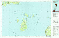 1984 Beaver Island1985 Print · USGSBeaver Island and the surrounding archipelago are shown in the mid-eighties before modern developments changed these remote coastal landscapes. Researchers can trace the layout of island settlements like St James or mainland hamlets such as Good Hart and Middle Village.2 unique versions available
 - 1985 Map of Manistique Lake
 1985 Manistique Lake1985 Print · USGSThe eastern Upper Peninsula’s wilderness and rail-side villages are captured here in the mid-1980s, from the Soo Line corridor to the Lake Michigan shore. Genealogists and historians can trace the foundations of local life in Newberry, Engadine, and Seney, alongside industrial landmarks like the Calspar Quarry Pool.2 unique versions available
End of results
Showing maps 1-4 of 4
Top cities near Doyle Township
Top neighborhoods of Doyle Township
Frequently asked questions
- What are the different types of historical maps available for Doyle Township?
- What is the oldest map of Doyle Township?
- Where can I purchase historical maps of Doyle Township for my home or office?
- Where can I download high-res historical maps of Doyle Township?
- Are there historical topographic maps available for Doyle Township?
- Is there historical aerial imagery available for Doyle Township?
- Where are historical maps of Doyle Township sourced from?