Old Maps of Pines, Hiawatha Township for Metal Detecting
Plan your next treasure hunt with 13 historic maps of Pines. Find old homesites, ghost towns, trails, and gathering spots that may be lost to time — perfect for identifying promising metal detecting locations.
- Locate forgotten sites: Uncover places like long-lost settlements, abandoned rail lines, or gathering spots.
- Plan better hunts: Use map overlays combined with LiDAR or satellite views to narrow in on historically rich areas.
- Made for detectorists: Thousands of hobbyists use these maps to discover relics, coins, and hidden history.
Use these historic maps to boost your research and find new opportunities beneath the surface of Pines.
Pines, Hiawatha Township maps
(13)- 1931 Map of Shingleton SE
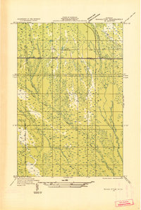 1931 Shingleton SE1931 Print · USGSSchoolcraft County in the early 1930s shows a landscape of expansive wetlands being crossed by new industrial infrastructure. Researchers can trace the path of the Duluth South Shore and Atlantic railroad and find localized points like Creighton and Hickey Creek.
 - 1958 Map of Shingleton, 1959 Print
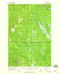 1958 Shingleton1959 Print · USGSUpper Peninsula timber and rail history come alive in the late fifties across the Alger and Schoolcraft county lines. Trace old transport routes through Shingleton and Creighton, or locate logging era sites like Hartman Camp and the Old Railroad Grade.3 unique versions available
 - 1958 Map of Marquette, 1968 Print
 1958 Marquette1968 Print · USGSThe Upper Peninsula’s central corridor is captured here in the mid-twentieth century as mining and timber industries thrived alongside new military installations. Genealogists and historians can trace the rail lines of the Soo Line Railroad through settlements like Gwinn, Turin, and Chatham.2 unique versions available
 - 1960 Map of Marquette
 1960 Marquette1960 Print · USGSUpper Peninsula mining and maritime commerce reach their peak in the late fifties across the Lake Superior shoreline. Genealogists and historians can locate remote settlements like Big Bay and Dukes, while tracing the Cyr Mine and the active rail lines of the Lake Superior and Ishpeming railroad.
 - 1961 Map of Marquette
 1961 Marquette1961 Print · USGSUpper Peninsula life in the early sixties centered on the iron docks and timber stands of the Lake Superior shore. Genealogists and historians can trace rail-to-port connections via the Lake Superior and Ishpeming Railroad and locate active sites like Republic Mine or the K.I. Sawyer Air Force Base.
 - 1968 Map of Marquette, 1977 Print
 1968 Marquette1977 Print · USGSThe Upper Peninsula iron range and Lake Superior coastline are captured here in the late sixties. Genealogists and historians can trace the rail-to-port infrastructure and the Cold War presence of K I Sawyer Air Force Base alongside towns like Ishpeming and Munising.
 - 1983 Map of Munising
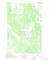
 1983 Munising1983 Print · USGSThe Upper Peninsula lakefront and deep timberlands are documented here in the early eighties, centered on the Munising harbor. Genealogists and historians can trace rail stops along the Soo Line and remote outposts like Shingleton, Eben Junction, and Traunik.2 unique versions available
 - 1983 Map of Creighton, 1984 Print
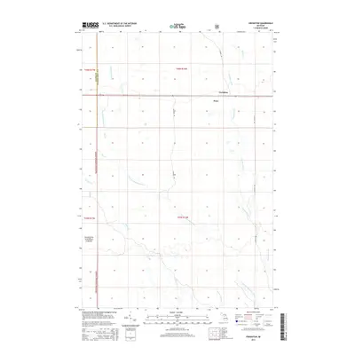
 1983 Creighton1984 Print · USGSUpper Peninsula timberlands and wetlands are mapped here in the early 1980s, centered on the Soo Line railroad corridor. Researchers can locate the small settlements of Creighton and Pines or trace the winding course of the Creighton River through public lands.
 - 2011 Map of Creighton, 2011 Print
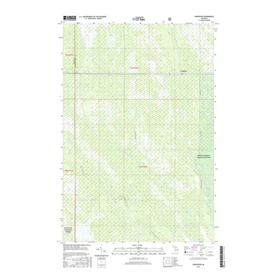
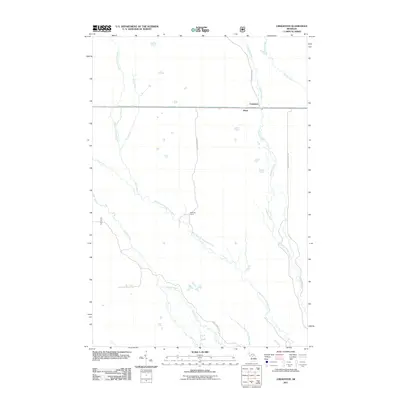 2011 Creighton2011 Print · USGSCovers Pines, including Creighton, Hiawatha Township, and other nearby areas
 - 2014 Map of Creighton, 2014 Print
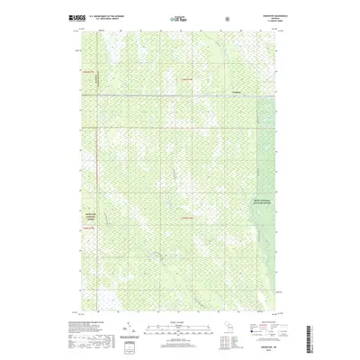
 2014 Creighton2014 Print · USGSCovers Pines, including Creighton, Hiawatha Township, and other nearby areas
 - 2017 Map of Creighton, 2017 Print
 2017 Creighton2017 Print · USGSCovers Pines, including Creighton, Hiawatha Township, and other nearby areas
 - 2019 Map of Creighton, 2019 Print
 2019 Creighton2019 Print · USGSCovers Pines, including Creighton, Hiawatha Township, and other nearby areas
 - 2023 Map of Creighton, 2023 Print
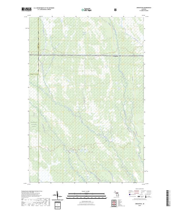 2023 Creighton2023 Print · USGSThe Upper Peninsula wilderness around the Alger and Schoolcraft county line is shown here in the early 2020s. Researchers can trace the boundaries of the Seney Wilderness and follow remote routes like Hartman Camp Rd through the Creighton Marsh.
End of results
Showing maps 1-13 of 13
Frequently asked questions
- What are the different types of historical maps available for Pines?
- What is the oldest map of Pines?
- Where can I purchase historical maps of Pines for my home or office?
- Where can I download high-res historical maps of Pines?
- Are there historical topographic maps available for Pines?
- Is there historical aerial imagery available for Pines?
- Where are historical maps of Pines sourced from?