Old Maps of Port Inland, Mueller Township for Genealogy
Trace your family roots with 10 historic maps of Port Inland. These high-res maps reveal old neighborhoods, homesites, landmarks, and streets — helping you uncover where your ancestors lived and how the area evolved over time.
- Explore historic neighborhoods: Identify where your relatives may have lived in the 1800s or 1900s.
- Compare maps over time: Trace the changes in streets, buildings, and landmarks for multi-generational research.
- Perfect for genealogy & ancestry research: Used by family historians and researchers to map out lineage and migration.
These maps are an incredible resource for exploring your personal connection to Port Inland's past.
Port Inland, Mueller Township maps
(10)- 1931 Map of Seul Choix Point NE
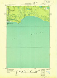 1931 Seul Choix Point NE1931 Print · USGSThe Upper Peninsula coast of Lake Michigan in the early 1930s is defined here by its maritime infrastructure and vast wetlands. Researchers can trace the industrial footprint of Inland Harbor, the navigation at Port Inland Light, and secluded water bodies like Batty Doe Lake.2 unique versions available
 - 1955 Map of Cheboygan, 1964 Print
 1955 Cheboygan1964 Print · USGSNorthern Michigan in the mid-fifties is a landscape of dense timber and deep water, showing the region just as the road network began to modernize. Trace family roots in lakeside towns like St Ignace and Petoskey, or follow the historic tracks of the Pennsylvania RR and New York Central RR.5 unique versions available
 - 1958 Map of Cheboygan
 1958 Cheboygan1958 Print · USGSThe tip of Michigan's Lower Peninsula and the surrounding Great Lakes islands are shown here in the late fifties, during the peak of the rail-and-ferry era. Trace the paths of the Pennsylvania RR and explore lakeside settlements like St James, Petoskey, and Indian River.2 unique versions available
 - 1972 Map of Hughes Point, 1974 Print
 1972 Hughes Point1974 Print · USGSUpper Peninsula shoreline and wetlands are documented here in the early seventies, just as modern hydrographic surveys were updated. Trace the rugged coastal features of Island Harbor, Port Island, and the secluded waters of Batty Doe Lake within the Mackinac State Forest.2 unique versions available
 - 1984 Map of Beaver Island, 1985 Print
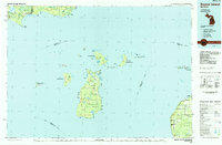 1984 Beaver Island1985 Print · USGSBeaver Island and the surrounding archipelago are shown in the mid-eighties before modern developments changed these remote coastal landscapes. Researchers can trace the layout of island settlements like St James or mainland hamlets such as Good Hart and Middle Village.2 unique versions available
 - 2011 Map of Hughes Point, 2011 Print
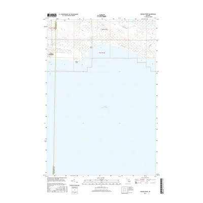
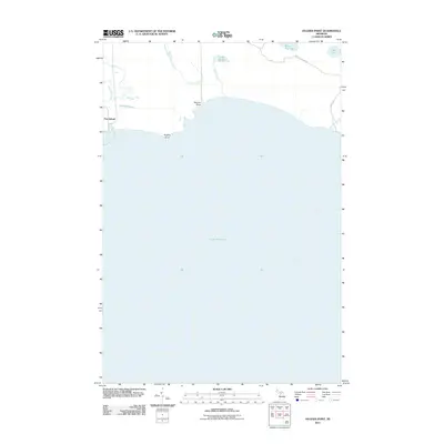 2011 Hughes Point2011 Print · USGSCovers Port Inland, including Newton Township, Mueller Township, and other nearby areas
 - 2014 Map of Hughes Point, 2014 Print
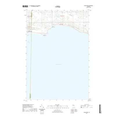
 2014 Hughes Point2014 Print · USGSCovers Port Inland, including Newton Township, Mueller Township, and other nearby areas
 - 2017 Map of Hughes Point, 2017 Print
 2017 Hughes Point2017 Print · USGSCovers Port Inland, including Newton Township, Mueller Township, and other nearby areas
 - 2019 Map of Hughes Point, 2019 Print
 2019 Hughes Point2019 Print · USGSCovers Port Inland, including Newton Township, Mueller Township, and other nearby areas
 - 2023 Map of Hughes Point, 2023 Print
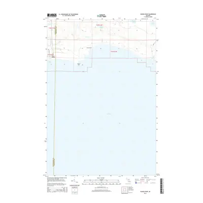
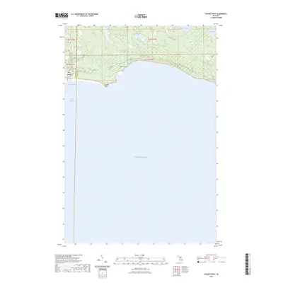 2023 Hughes Point2023 Print · USGSThe Mackinac and Schoolcraft county line meets the Great Lakes shore in this contemporary survey of the Michigan Upper Peninsula coastline. Local historians can trace maritime and industrial infrastructure at Port Inland and explore the inland wetlands of Swan Marsh and Batty Doe Lake.
End of results
Showing maps 1-10 of 10
Frequently asked questions
- What are the different types of historical maps available for Port Inland?
- What is the oldest map of Port Inland?
- Where can I purchase historical maps of Port Inland for my home or office?
- Where can I download high-res historical maps of Port Inland?
- Are there historical topographic maps available for Port Inland?
- Is there historical aerial imagery available for Port Inland?
- Where are historical maps of Port Inland sourced from?