2020s Maps of Seney Township, Michigan
Explore 12 historic maps of Seney Township from the 2020s. These maps offer a rare glimpse into what life looked like during the 2020s — showing old roads, neighborhoods, homes, and landmarks that have changed or disappeared over time.
Whether you're researching your family's past, planning a metal detecting trip, or studying how Seney Township's landscape evolved across the 2020s, these high-resolution maps are a powerful tool for exploring the history of this region.
- Focus on a specific era: All maps on this page are from the 2020s, giving you a focused view of this time period.
- See what’s changed: Compare century-old streets, trails, and buildings to today's modern landscape using overlays and satellite layers.
- Research with precision: Use these maps for genealogy, historical research, land use analysis, or educational projects.
- View, download, or print: Maps are fully viewable online in high resolution, and can be downloaded or printed for your own records.
Start exploring Seney Township's history through authentic maps from the 2020s. This is your window into the past.
Seney Township, MI maps
(12)- 2023 Map of Hardwood Island, 2023 Print
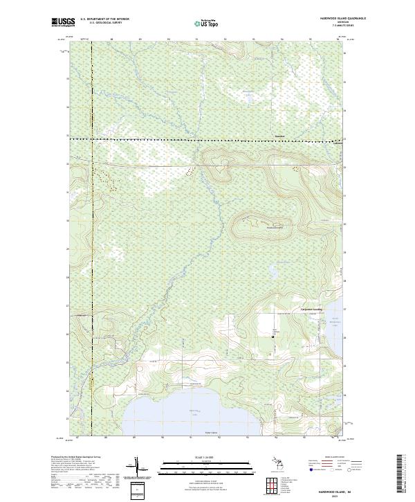 2023 Hardwood Island2023 Print · USGSModern-day Luce and Schoolcraft counties are shown here as a complex network of wetlands and rivers. Researchers can trace the rural communities of Danaher and Laketon or find family markers at the West Lakefield Cem.
 - 2023 Map of Seney, 2023 Print
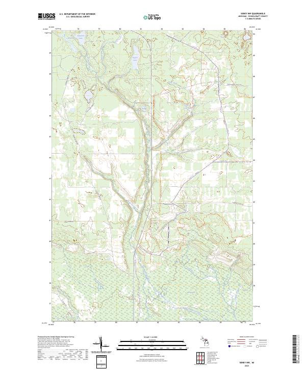
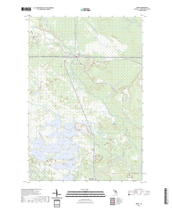 2023 Seney2023 Print · USGSIn the modern Michigan wilderness, this survey tracks the intricate water systems and conservation pools of Schoolcraft County. Researchers can locate Boot Hill Cem near Seney or trace the Fox River down toward Germfask.
 - 2023 Map of Grand Marais SE, 2023 Print
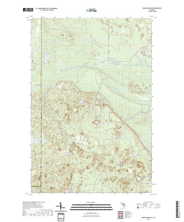 2023 Grand Marais SE2023 Print · USGSUpper Peninsula wilderness in eastern Luce County is defined here by the winding North Branch Two Hearted River and its vast wetlands. Researchers can trace historic access routes like McCloud Grade and locate remote water bodies including Potters Lake and Dairy Lake.
 - 2023 Map of Tahquamenon Lakes, 2023 Print
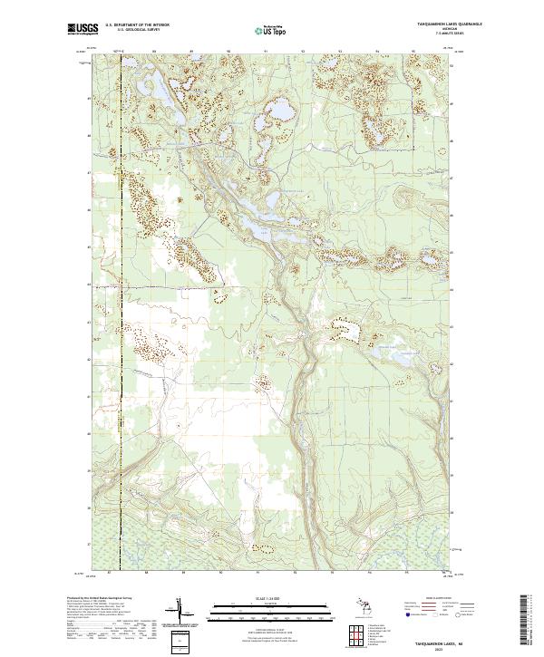 2023 Tahquamenon Lakes2023 Print · USGSThe Upper Peninsula lake country is shown here in the contemporary era, spanning the Schoolcraft and Luce county line. Trace the winding Tahquamenon River through The Spreads and locate remote landmarks like Bennet Springs and Whitney Lake.
 - 2023 Map of Seney NW, 2023 Print
 2023 Seney NW2023 Print · USGSUpper Peninsula wetlands and the East Branch Fox River are documented in this contemporary survey of Schoolcraft County. Researchers can trace the intricate waterways of The Spreads and locate remote landmarks such as Kings Pond and the Danaher Plains.
 - 2023 Map of Nawakwa Lake, 2023 Print
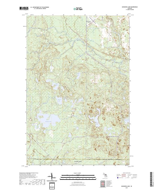 2023 Nawakwa Lake2023 Print · USGSThe Alger-Schoolcraft county line near the turn of the twenty-first century reveals a landscape defined by water and woods. Trace family camp locations near Nawakwa Lake, the old Mccloud Grade, or the small settlement at Lavender Corner.
 - 2023 Map of Driggs Lake SE, 2023 Print
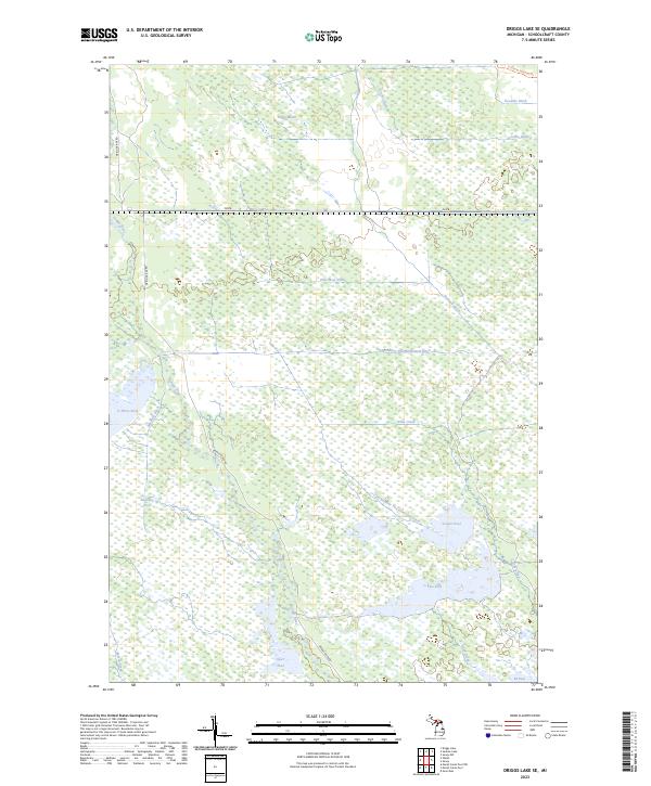 2023 Driggs Lake SE2023 Print · USGSThe wetland systems of Schoolcraft County are meticulously documented in the 2020s, showing a landscape defined by water management and conservation. Trace the intricate network of the Driggs River and engineered sites like A-Two Pool or the Fox River Pathway Trl.
 - 2023 Map of Au Sable Point SW, 2023 Print
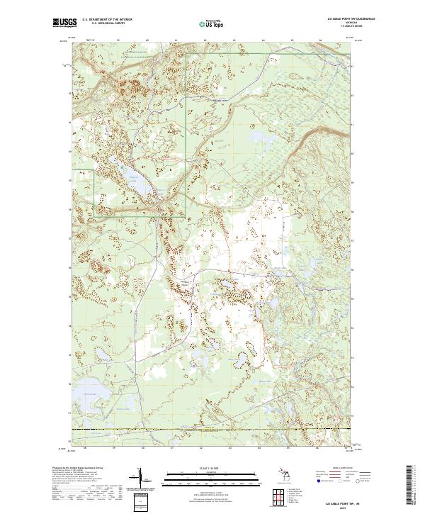 2023 Au Sable Point SW2023 Print · USGSAlger County's backcountry is captured here in the early twenty-first century, showing the transition from protected parkland to state forest. Researchers can trace the rugged Fox River Pathway Trl as it winds past Kingston Lake and through the Kingston Plains.
 - 2023 Map of Walsh, 2023 Print
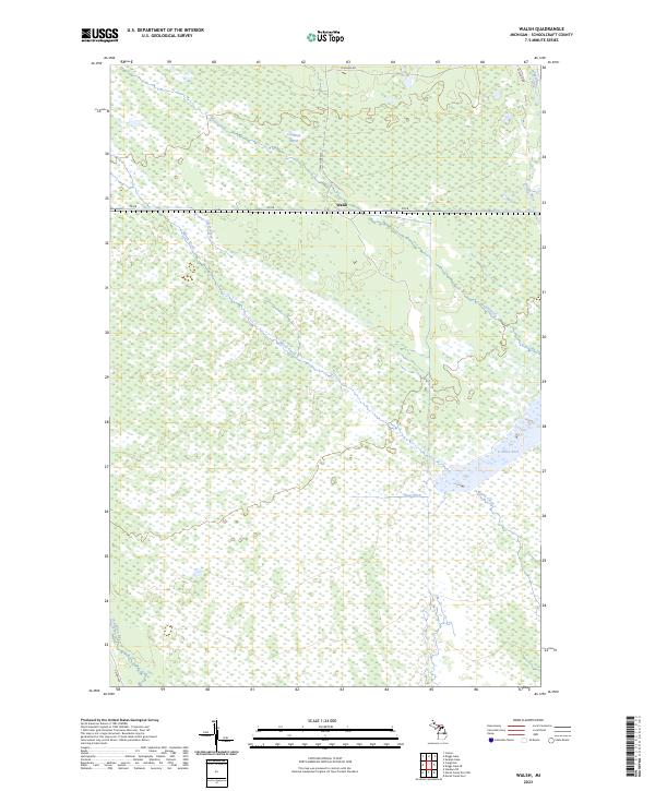 2023 Walsh2023 Print · USGSWalsh and the surrounding wetlands of Schoolcraft County are documented in the early twenty-first century. Researchers can trace the hydrologic patterns of Creighton Marsh and locate landmarks like the C-Three Pool and the Walsh Grade.
 - 2023 Map of Au Sable Point SE, 2023 Print
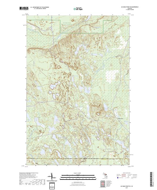 2023 Au Sable Point SE2023 Print · USGSUpper Peninsula lake country is captured in this recent survey of the Alger and Schoolcraft county line. Researchers can trace remote trails like Rhody Creek Trl and find quiet settlements like Green Haven among the Porky Lakes and Lavender Lake.
 - 2023 Map of Sunken Lake, 2023 Print
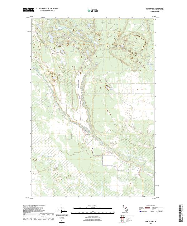 2023 Sunken Lake2023 Print · USGSSchoolcraft County’s wetlands and glacial lakes are captured here in the contemporary era, showing a landscape shaped by the Fox River and its many branches. Researchers can trace the path of the Fox River Pathway Trl or locate water features like Taylor Dam and Sunken Lake.
 - 2023 Map of Driggs Lake, 2023 Print
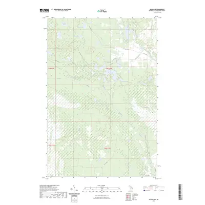 2023 Driggs Lake2023 Print · USGSSchoolcraft County in the early 2020s remains a landscape defined by its sprawling wetlands and secluded lakes. Researchers can trace historic access routes like Walsh Grade or locate remote water bodies such as Driggs Lake and Creighton Marsh.
End of results
Showing maps 1-12 of 12
Top cities near Seney Township
Top neighborhoods of Seney Township
Frequently asked questions
- What are the different types of historical maps available for Seney Township?
- What is the oldest map of Seney Township?
- Where can I purchase historical maps of Seney Township for my home or office?
- Where can I download high-res historical maps of Seney Township?
- Are there historical topographic maps available for Seney Township?
- Is there historical aerial imagery available for Seney Township?
- Where are historical maps of Seney Township sourced from?