1960s Maps of Shiawassee County, Michigan
Explore 9 historic maps of Shiawassee County from the 1960s. These maps offer a rare glimpse into what life looked like during the 1960s — showing old roads, neighborhoods, homes, and landmarks that have changed or disappeared over time.
Whether you're researching your family's past, planning a metal detecting trip, or studying how Shiawassee County's landscape evolved across the 1960s, these high-resolution maps are a powerful tool for exploring the history of this region.
- Focus on a specific era: All maps on this page are from the 1960s, giving you a focused view of this time period.
- See what’s changed: Compare century-old streets, trails, and buildings to today's modern landscape using overlays and satellite layers.
- Research with precision: Use these maps for genealogy, historical research, land use analysis, or educational projects.
- View, download, or print: Maps are fully viewable online in high resolution, and can be downloaded or printed for your own records.
Start exploring Shiawassee County's history through authentic maps from the 1960s. This is your window into the past.
Shiawassee County, MI maps
(9)- 1961 Map of Grand Rapids
 1961 Grand Rapids1961 Print · USGSSouthern Michigan at the dawn of the 1960s reveals a region shaped by major river systems and a robust rail network. Trace mid-century industrial growth and land use from Grand Rapids to the Fort Custer Military Reservation and Gun Lake.
 - 1961 Map of Detroit, 1973 Print
 1961 Detroit1973 Print · USGSThe international border between Michigan and Ontario was a bustling industrial corridor in the early sixties. Researchers can trace the transit networks and riverfront infrastructure connecting Detroit to Windsor via the Detroit-Windsor Tunnel and major air hubs like Willow Run Airport.2 unique versions available
 - 1962 Map of Grand Rapids
 1962 Grand Rapids1962 Print · USGSMid-century Southern Michigan is mapped here at a time of massive growth, showing the expanding urban footprints of Grand Rapids and Lansing. Researchers can trace the legacy of the Grand Trunk Western RR, find historic boundaries of the Fort Custer Military Reservation, or locate sporting camps around Gun Lake.2 unique versions available
 - 1965 Map of Detroit
 1965 Detroit1965 Print · USGSThe industrial corridor between Michigan and Ontario is captured here at mid-century, showing the dense rail and river networks of the Great Lakes. Local historians can trace the paths of the Grand Trunk Western RR and locate key landmarks like Selfridge Air Force Base and Grosse Ile.
 - 1966 Map of Midland
 1966 Midland1966 Print · USGSCentral Michigan in the mid-1960s shows a landscape of growing manufacturing hubs and active resource extraction. Genealogists and historians can trace the rail corridors of the Grand Trunk Western or locate family-named landmarks near Oil wells and the Muskegon River.
 - 1969 Map of Montrose, 1971 Print
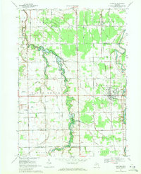 1969 Montrose1971 Print · USGSThe agricultural borderlands of Saginaw and Genesee counties are captured here in the late sixties as traditional farming life centered around the Grand Trunk Western rail line. Researchers can trace family-named sites like Layton Corners, Indian Cem, and Cook Chapel.2 unique versions available
 - 1969 Map of Durand, 1971 Print
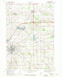 1969 Durand1971 Print · USGSShiawassee and Genesee Counties are captured in the late sixties as the rail-driven town of Durand and surrounding farmsteads expanded. Local historians can trace family roots through Yerian Cem, Pilgrim Ch, and the small rail-side hamlet of Duffield.2 unique versions available
 - 1969 Map of New Lothrop, 1971 Print
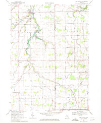 1969 New Lothrop1971 Print · USGSThe rural borderlands of Shiawassee and Genesee counties are captured here in the late sixties, showing a landscape defined by agriculture and family farms. Genealogists can locate family sites near Hazelton Cem, the settlement of Juddville, and the waters of Misteguay Creek.2 unique versions available
 - 1969 Map of Byron, 1971 Print
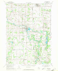 1969 Byron1971 Print · USGSByron and the Shiawassee River valley are captured here in the late sixties, showing a landscape of small villages and glacial lakes. Trace family history at Oakwood Cem or explore old local landmarks like the Byron Millpond and Lyndee Landing Strip.3 unique versions available
End of results
Showing maps 1-9 of 9
Top cities of Shiawassee County
Frequently asked questions
- What are the different types of historical maps available for Shiawassee County?
- What is the oldest map of Shiawassee County?
- Where can I purchase historical maps of Shiawassee County for my home or office?
- Where can I download high-res historical maps of Shiawassee County?
- Are there historical topographic maps available for Shiawassee County?
- Is there historical aerial imagery available for Shiawassee County?
- Where are historical maps of Shiawassee County sourced from?