1970s Maps of Shiawassee County, Michigan
Explore 12 historic maps of Shiawassee County from the 1970s. These maps offer a rare glimpse into what life looked like during the 1970s — showing old roads, neighborhoods, homes, and landmarks that have changed or disappeared over time.
Whether you're researching your family's past, planning a metal detecting trip, or studying how Shiawassee County's landscape evolved across the 1970s, these high-resolution maps are a powerful tool for exploring the history of this region.
- Focus on a specific era: All maps on this page are from the 1970s, giving you a focused view of this time period.
- See what’s changed: Compare century-old streets, trails, and buildings to today's modern landscape using overlays and satellite layers.
- Research with precision: Use these maps for genealogy, historical research, land use analysis, or educational projects.
- View, download, or print: Maps are fully viewable online in high resolution, and can be downloaded or printed for your own records.
Start exploring Shiawassee County's history through authentic maps from the 1970s. This is your window into the past.
Shiawassee County, MI maps
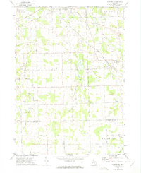
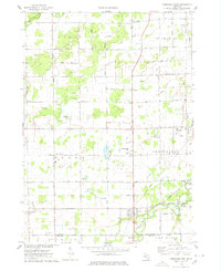
(12)- 1972 Map of Laingsburg, 1974 Print
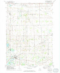 1972 Laingsburg1974 Print · USGSShiawassee County in the early seventies centers on the rail-linked hub of Laingsburg and the rural reaches of Ovid. Trace family history and land use through Oak Grove Cem, the Middlebury Ch, and the many Gravel Pits along the Maple River.
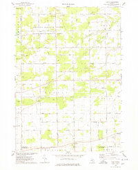
 - 1972 Map of Shaftsburg, 1974 Print
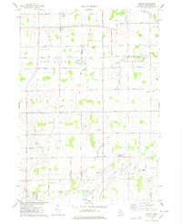
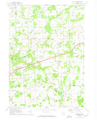 1972 Shaftsburg1974 Print · USGSShiawassee County's rural character is preserved here in the early seventies, centered on the village of Shaftsburg. Researchers can trace family roots at Oak Plain Cem, locate the Perry Sch, or follow the Grand Trunk Western rail line.
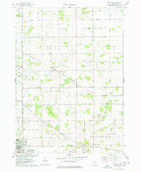
 - 1972 Map of Perry, 1975 Print
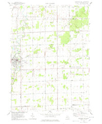
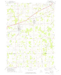 1972 Perry1975 Print · USGSMid-century Perry and Morrice are captured here as the Grand Trunk Western railroad defines the local industry. Researchers can trace family roots through Roselawn Cem or locate the private Dysinger Landing Strip.
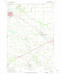
 - 1972 Map of Owosso South, 1975 Print
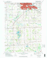 1972 Owosso South1975 Print · USGSMid-Michigan settlement and industry converge along the Shiawassee River during the early seventies. Researchers can trace local lineage through Oak Hill Cem or explore the campus footprints of John Wesley College and Spring Vale Academy.2 unique versions available
 - 1972 Map of Corunna SE, 1975 Print
 1972 Corunna SE1975 Print · USGSSoutheastern Shiawassee County is captured here in the early seventies, showing a landscape of small agricultural settlements and winding river valleys. Family historians can trace the locations of the Gaylord Cem, the community at Antrim Center, and the rural Antrim Ch.
 - 1972 Map of Corunna, 1975 Print
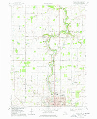
 1972 Corunna1975 Print · USGSShiawassee County's river-valley settlements and rail corridors are captured in detail in the early 1970s. Researchers can trace the legacy of coal mining at the Strip Mine or locate family roots at rural sites like Hawkins Cem and Shiawasseetown.
 - 1974 Map of Ovid East, 1978 Print
 1974 Ovid East1978 Print · USGSShiawassee and Clinton Counties are captured here in the 1970s, showing a landscape shaped by rail transport and agrarian development. Genealogists can locate family landmarks like Hoovers Corners, Old Fairfield Cem, and the Juddville Brethren in Christ Ch.
 - 1974 Map of Chapin, 1978 Print
 1974 Chapin1978 Print · USGSCentral Michigan farmland and managed game areas meet in the mid-1970s. Local researchers can locate family burial plots at St Theresa Cem, trace the rural community at Marion Springs, or find old school sites like Johns Sch.
 - 1974 Map of Chesaning West, 1978 Print
 1974 Chesaning West1978 Print · USGSSaginaw County farmland and river valleys are captured here in the mid-1970s. Trace local family history through old burial sites like Ridge Road Cem or explore the riverfront settlements of Oakley and Parshallburg (Havana).
 - 1974 Map of Owosso North, 1978 Print
 1974 Owosso North1978 Print · USGSShiawassee County farmland and the northern reaches of Owosso are captured here in the mid-seventies, documenting a transitional period for local industry and rail. Genealogists can trace family names through sites like Old Henderson Cem and West Haven Cem or locate the rural Green Meadow Sch.
 - 1975 Map of Easton, 1978 Print
 1975 Easton1978 Print · USGSShiawassee County farming communities and drainage networks are meticulously documented in the mid-seventies. Genealogists can locate family sites near Easton, the Wilkinson Cem, or the Eveleth Sch amid the township fields.
 - 1975 Map of Chesaning East, 1978 Print
 1975 Chesaning East1978 Print · USGSSaginaw County's agricultural heartland is documented here in the mid-seventies, centered on the riverfront village of Chesaning. Genealogists and local historians can trace family locations near St Mary Cem, the Conrail line, and numerous rural crossroads like Amman Road.
End of results
Showing maps 1-12 of 12
Top cities of Shiawassee County
Frequently asked questions
- What are the different types of historical maps available for Shiawassee County?
- What is the oldest map of Shiawassee County?
- Where can I purchase historical maps of Shiawassee County for my home or office?
- Where can I download high-res historical maps of Shiawassee County?
- Are there historical topographic maps available for Shiawassee County?
- Is there historical aerial imagery available for Shiawassee County?
- Where are historical maps of Shiawassee County sourced from?