Old Maps of Hartford, Michigan for Metal Detecting
Plan your next treasure hunt with 10 historic maps of Hartford. Find old homesites, ghost towns, trails, and gathering spots that may be lost to time — perfect for identifying promising metal detecting locations.
- Locate forgotten sites: Uncover places like long-lost settlements, abandoned rail lines, or gathering spots.
- Plan better hunts: Use map overlays combined with LiDAR or satellite views to narrow in on historically rich areas.
- Made for detectorists: Thousands of hobbyists use these maps to discover relics, coins, and hidden history.
Use these historic maps to boost your research and find new opportunities beneath the surface of Hartford.
Hartford, MI maps
(10)- 1927 Map of Hartford, 1943 Print
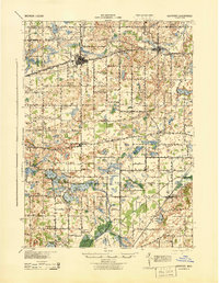 1927 Hartford1943 Print · USGSVan Buren County agriculture and lakeside leisure meet in the late 1920s as Hartford and Lawrence thrive along the Pere Marquette rail line. Researchers can locate numerous rural schoolhouses, the historic Red Mill, and early resort development at Sister Lakes and Woodland Beach.3 unique versions available
 - 1931 Map of Hartford
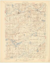 1931 Hartford1931 Print · USGSVan Buren County and the northern edge of Cass County appear here in the late twenties, defined by a dense landscape of glacial lakes and river bottomlands. Researchers can locate early country schools like Brague Sch, the Red Mill on Silver Creek, and historic crossroads including Keeler and Fritzburg.2 unique versions available
 - 1958 Map of Racine, 1971 Print
 1958 Racine1971 Print · USGSThe Lake Michigan shoreline in the late fifties was a study in contrasts between the industrial bustle of Kenosha and the quiet woods of the Allegan State Forest. Genealogists and historians can trace the urban footprint of Evanston or locate strategic sites like Fort Sheridan and the Wind Point Light.3 unique versions available
 - 1962 Map of Racine
 1962 Racine1962 Print · USGSThe Lake Michigan shoreline in the early sixties reveals a fascinating contrast between the dense industrial rail hubs of RACINE and CHICAGO and the forested dunes of Michigan. Local historians can trace military installations like Fort Sheridan or explore the numerous inland retreats around Paw Paw Lake and Sister Lakes.
 - 1981 Map of Hartford, 1982 Print
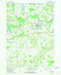 1981 Hartford1982 Print · USGSHartford and its surrounding rural townships are documented here in the early eighties as the rail and highway corridor thrived. Genealogists can locate family sites at Maple Hill Cem and Fairview Memorial Cem or trace community life at Woodside Sch and Stoughton Corners.
 - 2011 Map of Hartford, 2011 Print
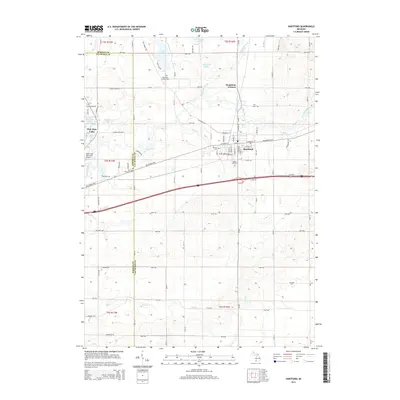
 2011 Hartford2011 Print · USGSCovers Hartford, including Watervliet, Bangor Township, and other nearby areas
 - 2014 Map of Hartford, 2014 Print
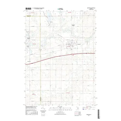
 2014 Hartford2014 Print · USGSCovers Hartford, including Watervliet, Bangor Township, and other nearby areas
 - 2017 Map of Hartford, 2017 Print
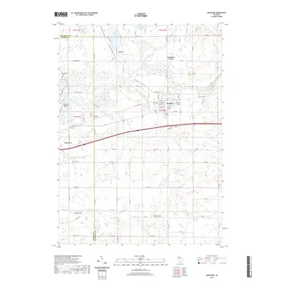
 2017 Hartford2017 Print · USGSCovers Hartford, including Watervliet, Bangor Township, and other nearby areas
 - 2019 Map of Hartford, 2019 Print
 2019 Hartford2019 Print · USGSCovers Hartford, including Watervliet, Bangor Township, and other nearby areas
 - 2023 Map of Hartford, 2023 Print
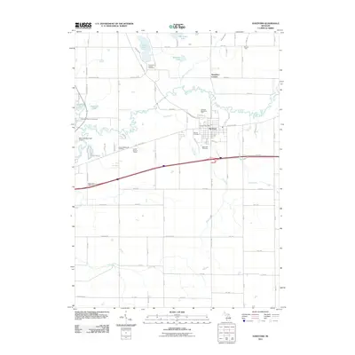
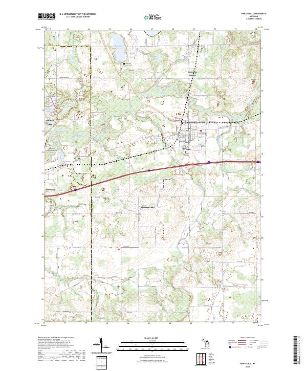 2023 Hartford2023 Print · USGSThe rural landscape of Van Buren County is captured here in the early twenty-first century, showing the town of Hartford and the winding Paw Paw River. Genealogists can trace family locations near Rush Lake Indian Cem, Pioneer Cem, and Stoughton Corners.
End of results
Showing maps 1-10 of 10
Top cities near Hartford
- Dowagiac historical maps
- South Haven historical maps
- Covert historical maps
- Keeler historical maps
- Sodus historical maps
- Bangor historical maps
See more
Frequently asked questions
- What are the different types of historical maps available for Hartford?
- What is the oldest map of Hartford?
- Where can I purchase historical maps of Hartford for my home or office?
- Where can I download high-res historical maps of Hartford?
- Are there historical topographic maps available for Hartford?
- Is there historical aerial imagery available for Hartford?
- Where are historical maps of Hartford sourced from?