1900s (20th Century) Maps of Gates Corner, Minnesota
Explore 6 historic maps of Gates Corner from the 1900s (20th Century). These maps offer a rare glimpse into what life looked like during the 1900s — showing old roads, neighborhoods, homes, and landmarks that have changed or disappeared over time.
Whether you're researching your family's past, planning a metal detecting trip, or studying how Gates Corner's landscape evolved across the 1900s, these high-resolution maps are a powerful tool for exploring the history of this region.
- Focus on a specific era: All maps on this page are from the 1900s, giving you a focused view of this time period.
- See what’s changed: Compare century-old streets, trails, and buildings to today's modern landscape using overlays and satellite layers.
- Research with precision: Use these maps for genealogy, historical research, land use analysis, or educational projects.
- View, download, or print: Maps are fully viewable online in high resolution, and can be downloaded or printed for your own records.
Start exploring Gates Corner's history through authentic maps from the 1900s. This is your window into the past.
Gates Corner, MN maps
(6)- 1918 Map of Malcolm
 1918 Malcolm1918 Print · USGSBeltrami County was undergoing a massive hydrological transformation during the late teen years as drainage projects opened new lands for settlement. Genealogists and researchers can trace the early townships of Steenerson and Spruce Grove, locating rural hubs like Malcolm, Orheim, and the Town Hall at Carmel.
 - 1954 Map of Roseau, 1969 Print
 1954 Roseau1969 Print · USGSNorthern Minnesota's borderlands come alive in the 1950s, showing a landscape defined by timber, water, and rail. Trace family roots through old schools and cemeteries near Roseau, Warroad, and the expansive Red Lake Indian Reservation.2 unique versions available
 - 1957 Map of Roseau
 1957 Roseau1957 Print · USGSThe international border and tribal lands define Northern Minnesota in the mid-fifties, from the shores of Lake of the Woods to the Red Lake Indian Reservation. Researchers can trace the path of the Great Northern railroad and locate isolated outposts like the U S Custom House and Ponemah.
 - 1958 Map of Roseau
 1958 Roseau1958 Print · USGSNorthern Minnesota's borderlands and vast lake country are captured here in the late fifties. Researchers can trace the Canadian National rail line through Warroad or find family history in frontier settlements like Baudette, Waskish, and Shotley.
 - 1973 Map of Gates Corner, 1976 Print
 1973 Gates Corner1976 Print · USGSNorthern Minnesota's wilderness is captured in the early seventies, showing the intersection of managed timberland and reservation boundaries. Genealogists and historians can trace seasonal paths like the Winter Trail and locate remote junctions such as Gates Corner or Jacks Parkway.
 - 1977 Map of Grygla, 1978 Print
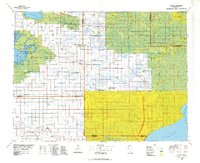 1977 Grygla1978 Print · USGSNorthern Minnesota in the late seventies is a landscape of expansive state forests and managed wetlands. Genealogists and historians can trace the remote outposts of Malcolm, Four Town, and Erie or locate family landmarks near Randeen Ridge and Thief Lake.
End of results
Showing maps 1-6 of 6
Frequently asked questions
- What are the different types of historical maps available for Gates Corner?
- What is the oldest map of Gates Corner?
- Where can I purchase historical maps of Gates Corner for my home or office?
- Where can I download high-res historical maps of Gates Corner?
- Are there historical topographic maps available for Gates Corner?
- Is there historical aerial imagery available for Gates Corner?
- Where are historical maps of Gates Corner sourced from?