2020s Maps of Big Stone County, Minnesota
Explore 21 historic maps of Big Stone County from the 2020s. These maps offer a rare glimpse into what life looked like during the 2020s — showing old roads, neighborhoods, homes, and landmarks that have changed or disappeared over time.
Whether you're researching your family's past, planning a metal detecting trip, or studying how Big Stone County's landscape evolved across the 2020s, these high-resolution maps are a powerful tool for exploring the history of this region.
- Focus on a specific era: All maps on this page are from the 2020s, giving you a focused view of this time period.
- See what’s changed: Compare century-old streets, trails, and buildings to today's modern landscape using overlays and satellite layers.
- Research with precision: Use these maps for genealogy, historical research, land use analysis, or educational projects.
- View, download, or print: Maps are fully viewable online in high resolution, and can be downloaded or printed for your own records.
Start exploring Big Stone County's history through authentic maps from the 2020s. This is your window into the past.
Big Stone County, MN maps
(21)- 2021 Map of Big Stone Lake SE, 2021 Print
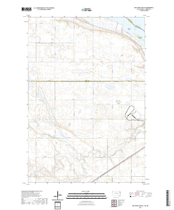 2021 Big Stone Lake SE2021 Print · USGSThe South Dakota and Minnesota border comes alive in the early 2020s where the Whetstone River flows toward Big Stone Lake. Trace the local landscape through landmarks like Goose Island and the rural network of Frevert Farm Rd.
 - 2021 Map of Wilmot, 2021 Print
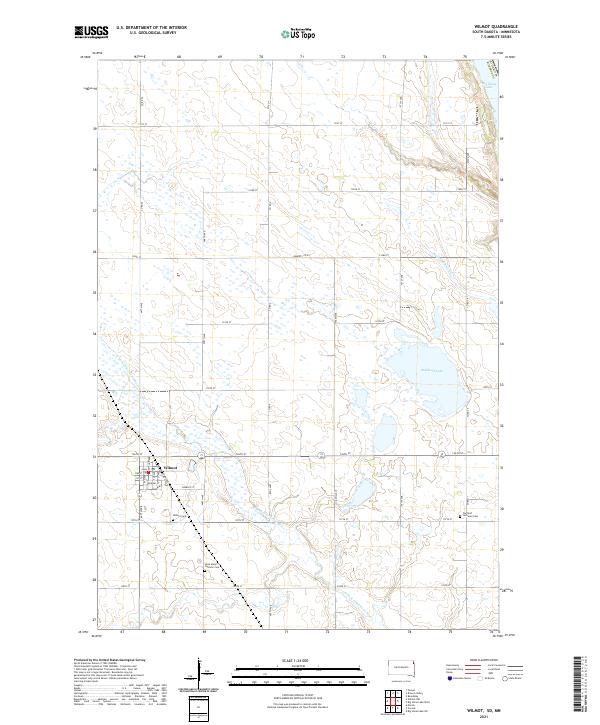 2021 Wilmot2021 Print · USGSWilmot and the surrounding prairie of Roberts County are shown in detail during the early 2020s. Genealogists and local historians can trace family locations near Wilmot Cem, Saint Mary's Catholic Cem, and the waters of Bullhead Lake.
 - 2022 Map of Johnson, 2022 Print
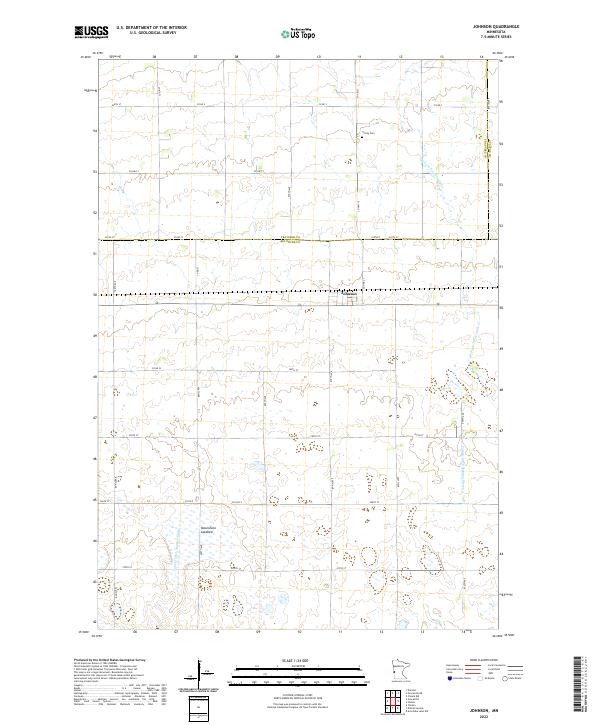 2022 Johnson2022 Print · USGSBig Stone County agriculture and drainage patterns are on full display in this recent survey of the Minnesota prairie. Genealogists can locate Trinity Cem near the town of Johnson, while water features like Moonshine Lakebed reveal the natural landscape.
 - 2022 Map of Beardsley, 2022 Print
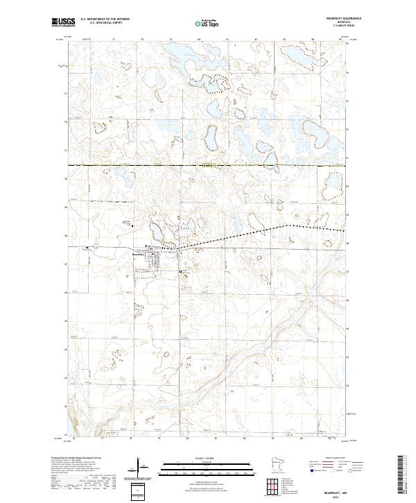 2022 Beardsley2022 Print · USGSBeardsley and the borderlands of Big Stone and Traverse counties are captured in this recent survey. Local researchers can locate three distinct burial grounds, including Saint Mary Cem and Midway Cem, while tracing the course of Fish Cr.
 - 2022 Map of Appleton, 2022 Print
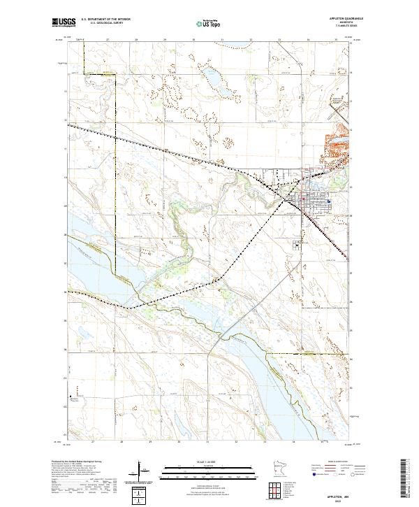 2022 Appleton2022 Print · USGSAppleton and the surrounding river bluffs are captured in this recent survey at the junction of four counties. Researchers can trace local roots at the Appleton Cem and Minnesota Valley Cem or follow the paths of the Minnesota River Trl.
 - 2022 Map of Chokio, 2022 Print
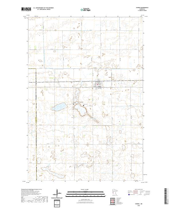 2022 Chokio2022 Print · USGSWestern Minnesota farmland is documented here in the early twenty-first century, centered on the grid of Chokio. Genealogists and local historians can locate Saint Marys Cem, trace the drainage of Vipson Slough, or follow the path of Muddy Cr through the prairie.
 - 2022 Map of Browns Valley, 2022 Print
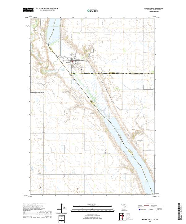 2022 Browns Valley2022 Print · USGSBrowns Valley sits at a historic continental divide in the early twenty-first century, where ancient glacial pathways meet modern state lines. Researchers can trace the town's geography from Plateau Cem down to the shores of Big Stone Lake and Lake Traverse.
 - 2022 Map of Lake Oliver, 2022 Print
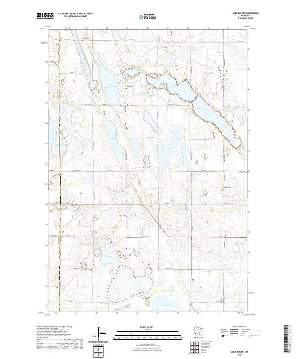 2022 Lake Oliver2022 Print · USGSWestern Minnesota prairie and wetland basins are documented here during the early 2020s. Researchers can trace rural lineages through family-named landmarks and sites like Long Lake Cem, Immanuel Cem, and Lake Oliver.
 - 2022 Map of Graceville, 2022 Print
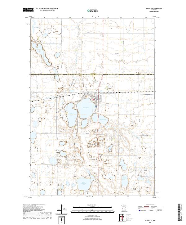 2022 Graceville2022 Print · USGSThe rural prairie of western Minnesota is shown here in the contemporary era, centered on the grid of Graceville. Genealogists and local historians can trace the town's modern layout and its proximity to Saint Marys Lake and the surrounding farmland.
 - 2022 Map of Artichoke Lake NW, 2022 Print
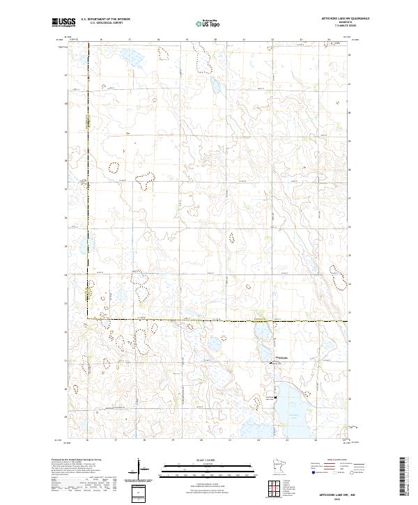 2022 Artichoke Lake NW2022 Print · USGSThe Big Stone and Stevens county line comes alive in this modern survey of Minnesota's prairie lake country. Genealogists and local historians can trace the community of Artichoke and locate family burial sites at Artichoke Baptist Cem and Artichoke Lake Cem.
 - 2022 Map of Dry Wood Lake, 2022 Print
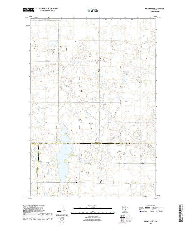 2022 Dry Wood Lake2022 Print · USGSThe tri-county borderlands of Stevens, Big Stone, and Swift counties are mapped here in the early twenty-first century. Genealogists and local historians can locate family plots at Synnes Cem or Saint Agnes Cem and trace the drainage of Dry Wood Cr.
 - 2022 Map of Correll, 2022 Print
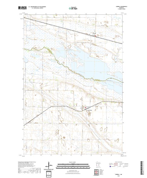 2022 Correll2022 Print · USGSThe river valley and rural townships of Big Stone County come to life in this contemporary survey of the Minnesota prairie. Genealogists and local historians can locate the Louisburg Lutheran Cemetery and trace the small community centers of Correll and Louisburg.
 - 2022 Map of Clinton, 2022 Print
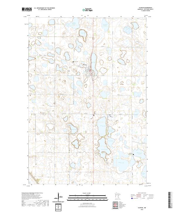 2022 Clinton2022 Print · USGSBig Stone County is shown here in the early 2020s, defined by a mosaic of prairie potholes and farm roads. Researchers can trace rural cemetery locations like Saint Pauli Cem and Big Stone Baptist Cem or identify land holdings near Thielke Lake and Clinton.
 - 2022 Map of Bellingham, 2022 Print
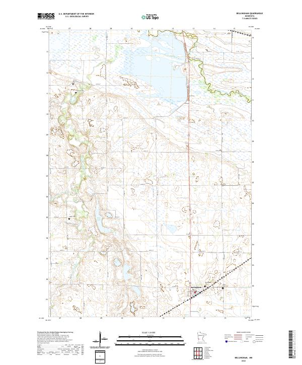 2022 Bellingham2022 Print · USGSThe rural landscape near the Minnesota River is captured here in the early twenty-first century, centered on the community of Bellingham. Researchers can trace local genealogy through several established burial sites like Salem Cem, Yellow Bank Cem, and Saint Pauls Cem.
 - 2022 Map of Artichoke Lake, 2022 Print
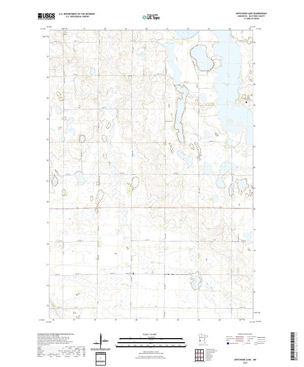 2022 Artichoke Lake2022 Print · USGSBig Stone County’s glaciated prairie is captured here in the modern era, showing a landscape defined by wetlands and section-line roads. Genealogists can locate family-named landmarks like Johnson Family Cem and the Akron Cem near Artichoke Lake.
 - 2022 Map of Ortonville, 2022 Print
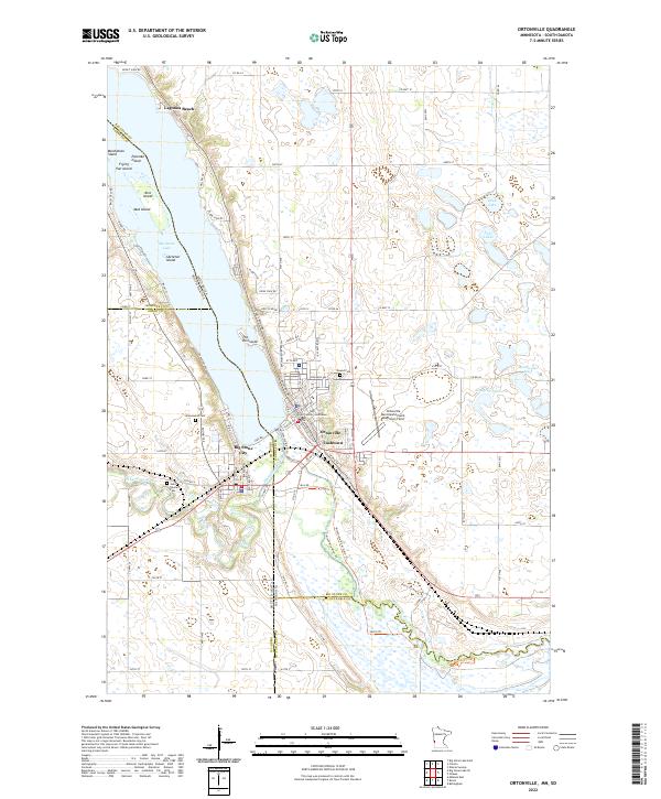 2022 Ortonville2022 Print · USGSThe Minnesota and South Dakota border comes alive in this survey of the communities surrounding the southern end of Big Stone Lake. Researchers can locate civic landmarks like the Big Stone County Courthouse and local cemeteries including Mound Cem and Saint Charles Cem.
 - 2022 Map of Dismal Swamp, 2022 Print
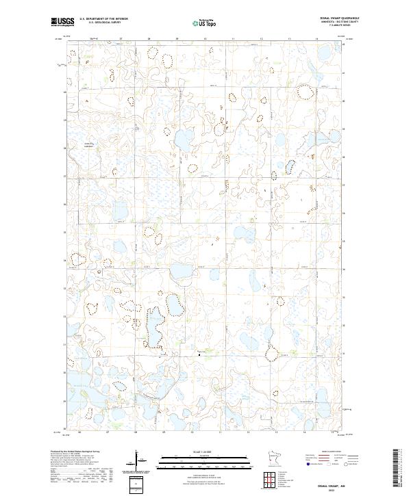 2022 Dismal Swamp2022 Print · USGSBig Stone County is shown in this modern survey during a period of agricultural stability and wetland preservation. Family researchers and local historians can locate Maple Cem or trace the drainage of Dismal Swamp and the Lone Tree Lakebed.
 - 2022 Map of Big Stone Lake West, 2022 Print
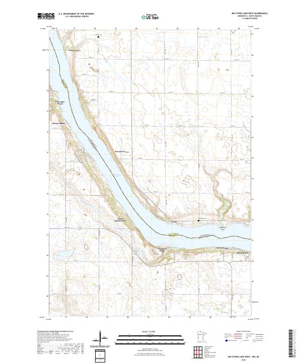 2022 Big Stone Lake West2022 Print · USGSThe Minnesota-South Dakota borderlands come alive in this survey of the shoreline around the turn of the 21st century. Researchers can trace lakeside developments from Yankeetown to Shady Beach and locate historic burial grounds like Holden Cem.
 - 2022 Map of Odessa, 2022 Print
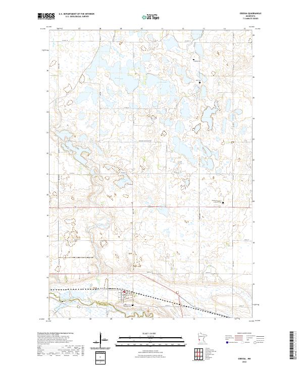 2022 Odessa2022 Print · USGSThe northern banks of the Minnesota River come into focus in the early 2020s, showing a prairie landscape dotted with glacial lakes. Researchers can trace rural lineages through local landmarks like Eldskog Cemetery and the township streets of Odessa.
 - 2022 Map of Barry, 2022 Print
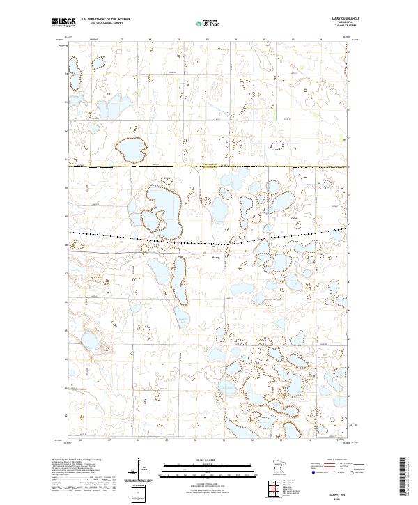 2022 Barry2022 Print · USGSWestern Minnesota prairie life is captured here in the early twenty-first century, centered on the border town of Barry. Researchers can trace the drainage of the local watershed via Judicial Ditch Number Four or locate property boundaries near Fogarty Lake and Clear Lake.
 - 2022 Map of Big Stone Lake East, 2022 Print
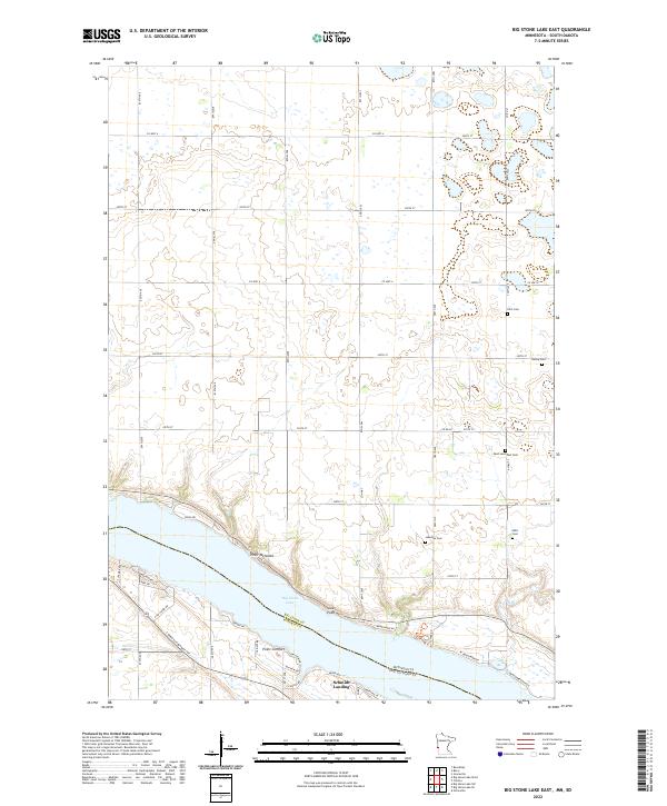 2022 Big Stone Lake East2022 Print · USGSThe eastern shores of Big Stone Lake are captured here in the modern era, showing the intersection of lakeside living and traditional prairie agriculture. Genealogists can trace several local burial sites including Elim Cem, Bailey Cem, and the West Saint Paul Cem.
End of results
Showing maps 1-21 of 21
Top cities of Big Stone County
- Ortonville historical maps
- Graceville historical maps
- Clinton historical maps
- Beardsley historical maps
- Foster historical maps
- Odessa historical maps
See more
Frequently asked questions
- What are the different types of historical maps available for Big Stone County?
- What is the oldest map of Big Stone County?
- Where can I purchase historical maps of Big Stone County for my home or office?
- Where can I download high-res historical maps of Big Stone County?
- Are there historical topographic maps available for Big Stone County?
- Is there historical aerial imagery available for Big Stone County?
- Where are historical maps of Big Stone County sourced from?