Old Maps of Big Stone County, Minnesota for Academic Research
Study the evolution of Big Stone County with 141 high-resolution historic maps. Whether you're teaching, researching, or modeling changes in land use, these maps provide essential visual documentation of urban, environmental, and geographic change.
- Analyze long-term change: Track patterns in development, transportation, and natural features.
- Ideal for environmental or urban studies: Support academic projects with primary historical map data.
- Use in the classroom or lab: Educators and researchers rely on these maps to bring historical context to life.
These maps are a powerful tool for teaching, research, and visualizing how Big Stone County has changed over the decades.
Big Stone County, MN maps
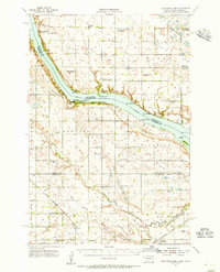
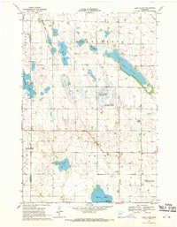
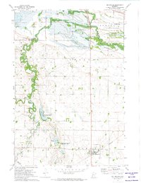
(141)- 1910 Map of Chokio, 1968 Print
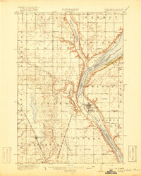
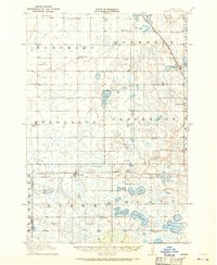 1910 Chokio1968 Print · USGSStevens County is shown here at the height of its rail-and-schoolhouse era in the early twentieth century. Genealogists can locate specific rural properties near landmarks like Harstad Slough, Town Hall, and over twenty numbered school sites including School No 35.
 - 1912 Map of Chokio
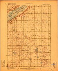
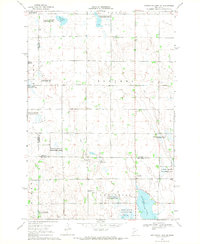
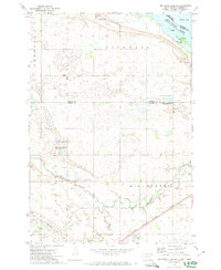
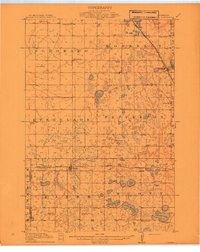 1912 Chokio1912 Print · USGSWestern Minnesota prairie life is centered on the rail lines of Donnelly and Chokio during the early twentieth century. Genealogists and researchers can trace local school districts from School No 56 to School No 42 and locate landmarks like the Town Hall and Harstad Slough.
 - 1916 Map of Peever, 1954 Print
 1916 Peever1954 Print · USGSThe borderlands of South Dakota and Minnesota come alive in this survey of the early twentieth century. Genealogists and local historians can trace the paths of the Great Northern railroad and locate rural landmarks like Windom School, Peever, and the Erdman School.
 - 1916 Map of Beardsley, 1968 Print
 1916 Beardsley1968 Print · USGSWestern Minnesota and the South Dakota border are captured here during the height of the steam-rail era. Genealogists and researchers can trace dozens of early rural schoolhouses, including Hilo School and Twingrove School, alongside the Great Northern line.2 unique versions available
 - 1918 Map of Peever
 1918 Peever1918 Print · USGSThe borderlands of South Dakota and Minnesota are captured here during the First World War, centered on the strategic divide at Browns Valley. Genealogists and local historians can trace rural school locations like Morehead School and Becker School alongside the tracks of the Great Northern railroad.4 unique versions available
 - 1918 Map of Beardsley
 1918 Beardsley1918 Print · USGSWestern Minnesota and the South Dakota borderlands appear here during the height of the steam rail era. Genealogists can trace family footprints across dozens of local districts, from Round Mound School to the village streets of Beardsley.3 unique versions available
 - 1950 Map of Graceville
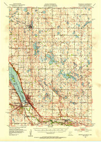
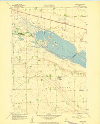
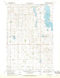
 1950 Graceville1950 Print · USGSBig Stone and Traverse counties come alive in this mid-century survey of the Minnesota prairie at the peak of its rail-and-farm economy. Local historians can trace the foundations of Graceville and identify vanished rural landmarks like Golden Rule Sch and the Trinity Sch.
 - 1953 Map of Ortonville, 1955 Print
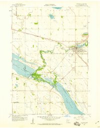
 1953 Ortonville1955 Print · USGSThe Minnesota-South Dakota borderlands come alive in this mid-century survey of the lake-rich prairie. Genealogists and historians can locate numerous rural landmarks like Greenwood Cem, Pleasant Valley Ch, and the many numbered schools scattered between Clinton and Odessa.
 - 1953 Map of Bellingham, 1955 Print
 1953 Bellingham1955 Print · USGSThe borderlands of western Minnesota and South Dakota are shown here in the mid-fifties as a landscape of rail-connected prairie towns and a dense network of country school districts. Genealogists can trace family footprints near Bellingham and Marietta, or locate rural sites like Immanuel Ch and the Swedish Mission Cem.
 - 1953 Map of Milbank, 1958 Print
 1953 Milbank1958 Print · USGSThe tri-state border region of South Dakota, North Dakota, and Minnesota is shown here during the early fifties, a landscape defined by glacial lakes and the Sisseton Indian Reservation. Researchers can trace the legacy of the western railroads, locating old stops along the Great Northern and settlements like Milbank, Webster, and Sisseton.3 unique versions available
 - 1954 Map of Big Stone Lake, 1956 Print
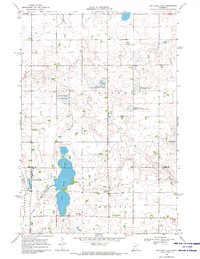
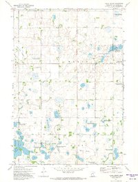
 1954 Big Stone Lake1956 Print · USGSThe borderlands of Roberts County and Minnesota come into focus in the mid-1950s as rural school districts began to fade from the prairie. Trace the disappearance of early education at Golden Prairie Sch and School No 19, or locate family plots at Lakeside Cem and Effm Cem.2 unique versions available
 - 1958 Map of Milbank
 1958 Milbank1958 Print · USGSThe northern Great Plains in the late fifties show a landscape of glacial lakes and reservation lands shaped by the Great Northern railroad. Genealogists and local historians can trace the grid of settlements from Britton to Milbank and locate landmarks like Enemy Swim Lake and the Sisseton Indian Reservation.
 - 1958 Map of Correll, 1959 Print
 1958 Correll1959 Print · USGSBig Stone and Lac qui Parle counties meet along the Minnesota River in the late fifties, where rail and water shaped the local economy. Genealogists and historians can trace the footprint of Correll and Louisburg, or locate School No 867 and the local Quarry.
 - 1958 Map of Appleton, 1960 Print
 1958 Appleton1960 Print · USGSAppleton and the surrounding prairies of Swift County are documented here in the late fifties, where the river systems dominate the terrain. Genealogists and local historians can trace family-named sites like Appleton Cem, the Minnesota Valley Ch, and the old rail lines of the Great Northern.2 unique versions available
 - 1968 Map of Dry Wood Lake, 1970 Print
 1968 Dry Wood Lake1970 Print · USGSThe Stevens and Swift County borderlands are preserved here in the late sixties, a landscape defined by glacial lakes and wildlife conservation. Genealogists and researchers can trace rural community hubs like Trinity Ch Cem, St Agnes Ch, and the shores of Dry Wood Lake.
 - 1968 Map of Lake Oliver, 1970 Print
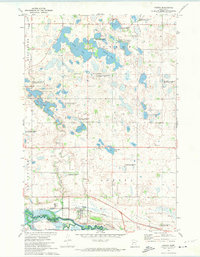
 1968 Lake Oliver1970 Print · USGSSwift and Big Stone Counties are shown here in the late sixties, a landscape defined by glacial lakes and dedicated wildlife management. Genealogists and local historians can locate Immanuel Ch, Waldrum Cem, and the old Townhall among the prairie potholes.
 - 1968 Map of Artichoke Lake NW, 1970 Print
 1968 Artichoke Lake NW1970 Print · USGSThe Stevens County prairie during the late 1960s is revealed here as a landscape of managed wetlands and quiet rural outposts. Local historians can locate School No 142, the Artichoke Lake Ch, and the central Townhall in Baker.
 - 1968 Map of Artichoke Lake, 1970 Print
 1968 Artichoke Lake1970 Print · USGSBig Stone County's glacial lake country is captured here in the late sixties as conservation efforts began reshaping the prairie. Researchers can locate the Akron Cem, the local Townhall, and early conservation boundaries like the Klages State Wildlife Management Areas.
 - 1971 Map of Big Stone Lake East, 1974 Print
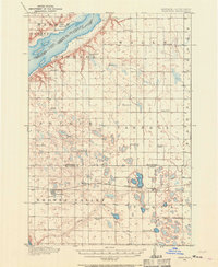
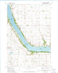
 1971 Big Stone Lake East1974 Print · USGSBig Stone Lake serves as the interstate boundary in the early 1970s, separating the prairie lands of Minnesota and South Dakota. Researchers can locate local cemeteries such as Elim and Lakeside, or trace the development of Schmidt Landing and the Fish Hatchery.
 - 1971 Map of Dismal Swamp, 1974 Print
 1971 Dismal Swamp1974 Print · USGSBig Stone County was a critical conservation hub in the early 1970s, focused on the management of its vital wetlands and sloughs. Researchers can trace the boundaries of the Thomson State Wildlife Management Area and find local landmarks like Bethany Ch and the Townhall.
 - 1971 Map of Browns Valley, 1974 Print
 1971 Browns Valley1974 Print · USGSBrowns Valley occupied this critical continental divide in the early seventies, positioned between two major reservoirs at the Minnesota-South Dakota border. Researchers can trace the rail-and-water geography of the era, locating the Burlington Northern line, the Valley View Cem, and the Townhall.
 - 1971 Map of Odessa, 1974 Print
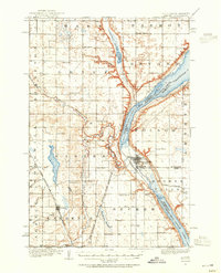
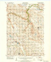
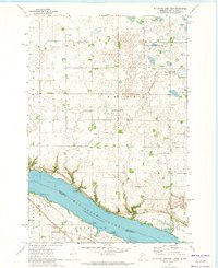
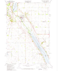
 1971 Odessa1974 Print · USGSBig Stone County and the Minnesota River valley are shown here in the early seventies, featuring the town of Odessa and its riverfront infrastructure. Researchers can trace the Milwaukee Road railroad and locate rural landmarks like Eidskog Ch and Immanuel Ch.
 - 1971 Map of Big Stone Lake West, 1974 Print
 1971 Big Stone Lake West1974 Print · USGSBig Stone Lake straddles the border of Minnesota and South Dakota in the early seventies, capturing a landscape of lakeside retreats and conservation. Trace local heritage at Holden Ch, the Indian Cem, and settlements like Yankeetown and Bonanza Grove.
 - 1971 Map of Bellingham, 1974 Print
 1971 Bellingham1974 Print · USGSBellingham and the Lac qui Parle river country are captured in the early seventies during a period of highway expansion. Researchers can trace family sites via St Pauls Cem and Salem Cem or locate the historic Old Indian Treaty Bdy.
 - 1971 Map of Big Stone Lake SE, 1974 Print
 1971 Big Stone Lake SE1974 Print · USGSEastern South Dakota in the early seventies shows a landscape where prairie conservation meets historical boundaries. Researchers can trace the Old Indian Treaty Boundary and locate landmarks like Camp Tepeetonka or the Townhall in Lockwood.
Showing maps 1-25 of 141
Top cities of Big Stone County
- Ortonville historical maps
- Graceville historical maps
- Clinton historical maps
- Beardsley historical maps
- Foster historical maps
- Odessa historical maps
See more
Frequently asked questions
- What are the different types of historical maps available for Big Stone County?
- What is the oldest map of Big Stone County?
- Where can I purchase historical maps of Big Stone County for my home or office?
- Where can I download high-res historical maps of Big Stone County?
- Are there historical topographic maps available for Big Stone County?
- Is there historical aerial imagery available for Big Stone County?
- Where are historical maps of Big Stone County sourced from?