Old Maps of Clay County, Minnesota for Academic Research
Study the evolution of Clay County with 198 high-resolution historic maps. Whether you're teaching, researching, or modeling changes in land use, these maps provide essential visual documentation of urban, environmental, and geographic change.
- Analyze long-term change: Track patterns in development, transportation, and natural features.
- Ideal for environmental or urban studies: Support academic projects with primary historical map data.
- Use in the classroom or lab: Educators and researchers rely on these maps to bring historical context to life.
These maps are a powerful tool for teaching, research, and visualizing how Clay County has changed over the decades.
Clay County, MN maps
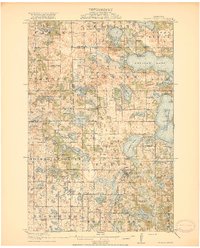
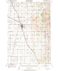
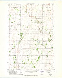
(198)- 1895 Map of Fargo, 1954 Print
 1895 Fargo1954 Print · USGSThe Red River Valley thrived as a rail and agricultural frontier during the 1890s, where North Dakota and Minnesota meet. Genealogists can trace family roots through pioneer settlements and rail stops like Kurtz (Elmer Sta.), Wild Rice, and Christine.3 unique versions available
 - 1897 Map of Fargo
 1897 Fargo1897 Print · USGSThe Red River Valley at the close of the nineteenth century was a bustling intersection of rail lines and river commerce. Genealogists and historians can trace the early footprints of Fargo and Moorhead, or find smaller depots like Kurtz (Elmer Sta.) and Wild Rice.12 unique versions available
 - 1914 Map of Pelican Rapids, 1949 Print
 1914 Pelican Rapids1949 Print · USGSThe glacier-carved landscape of Otter Tail County is shown here just before the First World War, when rural schools and lakefront resorts defined the local character. Genealogists can trace family roots through sites like South Emmanuel Church and Bangor Cemetery or locate the many schoolhouses including Rollag School.
 - 1917 Map of Pelican Rapids
 1917 Pelican Rapids1917 Print · USGSOtter Tail County was a landscape of dense rural school districts and lakeside retreats just before the First World War. Genealogists can trace family footprints through dozens of landmarks like Swede Grove Church, Dunn's Resort, and Bangor Cemetery.3 unique versions available
 - 1918 Map of Flom
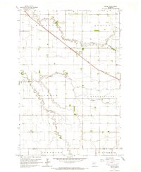
 1918 Flom1918 Print · USGSNorthwestern Minnesota's farming townships are captured here at the close of the First World War. Researchers can trace rural school districts and family church sites near Fossum, Flom P.O., and along the South Branch Wild Rice River.
 - 1918 Map of Ulen
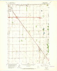
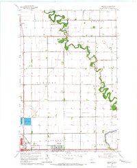
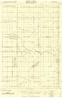 1918 Ulen1918 Print · USGSClay and Norman counties at the end of the Great War show a landscape being reshaped by the Northern Pacific railroad and drainage works. Researchers can trace rural school locations, cemeteries, and early settlements like Ulen and Syre among the prairie townships.2 unique versions available
 - 1919 Map of Barnesville, 1943 Print
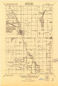 1919 Barnesville1943 Print · USGSThe Red River Valley's agricultural and rail infrastructure is meticulously detailed in this early twentieth-century military survey. Genealogists and historians can locate numerous rural schoolhouses and industrial landmarks like the Barnesville tall Elevator and the Lawndale Elevator.
 - 1919 Map of Hawley, 1943 Print
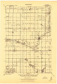 1919 Hawley1943 Print · USGSWestern Minnesota prairie life is captured here in the years following the Great War, as rail-side elevators drove the local economy. Trace the paths of the Northern Pacific Ry. and find local landmarks like the Hitterdal Elevator or the village of Muskoda.
 - 1952 Map of Barnesville, 1954 Print
 1952 Barnesville1954 Print · USGSThe Barnesville area in the early fifties shows a thriving rail-and-farm landscape at the Clay and Wilkin county border. Genealogists and historians can trace numerous rural schoolhouses, the Little Bethany Ch, and the site of the Braton Sch (Abandoned).
 - 1952 Map of Grand Forks, 1967 Print
 1952 Grand Forks1967 Print · USGSThe Red River Valley in the early fifties is shown here at the height of its rail-and-river agricultural economy. Researchers can locate small-town landmarks like the Pleasant View School, the Immanuel Lutheran Church, and trace the path of the Soo Line Railroad.3 unique versions available
 - 1953 Map of Fargo, 1965 Print
 1953 Fargo1965 Print · USGSThe Red River Valley in the mid-fifties was a bustling rail and agricultural corridor during a period of steady prairie growth. Genealogists and historians can trace the intricate rail networks of the Great Northern and Soo Line connecting local hubs like Casselton and Wahpeton.2 unique versions available
 - 1956 Map of Fargo
 1956 Fargo1956 Print · USGSThe Red River Valley's agricultural heartland is documented here in the mid-fifties as the rail-and-road network expanded across the plains. Genealogists can trace family roots through numerous small railroad towns and local landmarks like Casselton, Sheyenne Valley Church, and Sisseton Indian Res.
 - 1956 Map of Grand Forks
 1956 Grand Forks1956 Print · USGSThe Red River Valley in the mid-fifties is captured here as a thriving corridor of grain elevators and rail-linked towns along the North Dakota and Minnesota border. Researchers can trace historic church sites like Immanuel Lutheran Church, vanished rail stops at Tilde Junction, and the boundaries of the White Earth Indian Reservation.
 - 1959 Map of Fargo North, 1960 Print
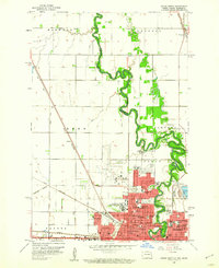 1959 Fargo North1960 Print · USGSThe Red River valley in the late fifties shows the post-war expansion of Fargo and Moorhead along their shared river border. Genealogists can locate family sites near Riverside Cem or trace the early campus of the North Dakota Agriculture College.4 unique versions available
 - 1959 Map of Fargo South, 1960 Print
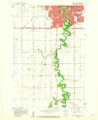 1959 Fargo South1960 Print · USGSFargo and Moorhead appear at a pivotal moment of mid-century growth as the Red River of the North defines the state line. Genealogists and local historians can locate early institutions like Concordia College, Sacred Heart Convent, and Riverside Cemetery.4 unique versions available
 - 1959 Map of Hickson, 1960 Print
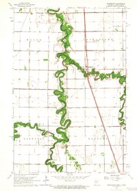
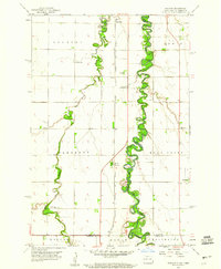 1959 Hickson1960 Print · USGSThe Red River Valley's rich agricultural borderlands are captured here in the late fifties, showcasing the intricate meanders of the Red River of the North. Genealogists can locate rural landmarks like St Benedict, Hickson, and the North Pleasant Cem.3 unique versions available
 - 1963 Map of Georgetown, 1964 Print
 1963 Georgetown1964 Print · USGSThe Red River Valley's winding borderlands are captured here in the early sixties, showing the fertile divide between Minnesota and North Dakota. Researchers can trace the paths of the Great Northern railroad and locate community sites like Osterdalen Ch and Osterdalen Cem.
 - 1963 Map of Perley, 1964 Print
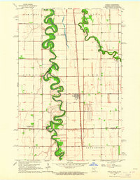 1963 Perley1964 Print · USGSThe Red River Valley at the Minnesota border comes into focus during the early sixties, showing the tight meanders of the Red River and Wild Rice River. Trace local history through the Great Northern rail stops, Perley townsite, and Kirkebo Cem.2 unique versions available
 - 1964 Map of Sabin, 1966 Print
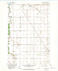
 1964 Sabin1966 Print · USGSClay County in the mid-1960s is shown here as a landscape of rail-driven settlements and vital drainage works. You can trace the path of the Northern Pacific through Sabin or locate early landmarks like the Moorhead Airport and the local Dragstrip.3 unique versions available
 - 1964 Map of Baker, 1966 Print
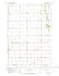
 1964 Baker1966 Print · USGSClay County's agricultural heartland is documented here in the mid-sixties, centered on the rail-side settlement of Baker. Researchers can trace the path of the Great Northern railroad and the winding courses of Whisky Creek and the South Branch Buffalo River.3 unique versions available
 - 1964 Map of Dilworth, 1966 Print
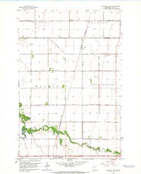
 1964 Dilworth1966 Print · USGSClay County at the height of the mid-century rail era shows a landscape shaped by the winding Buffalo River and the expanding town of Dilworth. Researchers can trace the local rail networks through Kragnes and locate family homesteads along the rural sectional roads.3 unique versions available
 - 1964 Map of Glyndon South, 1966 Print
 1964 Glyndon South1966 Print · USGSClay County's agricultural heartland is documented here in the mid-1960s, centered on the vital rail junction at Glyndon. Researchers can trace local heritage through the locations of the Elmwood Cem, Trinity Ch, and the many sections of the Great Northern railroad.
 - 1964 Map of Comstock, 1966 Print
 1964 Comstock1966 Print · USGSThe Red River Valley prairie in the mid-sixties shows a landscape shaped by the Great Northern rail line and complex drainage. Genealogists can locate the Comstock Cem and the small siding at Rustad along the Iron Horse route.
 - 1964 Map of Glyndon North, 1966 Print
 1964 Glyndon North1966 Print · USGSClay County's agricultural landscape is seen here in the mid-sixties, dominated by the precision of the Red River Valley's drainage grid. Researchers can trace family roots near Glyndon at Riverside Cem or follow the Great Northern rail line through Averill.2 unique versions available
 - 1965 Map of Syre, 1967 Print
 1965 Syre1967 Print · USGSNorthwestern Minnesota's agricultural landscape is captured in the mid-sixties, centered on the Northern Pacific railroad. Genealogists and local historians can trace the settlement of Syre, locate a rural Cem, or identify the township Townhall.
Showing maps 1-25 of 198
Top cities of Clay County
- Moorhead historical maps
- Dilworth historical maps
- Barnesville historical maps
- Hawley historical maps
- Glyndon historical maps
- Ulen historical maps
See more
Frequently asked questions
- What are the different types of historical maps available for Clay County?
- What is the oldest map of Clay County?
- Where can I purchase historical maps of Clay County for my home or office?
- Where can I download high-res historical maps of Clay County?
- Are there historical topographic maps available for Clay County?
- Is there historical aerial imagery available for Clay County?
- Where are historical maps of Clay County sourced from?