
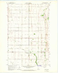
1965 Map of Syre
USGS Topo · Published 1967About this map
The Northern Pacific railroad corridor anchors this mid-century survey of the Red River Valley transition, passing directly through the small settlement of Syre. The landscape is defined by the sharp contrast between the rectilinear grid of township boundaries like Rockwell, Homelake, and Hagen, and the meandering, natural course of Coon Creek.
Find a feature on this map
17 named features on this map. Tap any name to fly to it.
Don’t see what you’re looking for? This feature index may not catch every label — zoom into the map to look around manually.
Map Details
Editions of this 1965 Syre Map
This is the sole edition of this map. No revisions or reprints were ever made.
Other maps of this area

1918 · Twin Valley
USGS Topo · 1:62,500

1918 · Flom
USGS Topo · 1:62,500

1918 · Ulen
USGS Topo · 1:62,500

1952 · Grand Forks
USGS Topo · 1:250,000

1956 · Grand Forks
USGS Topo · 1:250,000

1965 · Waukon
USGS Topo · 1:24,000

1965 · Twin Valley SW
USGS Topo · 1:24,000

1965 · Twin Valley
USGS Topo · 1:24,000
1965 · Ulen NW
USGS Topo · 1:24,000

1966 · Flom
USGS Topo · 1:24,000