
1965 Map of Twin Valley
USGS Topo · Published 1967About this map
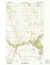
Wild Rice River meanders across this Norman County landscape, carving a deep, wooded valley through the otherwise flat agricultural plains of northwestern Minnesota. During the mid-1960s, the river valley stands out as a dense corridor of vegetation and relief in a region dominated by surveyed farm plots and gravel pits. The settlement of Twin Valley occupies the southeastern corner of the quadrangle, serving as a local hub alongside the town of Gary to the north. These communities are linked by the Northern Pacific railroad, which runs north-to-south, paralleling the section lines and anchoring the local economy. The map provides a detailed view of the rural infrastructure of the era, from the grid of unimproved dirt roads to the scattered gaging stations and cemeteries that mark the quiet development of the Red River Valley hinterland.
Find a feature on this map
4 named features on this map. Tap any name to fly to it.
Don’t see what you’re looking for? This feature index may not catch every label — zoom into the map to look around manually.
Map Details
Editions of this 1965 Twin Valley Map
2 editions found
Other maps of this area

1918 · Twin Valley
USGS Topo · 1:62,500

1918 · Flom
USGS Topo · 1:62,500

1918 · Ulen
USGS Topo · 1:62,500

1952 · Grand Forks
USGS Topo · 1:250,000

1956 · Grand Forks
USGS Topo · 1:250,000

1965 · Waukon
USGS Topo · 1:24,000

1965 · Twin Valley SW
USGS Topo · 1:24,000

1965 · Syre
USGS Topo · 1:24,000

1965 · Twin Valley NW
USGS Topo · 1:24,000

1965 · Flaming
USGS Topo · 1:24,000