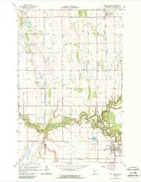
1918 Map of Twin Valley
USGS Topo · Published 1918About this map
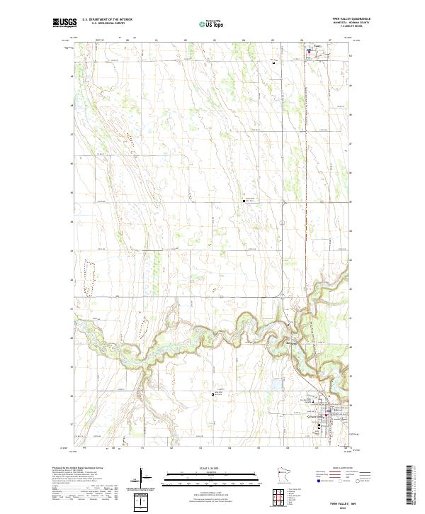
The Wild Rice River winds through the heart of this 1918 military survey, defining the landscape of southern Norman County. This advance sheet, compiled by the Corps of Engineers, U.S. Army, provides a snapshot of the region just before it was formally mapped by the USGS in the 1920s. The Northern Pacific railroad corridor serves as the primary north-south artery, connecting the established settlements of Twin Valley, Heiberg, Gary, and Flaming. The map reveals a highly structured rural landscape divided into townships like Green Meadow and Strand, where a network of country schools and churches—such as the Betcher School and the White Ch. spire—anchored the early 20th-century farming community. Large water bodies like Lake Ida and Long Lake stand out in the western reaches of McDonaldsville, alongside a system of artificial drainage ditches used to manage the prairie wetlands.
Find a feature on this map
44 named features on this map. Tap any name to fly to it.
Don’t see what you’re looking for? This feature index may not catch every label — zoom into the map to look around manually.
Map Details
Editions of this 1918 Twin Valley Map
This is the sole edition of this map. No revisions or reprints were ever made.
Historical Maps of Ada Through Time
7 maps found