
1918 Map of Ulen
USGS Topo · Published 1918About this map
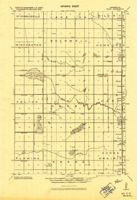
Ulen and Syre anchor the eastern edge of this 1918 military survey, marking the path of the Northern Pacific railroad through the transition from prairie to wetlands. The landscape is defined by an extensive drainage system, including the State Ditch and numerous numbered watercourses like Ditch No. 14 and Ditch No. 7, which illustrate early 20th-century efforts to manage the Red River Valley watershed.
Find a feature on this map
31 named features on this map. Tap any name to fly to it.
Don’t see what you’re looking for? This feature index may not catch every label — zoom into the map to look around manually.
Map Details
Editions of this 1918 Ulen Map
2 editions found
Other maps of this area

1895 · Fargo
USGS Topo · 1:125,000

1897 · Fargo
USGS Topo · 1:125,000

1918 · Twin Valley
USGS Topo · 1:62,500

1918 · Flom
USGS Topo · 1:62,500

1919 · Hawley
USGS Topo · 1:62,500

1924 · Ada
USGS Topo · 1:62,500

1952 · Grand Forks
USGS Topo · 1:250,000

1953 · Fargo
USGS Topo · 1:250,000

1956 · Fargo
USGS Topo · 1:250,000

1956 · Grand Forks
USGS Topo · 1:250,000