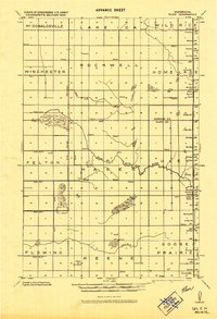
1918 Map of Ulen
USGS Topo · Published 1943About this map
The agricultural lands of the Red River Valley are defined by a complex drainage network in this 1918 military compilation. The landscape is dominated by the South Br. Wild Rice River and the expansive Wild Rice water system, which are augmented by an extensive system of artificial waterways including the State Ditch, Ditch No.14, and Ditch No.19. These ditches represent a significant era of land reclamation in Norman and Clay Counties, transforming the prairie into productive farmland.
Find a feature on this map
31 named features on this map. Tap any name to fly to it.
Don’t see what you’re looking for? This feature index may not catch every label — zoom into the map to look around manually.
Map Details
Editions of this 1918 Ulen Map
2 editions found
Other maps of this area

1895 · Fargo
USGS Topo · 1:125,000

1897 · Fargo
USGS Topo · 1:125,000

1918 · Twin Valley
USGS Topo · 1:62,500

1918 · Flom
USGS Topo · 1:62,500

1918 · Ulen
USGS Topo · 1:62,500

1919 · Hawley
USGS Topo · 1:62,500

1924 · Ada
USGS Topo · 1:62,500

1952 · Grand Forks
USGS Topo · 1:250,000

1953 · Fargo
USGS Topo · 1:250,000

1956 · Fargo
USGS Topo · 1:250,000